File:Tunisia adm location map.svg

Archivo original (archivo SVG, nominalmente 378 × 743 píxeles, tamaño de archivo: 162 kB)
Leyendas
Leyendas
Resumen
[editar]
| Descripción |
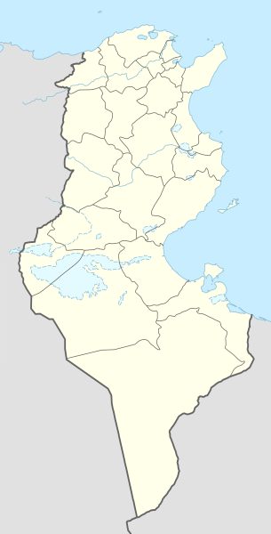
Deutsch: Positionskarte von Tunesien
English: Location map of Tunisia
|
||||||||||||
| Fecha | |||||||||||||
| Fuente |
Trabajo propio utilizando:
|
||||||||||||
| Autor | NordNordWest | ||||||||||||

|
Este mapa se ha hecho o mejorado en el Kartenwerkstatt (taller cartográfico) alemán. También puede proponer mapas para mejorar.
|
Licencia
[editar]
Usage of this file with:

explanatory notes: Legally binding is only the full legalcode. For a free usage I recommend to respect the following licence conditions:
1. Provide my name as given above: NordNordWest,
2. a copy of, or the URI for, the applicable license: https://creativecommons.org/licenses/by-sa/3.0/de/legalcode,
3. the title of the work,
4. in the case of an adaptation, a credit identifying the use of the work in the adaptation.
This license and the rights granted hereunder will terminate automatically upon any breach by you of the terms of this license. Any of the above conditions can be waived if you get permission from the copyright holder. If you have questions or wish differing conditions, please contact me through nnwest or my discussion page ![]() t-online.de
t-online.de
- Eres libre:
- de compartir – de copiar, distribuir y transmitir el trabajo
- de remezclar – de adaptar el trabajo
- Bajo las siguientes condiciones:
- atribución – Debes otorgar el crédito correspondiente, proporcionar un enlace a la licencia e indicar si realizaste algún cambio. Puedes hacerlo de cualquier manera razonable pero no de manera que sugiera que el licenciante te respalda a ti o al uso que hagas del trabajo.
- compartir igual – En caso de mezclar, transformar o modificar este trabajo, deberás distribuir el trabajo resultante bajo la misma licencia o una compatible como el original.

Historial del archivo
Haz clic sobre una fecha y hora para ver el archivo tal como apareció en ese momento.
| Fecha y hora | Miniatura | Dimensiones | Usuario | Comentario | |
|---|---|---|---|---|---|
| actual | 12:03 24 mar 2024 | | 378 × 743 (162 kB) | GrandEscogriffe (discusión | contribs.) | more correct north-south stretching |
| 15:59 9 nov 2014 |  | 378 × 713 (146 kB) | NordNordWest (discusión | contribs.) | == {{int:filedesc}} == {{Information |Description= {{de|1=Positionskarte von Tunesien}} {{en|1=Location map of Tunisia}} {{Location map series N |stretching=115 |top=37.7 |bottom=30.0 |left=7.2 |right=11.9 }} |Source={{Own using}} * United States Natio... |
No puedes sobrescribir este archivo.
Usos del archivo
Las siguientes páginas usan este archivo:
Uso global del archivo
Las wikis siguientes utilizan este archivo:
- Uso en af.wikipedia.org
- Uso en am.wikipedia.org
- Uso en an.wikipedia.org
- Uso en ar.wikipedia.org
- عروج بربروس
- الرابطة التونسية المحترفة الأولى
- كأس الأمم الإفريقية 2004
- قائمة مطارات تونس
- كأس الأمم الإفريقية 1994
- النادي الإفريقي
- قالب:خريطة مدن تونس
- قالب:خارطة جبال تونس
- قالب:خريطة مواقع تونس
- كأس الأمم الإفريقية 1965
- قائمة مدن تونس المتوأمة
- بطولة أمم إفريقيا لكرة السلة 2015
- قالب:خريطة مواقع التراث العالمي في تونس
- قائمة مواقع التراث العالمي في تونس
- قالب:ص.م/موقع جغرافي مضاعف
- قالب:ص.م/موقع جغرافي مضاعف/شرح
- بوابة:التراث العالمي/خريطة مختارة
- الرابطة التونسية المحترفة الأولى 2015–16
- بطولة إفريقيا لكرة اليد للرجال 2020
- بطولة أمم إفريقيا لكرة السلة 2017
- الرابطة التونسية المحترفة الأولى 2016–17
- الرابطة التونسية المحترفة الأولى 2017–18
- الرابطة التونسية المحترفة الأولى 2018–19
- كلاسيكو تونس
- ديربي تونس الصغير
- الحي الوطني الرياضي
- الرابطة التونسية المحترفة الأولى 2019–20
- وادي الساقي
- وادي سيدي صالح
- الرابطة التونسية المحترفة الأولى 2020–21
- دورة تونس للأمم الأربعة 2003
- وحدة:Location map/data/تونس
- وحدة:Location map/data/تونس/شرح
- كأس إل جي الدولية 1997 (تونس)
- كأس إل جي الدولية 2006 (تونس)
- الرابطة التونسية المحترفة الأولى 2021–22
- بطولة إفريقيا لكرة اليد للرجال 2006
- الرابطة التونسية المحترفة الأولى 2022–23
- جبال تبسة
Ver más uso global de este archivo.