File:Twisp River Fire Status Report.pdf
Jump to navigation
Jump to search

Size of this JPG preview of this PDF file: 463 × 599 pixels. Other resolutions: 185 × 240 pixels | 371 × 480 pixels | 593 × 768 pixels | 1,275 × 1,650 pixels.

Original file (1,275 × 1,650 pixels, file size: 1.56 MB, MIME type: application/pdf, 25 pages)
Captions
Captions
United States Department of Agriculture. 2016. Twisp river fire fatalities and entrapments: learning review narrative. 44 p.
Summary
[edit]| Description |
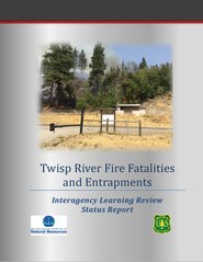
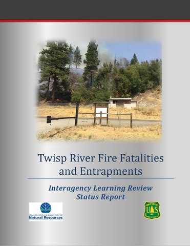
English: The Twisp River Fire was reported on August 19 at 1223 Pacific Daylight Time. The fire started when tree branches struck a nearby powerline. By 0600 hours on August 20, it was reported to be 7,231 acres and had reached the outskirts of Twisp, Washington. The fire’s final reported acreage on August 26 was 11,922 acres. This narrative describes the events that took place during the initial attack of this incident. The intent of this report is to capture - as accurately as we can - what happened on the Twisp River Fire so that we can learn how to prevent fatality fires in the future. |
| Date | |
| Source | https://www.frames.gov/catalog/23573 |
| Author | United States Department of Agriculture |
Licensing
[edit]This work is in the public domain in the United States because it is a work prepared by an officer or employee of the United States Government as part of that person’s official duties under the terms of Title 17, Chapter 1, Section 105 of the US Code.
Note: This only applies to original works of the Federal Government and not to the work of any individual U.S. state, territory, commonwealth, county, municipality, or any other subdivision. This template also does not apply to postage stamp designs published by the United States Postal Service since 1978. (See § 313.6(C)(1) of Compendium of U.S. Copyright Office Practices). It also does not apply to certain US coins; see The US Mint Terms of Use.
|
 | |
| This file has been identified as being free of known restrictions under copyright law, including all related and neighboring rights. | ||
File history
Click on a date/time to view the file as it appeared at that time.
| Date/Time | Thumbnail | Dimensions | User | Comment | |
|---|---|---|---|---|---|
| current | 09:11, 28 March 2019 |  | 1,275 × 1,650, 25 pages (1.56 MB) | Mvolz (talk | contribs) | User created page with UploadWizard |
You cannot overwrite this file.
File usage on Commons
There are no pages that use this file.