File:Txu-oclc-10552568-ng51-5.jpg
Jump to navigation
Jump to search

Size of this preview: 787 × 600 pixels. Other resolutions: 315 × 240 pixels | 630 × 480 pixels | 1,008 × 768 pixels | 1,280 × 975 pixels | 2,560 × 1,950 pixels | 5,000 × 3,809 pixels.
Original file (5,000 × 3,809 pixels, file size: 4.75 MB, MIME type: image/jpeg)
Captions
Captions
Add a one-line explanation of what this file represents
Summary[edit]
| Description |
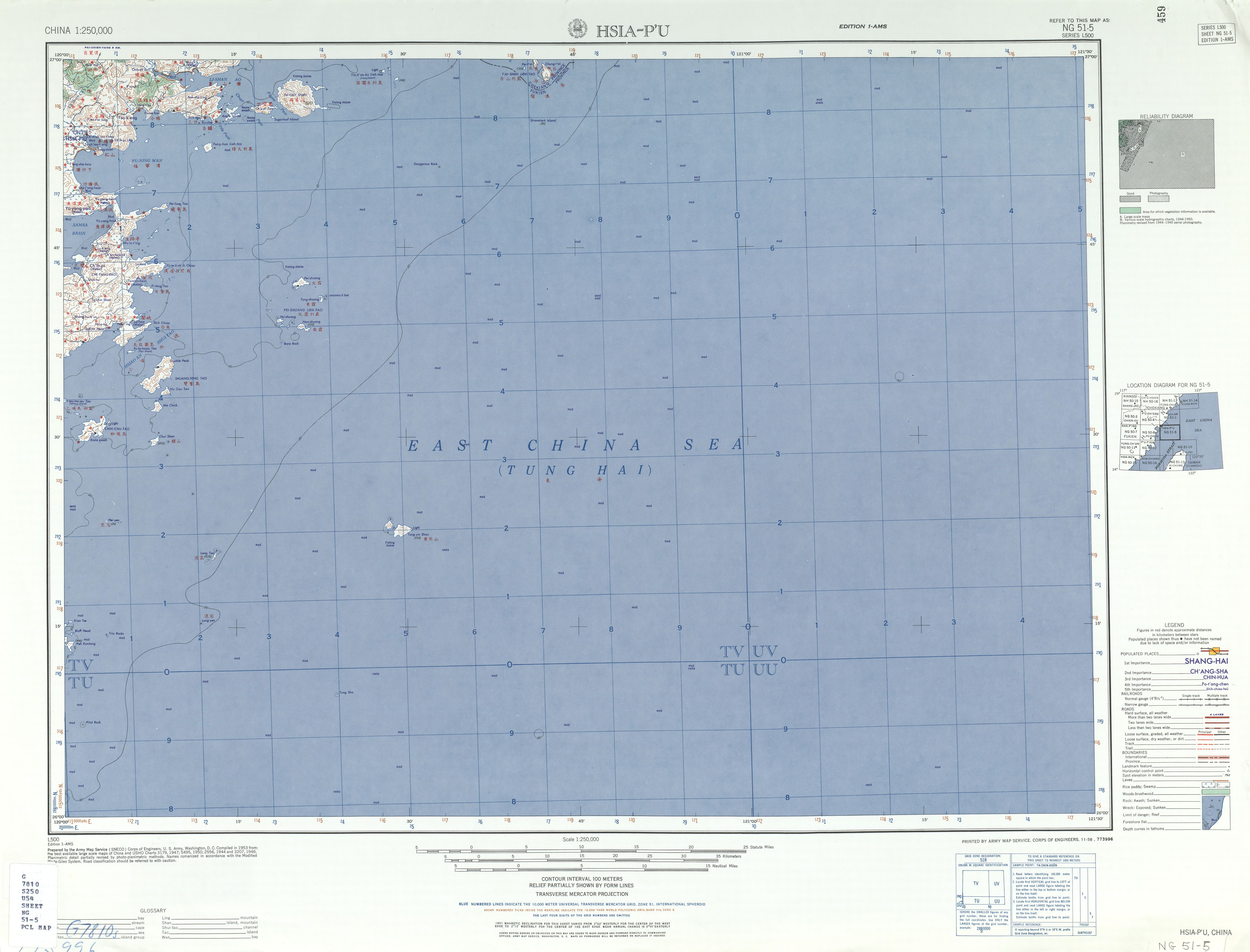
English: Map of Xiapu County (Hsia-p'u) area, Fujian, China and Dongyin Township and part of Beigan Township (Peikantang) in Lienchiang County (the Matsu Islands), Taiwan (ROC) 1953 |
| Date | |
| Source | Courtesy of the University of Texas Libraries, The University of Texas at Austin. (NG 51-5 Archived [1]) |
| Author | Army Map Service (SNECO), Corps of Engineers 1953 |
-
 Index Map

Licensing[edit]
This image or file is a work of a U.S. Army Corps of Engineers soldier or employee, taken or made as part of that person's official duties. As a work of the U.S. federal government, the image is in the public domain.
|
| Annotations | This image is annotated: View the annotations at Commons |
File history
Click on a date/time to view the file as it appeared at that time.
| Date/Time | Thumbnail | Dimensions | User | Comment | |
|---|---|---|---|---|---|
| current | 10:22, 6 September 2019 | | 5,000 × 3,809 (4.75 MB) | Geographyinitiative (talk | contribs) | User created page with UploadWizard |
You cannot overwrite this file.
File usage on Commons
There are no pages that use this file.
File usage on other wikis
The following other wikis use this file:
- Usage on de.wikipedia.org
- Usage on en.wikipedia.org