File:Txu-pclmaps-oclc-6612004-eryeen-tsab.jpg
Jump to navigation
Jump to search
Size of this preview: 800 × 597 pixels. Other resolutions: 320 × 239 pixels | 640 × 477 pixels | 1,024 × 764 pixels | 1,280 × 955 pixels | 2,560 × 1,909 pixels | 5,494 × 4,097 pixels.
Original file (5,494 × 4,097 pixels, file size: 4.3 MB, MIME type: image/jpeg)
Captions
Captions
Add a one-line explanation of what this file represents
Summary
[edit]
| Description |
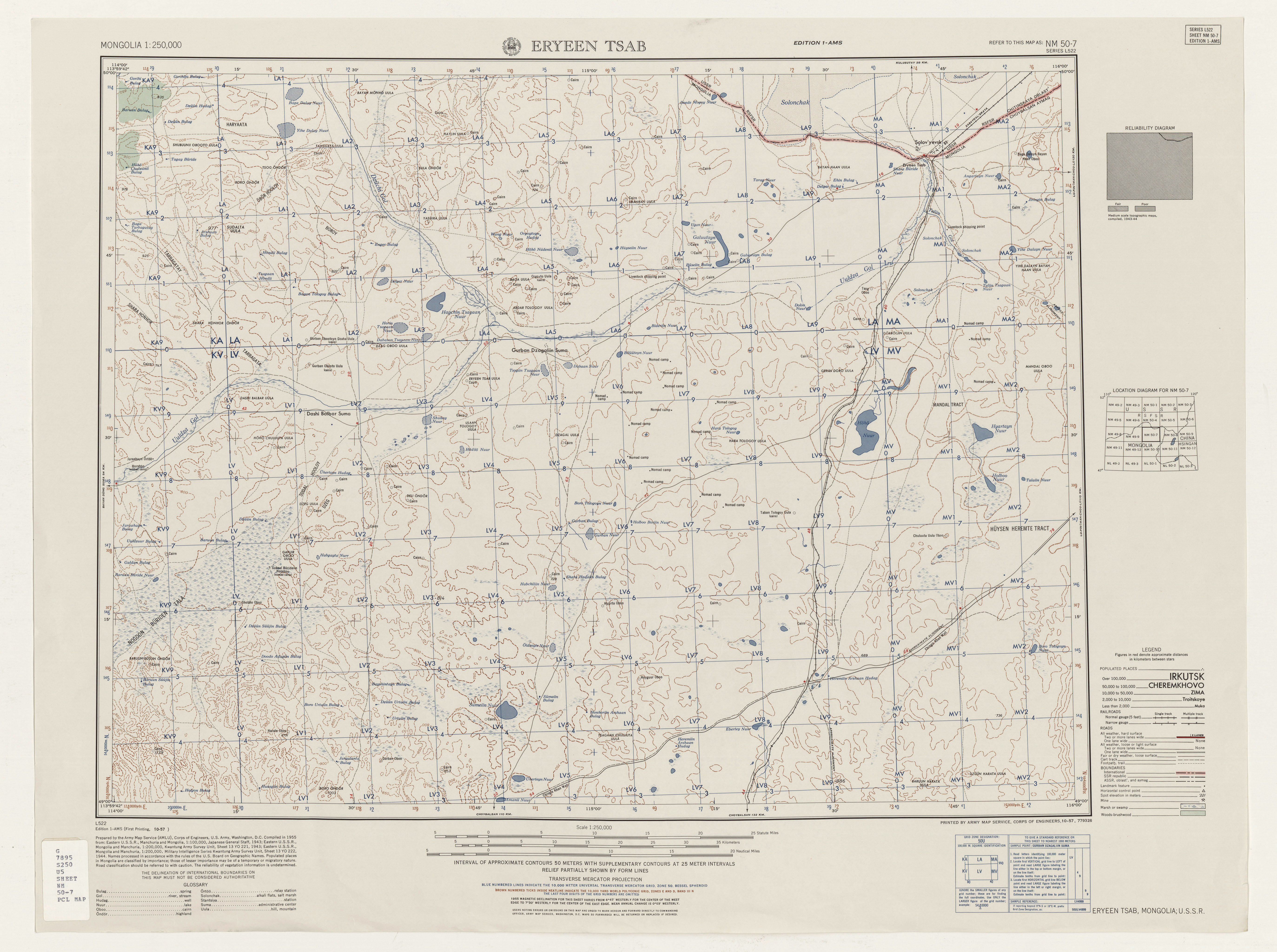
English: Mongolia AMS Topographic Maps |
| Date | 1950s |
| Source | http://legacy.lib.utexas.edu/maps/ams/mongolia_250k/ |
| Author | Army Map Serivce, Corps of Engineers |
Licensing
[edit]
This image or file is a work of a U.S. Army Corps of Engineers soldier or employee, taken or made as part of that person's official duties. As a work of the U.S. federal government, the image is in the public domain.
|
File history
Click on a date/time to view the file as it appeared at that time.
| Date/Time | Thumbnail | Dimensions | User | Comment | |
|---|---|---|---|---|---|
| current | 01:10, 13 September 2019 | | 5,494 × 4,097 (4.3 MB) | Geographyinitiative (talk | contribs) | User created page with UploadWizard |
You cannot overwrite this file.
File usage on Commons
There are no pages that use this file.