File:Typhoon In-Fa (MODIS 2021-07-22).jpg

Original file (6,852 × 5,791 pixels, file size: 4.45 MB, MIME type: image/jpeg)
Captions
Captions
Summary[edit]
.jpg&action=edit§ion=1)
| Description |
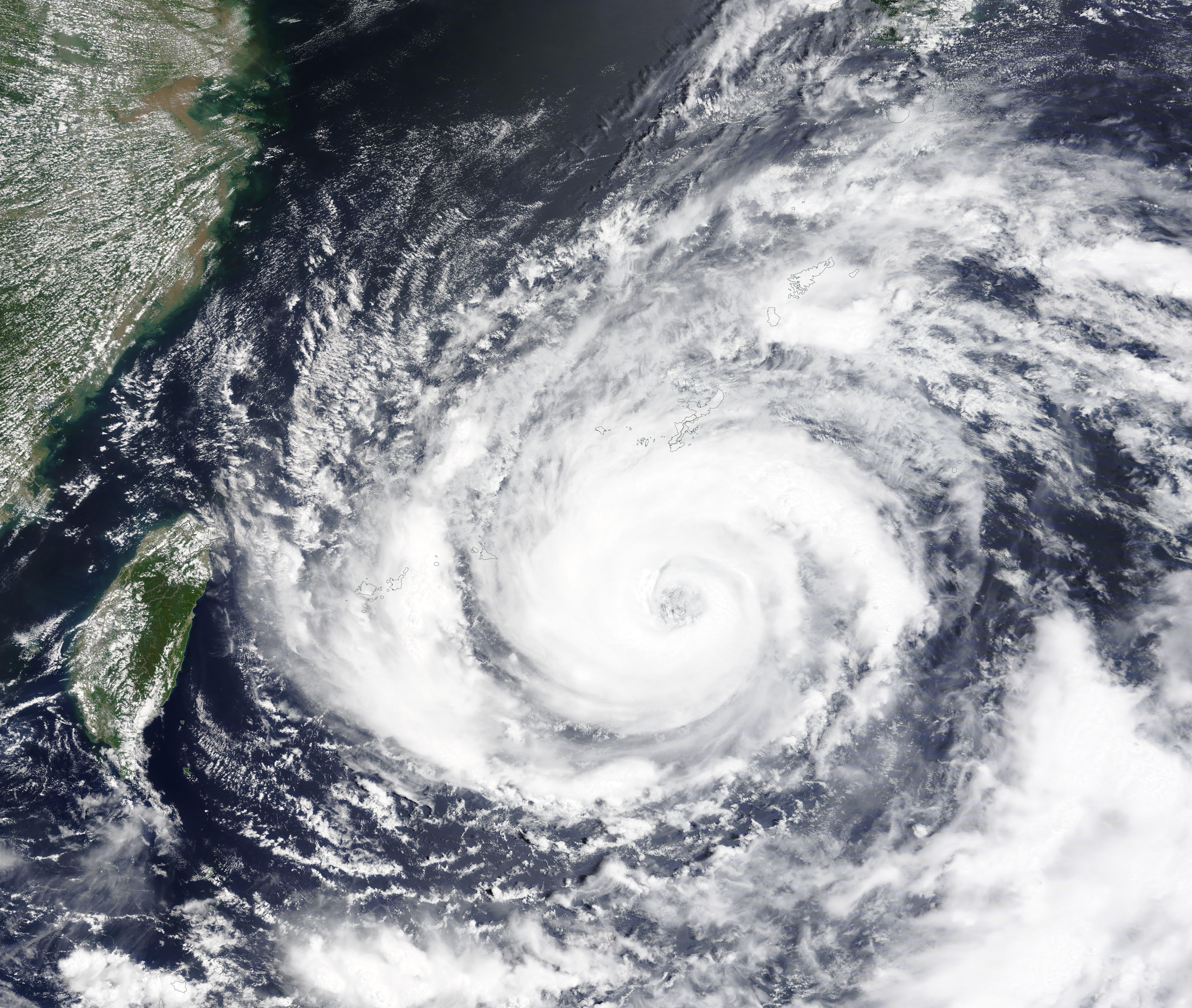
English: On July 21, 2021, the Moderate Resolution Imaging Spectroradiometer (MODIS) on board NASA’s Terra satellite acquired a true-color image of Typhoon In-Fa spinning over the Philippine Sea. The large storm stretches over the Ryukyu Islands, an archipelago of 55 islands and islets that are scattered across the ocean between southern Japan’s Kyushu Island and northeastern Taiwan, a distance of about 700 miles. The island of Taiwan sits to the southeast and mainland China can be seen in the west.
At 11:00 p.m. EDT on July 21 (0300 UTC July 22), the Joint Typhoon Warning Center (JTWC) reported that maximum sustained winds were about 104 mph (167 km/h). This places it as a Category 2 storm on the Saffir-Simpson Hurricane Wind Scale. Typhoon In-Fa (also known as Typhoon Fabian in the Philippines) was located about 249 mi (400 km) south-southwest of Kadena Air Force Base and was tracking south-southwestward. Maximum significant wave height measured 36 feet. Typhoon In-Fa has already brought flooding and power outages to parts of Japan and the Philippines as it moved westward. There is a red warning for high waves issued for the Ryukyu Islands, which will receive additional rain and wind through July 22. Heavy rains have also contributed to heavy flooding in China, even though the center of the storm remains well away from China’s mainland. The storm is forecast to continue on a westward track, making landfall south of Shanghai on July 25. Windspeeds may increase prior to landfall, but the storm is expected to dissipate quickly over land. |
||
| Date | Taken on 21 July 2021 | ||
| Source |
|
||
| Author | MODIS Land Rapid Response Team, NASA GSFC |
| This media is a product of the Terra mission Credit and attribution belongs to the mission team, if not already specified in the "author" row |
Licensing[edit]
.jpg&action=edit§ion=2)
| This file is in the public domain in the United States because it was solely created by NASA. NASA copyright policy states that "NASA material is not protected by copyright unless noted". (See Template:PD-USGov, NASA copyright policy page or JPL Image Use Policy.) | ||
 |
Warnings:
|
File history
Click on a date/time to view the file as it appeared at that time.
| Date/Time | Thumbnail | Dimensions | User | Comment | |
|---|---|---|---|---|---|
| current | 17:37, 30 January 2024 | | 6,852 × 5,791 (4.45 MB) | OptimusPrimeBot (talk | contribs) | #Spacemedia - Upload of http://modis.gsfc.nasa.gov/gallery/images/image07222021_250m.jpg via Commons:Spacemedia |
You cannot overwrite this file.
File usage on Commons
There are no pages that use this file.
.jpg&oldid=847282579)