File:UFAG plaque (Budapest-11 Gyapot u 8-12).jpg
Jump to navigation
Jump to search
Size of this preview: 800 × 554 pixels. Other resolutions: 320 × 222 pixels | 640 × 443 pixels | 1,024 × 709 pixels | 1,280 × 886 pixels | 2,050 × 1,419 pixels.
Original file (2,050 × 1,419 pixels, file size: 1.04 MB, MIME type: image/jpeg)
Captions
Captions
Add a one-line explanation of what this file represents
Summary
[edit].jpg&action=edit§ion=1)
| Description |
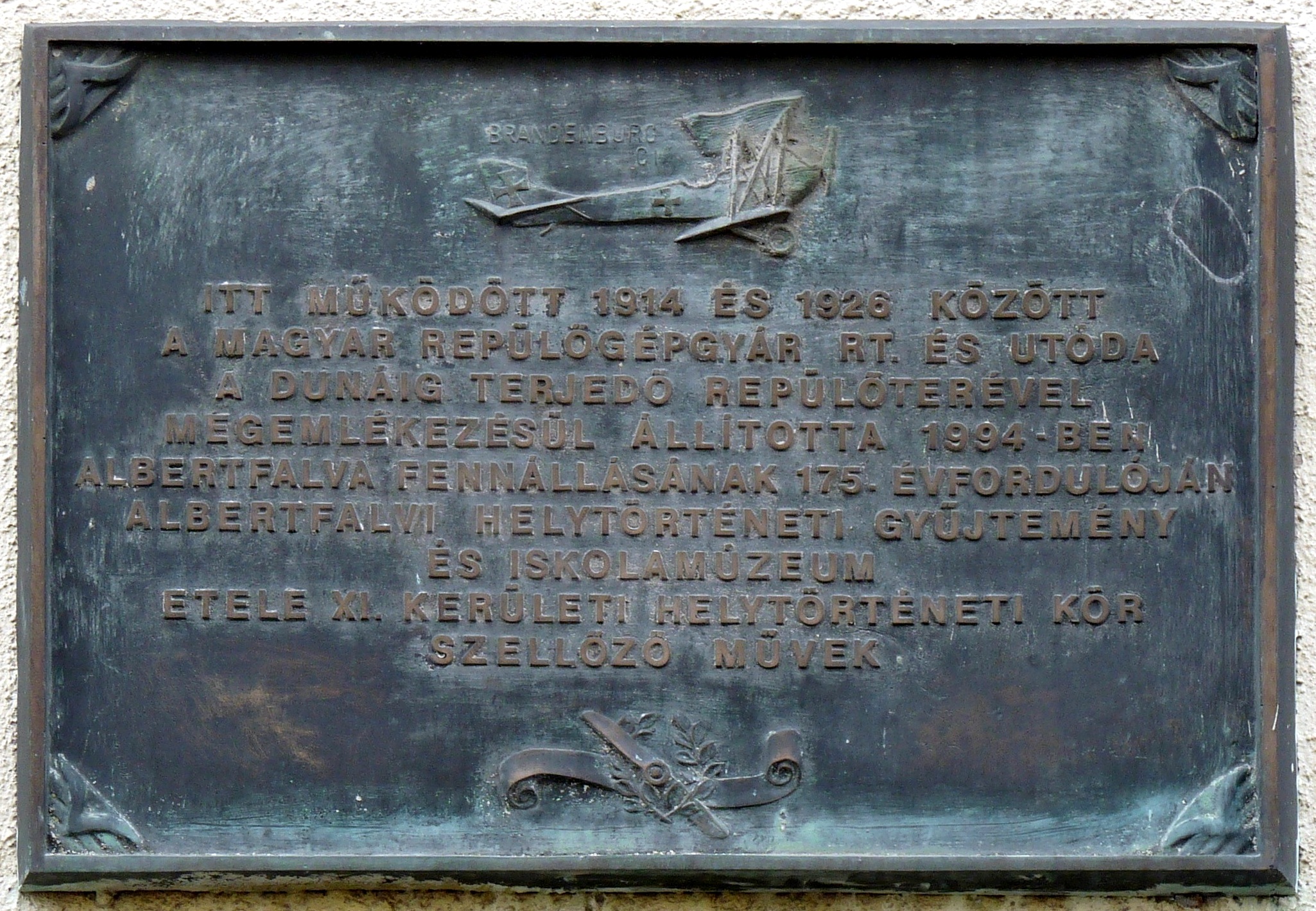
English: Plaque commemorating the UFAG (Ungarische Flugzeugfabrik Aktien Gesellschaft, in Hungarian: Magyar Repülőgépgyár Rt., i.e., Hungarian Aircraft Manufactory Ltd.) affixed to the wall of the workshop where the factory operated from 1914 to 1926. The bronze relief engraved by the painter and graphic artist Gyula Sajtos and representing an airplane Hansa-Brandenburg C.I plane manufactured at this location was inaugurated on 1 March 1994 on the occasion of the 175th anniversary of the founding of the municipality of Albertfalva. (Budapest, District XI, Gyapot Street Nr 8-12)
Français : Plaque commémorant le UFAG (Ungarische Flugzeugfabrik Aktien Gesellschaft, en hongrois : Magyar Repülőgépgyár Rt., c-à-d : Manufacture aéronautique hongroise SA) apposée sur le mur de l’atelier où l’usine functionnait de 1914 az 1926. Le relief en bronze gravé par le peintre et graphiste Gyula Sajtos et représentant un avion Hansa-Brandenburg C.I fabriqué à cet endroit a été inauguré le 1er mars 1994 à l’occasion du 175e anniversaire de la fondation de la commune d’Albertfalva. (8-12 rue Gyapot, Budapest 11e arr.)
Magyar: A Magyar Repülőgépgyár Rt. (MARE), németül Ungarische Flugzeugfabrik Aktien Gesellschaft (UFAG) emléktáblája annak a szerelőcsarnoknak a falán, ahol a gyár 1914 és 1926 között működött. Az Albertfalva 175. évfordulója alkalmából 1994. március 1-jén felavatott s egy Hansa-Brandenburg C.I repülőgépet ábrázoló bronz domborművet Sajtos Gyula festő, grafikus készítette. (Budapest XI. ker., Gyapot utca 8-12.) |
| Date | Taken on 17 January 2018, 15:54:22 |
| Source | Own work |
| Author | Fekist |
| Camera location | | View this and other nearby images on: OpenStreetMap |
|---|
.jpg¶ms=047.449155_N_0019.041077_E_globe:Earth_type:camera__&language=en)
Licensing
[edit].jpg&action=edit§ion=2)
I, the copyright holder of this work, hereby publish it under the following license:
This file is licensed under the Creative Commons Attribution-Share Alike 4.0 International license.
- You are free:
- to share – to copy, distribute and transmit the work
- to remix – to adapt the work
- Under the following conditions:
- attribution – You must give appropriate credit, provide a link to the license, and indicate if changes were made. You may do so in any reasonable manner, but not in any way that suggests the licensor endorses you or your use.
- share alike – If you remix, transform, or build upon the material, you must distribute your contributions under the same or compatible license as the original.
File history
Click on a date/time to view the file as it appeared at that time.
| Date/Time | Thumbnail | Dimensions | User | Comment | |
|---|---|---|---|---|---|
| current | 15:51, 17 January 2018 | | 2,050 × 1,419 (1.04 MB) | Fekist (talk | contribs) | User created page with UploadWizard |
You cannot overwrite this file.
File usage on Commons
The following 3 pages use this file:
File usage on other wikis
The following other wikis use this file:
- Usage on hu.wikipedia.org
.jpg&oldid=890127521)