File:USGS 1951 Ogdensburg topo cropped.png
Jump to navigation
Jump to search
Size of this preview: 800 × 475 pixels. Other resolutions: 320 × 190 pixels | 640 × 380 pixels | 900 × 534 pixels.
Original file (900 × 534 pixels, file size: 867 KB, MIME type: image/png)
Captions
Captions
Add a one-line explanation of what this file represents
Summary
[edit]
| Description |
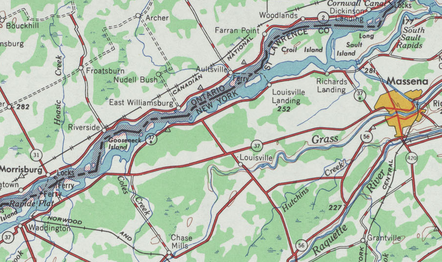
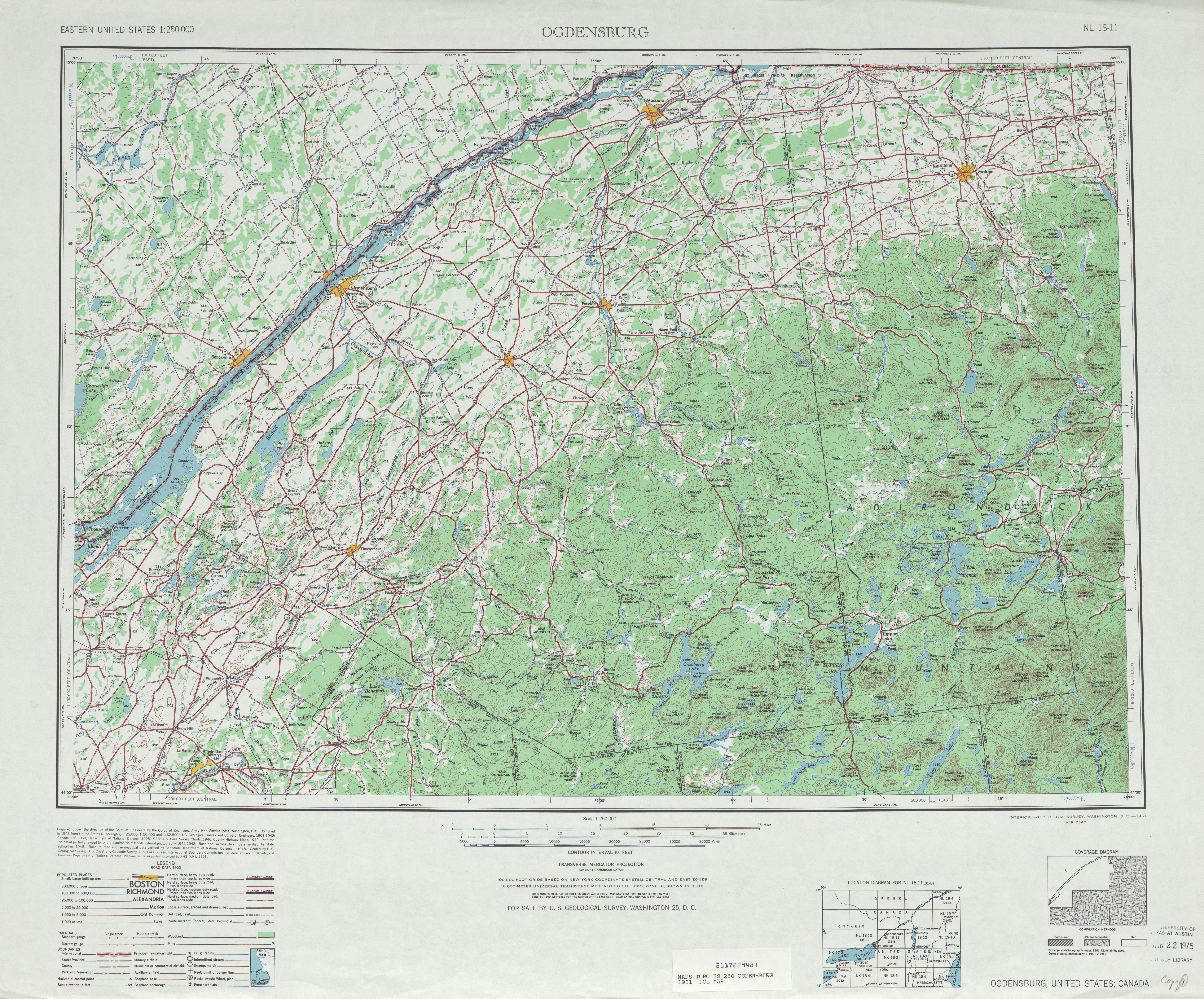
English: A cropped portion of the United States Geological Survey's 1951 1:250,000 scale topographic map of Ogdensburg, New York. The crop is mainly centered on NY 37B, but it may be suitable for other uses as well. |
| Date | |
| Source | http://www.lib.utexas.edu/maps/topo/250k/txu-pclmaps-topo-us-ogdensburg-1951.jpg |
| Author | United States Geological Survey |
Licensing
[edit]
This image is in the public domain in the United States because it only contains materials that originally came from the United States Geological Survey, an agency of the United States Department of the Interior. For more information, see the official USGS copyright policy.
|
File history
Click on a date/time to view the file as it appeared at that time.
| Date/Time | Thumbnail | Dimensions | User | Comment | |
|---|---|---|---|---|---|
| current | 20:48, 31 May 2009 | | 900 × 534 (867 KB) | TwinsMetsFan (talk | contribs) | {{Information |Description={{en|1=A cropped portion of the United States Geological Survey's 1951 1:250,000 scale topographic map of Ogdensburg, New York. The crop is mainly centered on NY 37B, but it may be suitable for other uses as well.}} |Source=http |
You cannot overwrite this file.
File usage on Commons
The following page uses this file:
File usage on other wikis
The following other wikis use this file:
- Usage on en.wikipedia.org