File:US 99 northern California 1937.jpg
Jump to navigation
Jump to search
Size of this preview: 366 × 600 pixels. Other resolutions: 146 × 240 pixels | 293 × 480 pixels | 469 × 768 pixels | 625 × 1,024 pixels | 1,670 × 2,736 pixels.
Original file (1,670 × 2,736 pixels, file size: 1.14 MB, MIME type: image/jpeg)
Captions
Captions
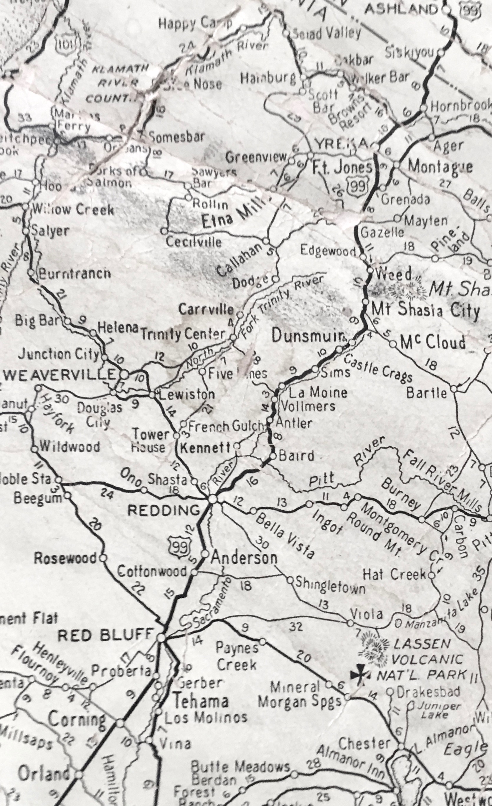
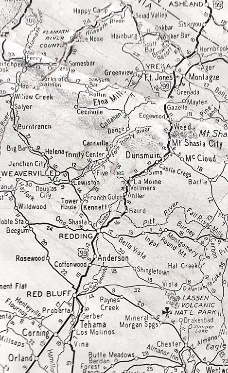
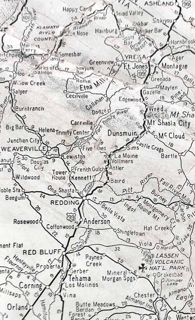
US 99 from Orland, CA to Ashland, OR in 1937
Summary
[edit]
| Description |
English: Section of a 1937 highway map along US99 |
| Date | |
| Source | Thomas Bros wall map |
| Author | Geo. Thomas |
| Camera location | | View this and other nearby images on: OpenStreetMap |
|---|
Licensing
[edit]
This work is in the public domain because it was published in the United States between 1929 and 1963, and although there may or may not have been a copyright notice, the copyright was not renewed. For further explanation, see Commons:Hirtle chart and the copyright renewal logs.
|
 |
File history
Click on a date/time to view the file as it appeared at that time.
| Date/Time | Thumbnail | Dimensions | User | Comment | |
|---|---|---|---|---|---|
| current | 01:08, 28 January 2019 | | 1,670 × 2,736 (1.14 MB) | FAHansson (talk | contribs) | User created page with UploadWizard |
You cannot overwrite this file.
File usage on Commons
The following page uses this file:
File usage on other wikis
The following other wikis use this file:
- Usage on en.wikipedia.org