File:Uxbridge 1945.png
Jump to navigation
Jump to search

Size of this preview: 800 × 401 pixels. Other resolutions: 320 × 160 pixels | 640 × 321 pixels | 1,023 × 513 pixels.
Original file (1,023 × 513 pixels, file size: 884 KB, MIME type: image/png)
Captions
Captions
Add a one-line explanation of what this file represents
Summary[edit]
| Description |
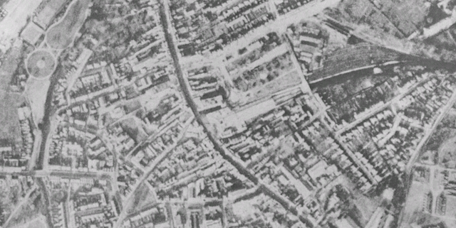
English: Uxbridge town centre in 1945. Fassnidge Park is in the north-western corner. The High Street crosses through the image from north to south. Uxbridge tube station is in the centre, with the tracks and sidings to the west. Uxbridge Vine Street can be seen partially on the southern edge. |
| Date | |
| Source | National Collection of Aerial Photography (Published through Google Earth) |
| Author | Attribution for images from Google Earth require attribution to Google and the other providers identified in imagery per [1]. |
| Permission (Reusing this file) |
PD-BRITISHGOV |
Licensing[edit]
This work created by the United Kingdom Government is in the public domain.
This is because it is one of the following:
HMSO has declared that the expiry of Crown Copyrights applies worldwide (ref: HMSO Email Reply)
|
 |
File history
Click on a date/time to view the file as it appeared at that time.
| Date/Time | Thumbnail | Dimensions | User | Comment | |
|---|---|---|---|---|---|
| current | 19:50, 2 July 2011 | | 1,023 × 513 (884 KB) | Harrison49 (talk | contribs) | {{Information |Description ={{en|1=Uxbridge town centre in 1945 {{PD-UKGov}}}} |Source =[http://aerial.rcahms.gov.uk/ National Collection of Aerial Photography] (Published through Google Earth) |Author =Attribution fo |
You cannot overwrite this file.
File usage on Commons
There are no pages that use this file.