File:Venus - 3D Perspective View of Maat Mons.jpg
跳转到导航
跳转到搜索
本预览的尺寸:800 × 600像素。 其他分辨率:320 × 240像素 | 640 × 480像素 | 1,024 × 768像素 | 1,280 × 960像素 | 2,560 × 1,920像素 | 4,000 × 3,000像素。
原始文件 (4,000 × 3,000像素,文件大小:1.09 MB,MIME类型:image/jpeg)
说明
说明
添加一行文字以描述该文件所表现的内容
| 描述 |
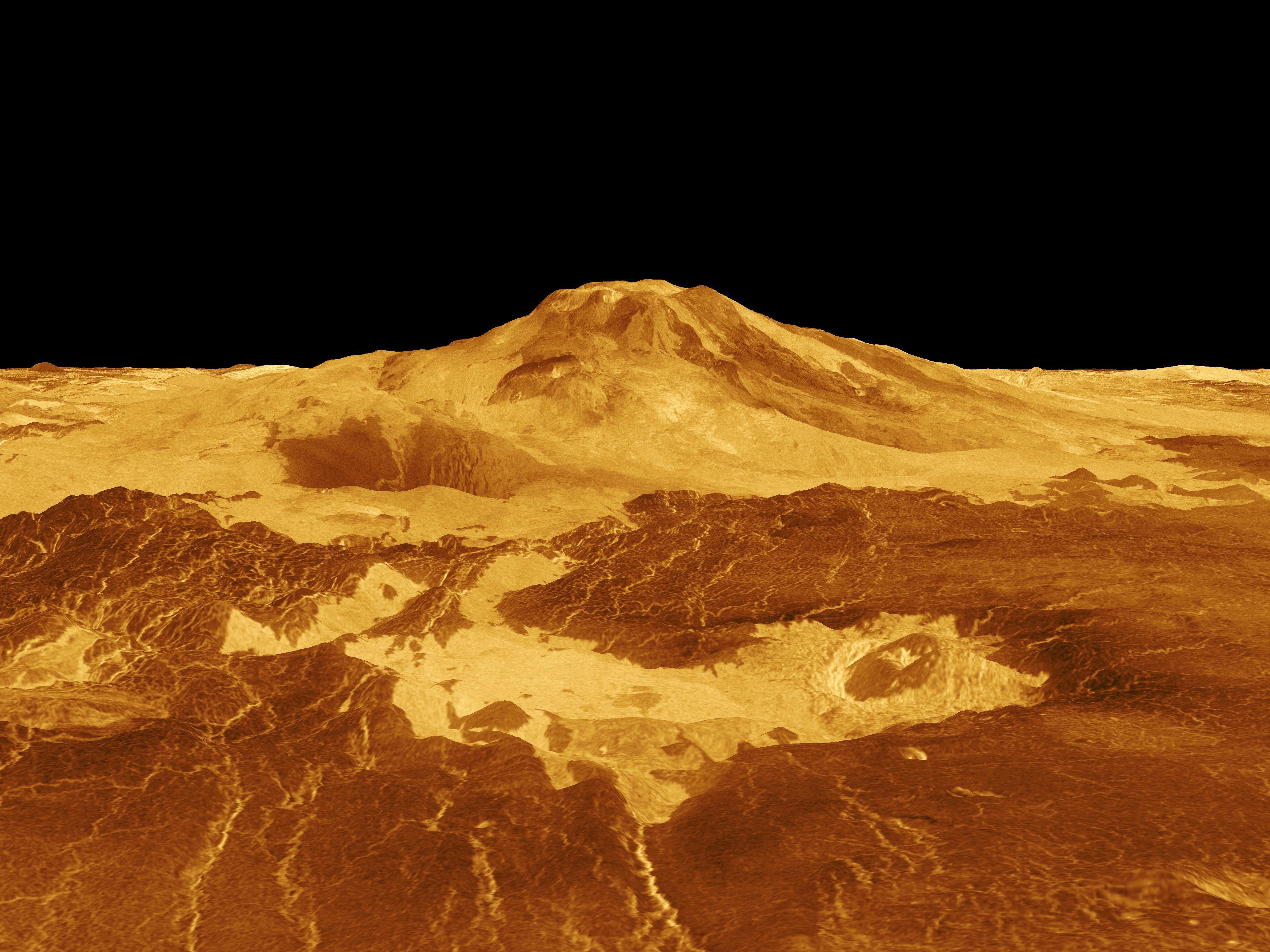
English: Maat Mons is displayed in this computer generated three-dimensional perspective of the surface of Venus. The viewpoint is located 634 kilometers (393 miles) north of Maat Mons at an elevation of 3 kilometers (2 miles) above the terrain. Lava flows extend for hundreds of kilometers across the fractured plains shown in the foreground, to the base of Maat Mons. The view is to the south with the volcano Maat Mons appearing at the center of the image on the horizon and rising to almost 5 kilometers (3 miles) above the surrounding terrain. Maat Mons is located at approximately 0.9 degrees north latitude, 194.5 degrees east longitude with a peak that ascends to 8 kilometers (5 miles) above the mean surface. Maat Mons is named for an Egyptian Goddess of truth and justice. Magellan synthetic aperture radar data is combined with radar altimetry to develop a three-dimensional map of the surface. The vertical scale in this perspective has been exaggerated 10 times. Rays cast in a computer intersect the surface to create a three-dimensional perspective view. Simulated color and a digital elevation map developed by the U.S. Geological Survey are used to enhance small-scale structure. The simulated hues are based on color images recorded by the Soviet Venera 13 and 14 spacecraft. The image was produced by the Solar System Visualization project and the Magellan Science team at the JPL Multimission Image Processing Laboratory and is a single frame from a video released at the April 22, 1992 news conference. Українська: Панорама Венери. Потоки лави на 400-км ділянці поверхні Венери |
|||||
| 日期 | ||||||
| 来源 | http://photojournal.jpl.nasa.gov/catalog/PIA00106 | |||||
| 作者 |
|
|||||
| 授权 (二次使用本文件) |
|

文件历史
点击某个日期/时间查看对应时刻的文件。
| 日期/时间 | 缩略图 | 大小 | 用户 | 备注 | |
|---|---|---|---|---|---|
| 当前 | 2009年2月14日 (六) 10:34 | | 4,000 × 3,000(1.09 MB) | Complex01(留言 | 贡献) | {{Information |Description={{en|1=Maat Mons is displayed in this computer generated three-dimensional perspective of the surface of Venus. The viewpoint is located 634 kilometers (393 miles) north of Maat Mons at an elevation of 3 kilometers (2 miles) abo |
您不可以覆盖此文件。
文件用途
以下页面使用本文件:
全域文件用途
以下其他wiki使用此文件:
- ar.wikipedia.org上的用途
- ca.wikipedia.org上的用途
- cy.wikipedia.org上的用途
- en.wikipedia.org上的用途
- es.wikipedia.org上的用途
- eu.wikipedia.org上的用途
- fr.wikipedia.org上的用途
- gl.wikipedia.org上的用途
- he.wikipedia.org上的用途
- it.wikipedia.org上的用途
- ja.wikipedia.org上的用途
- ja.wikibooks.org上的用途
- mk.wikipedia.org上的用途
- nl.wikipedia.org上的用途
- pl.wikipedia.org上的用途
- th.wikipedia.org上的用途
- tr.wikipedia.org上的用途
- uk.wikipedia.org上的用途
- www.wikidata.org上的用途
- zh.wikipedia.org上的用途