File:Viele Map 1865.jpg
Jump to navigation
Jump to search

Size of this preview: 800 × 236 pixels. Other resolutions: 320 × 94 pixels | 640 × 189 pixels | 1,024 × 302 pixels | 1,280 × 377 pixels | 2,560 × 755 pixels | 9,621 × 2,837 pixels.
Original file (9,621 × 2,837 pixels, file size: 8 MB, MIME type: image/jpeg)
Captions
Captions
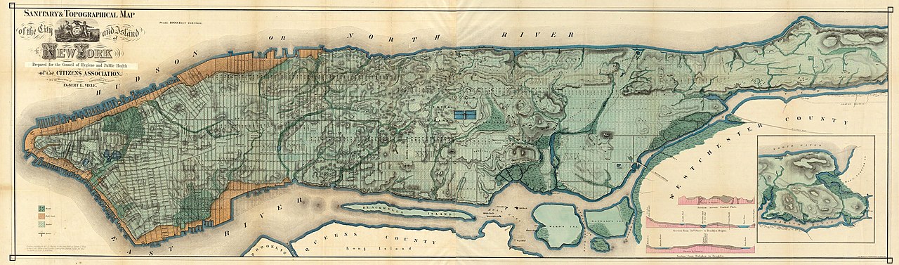
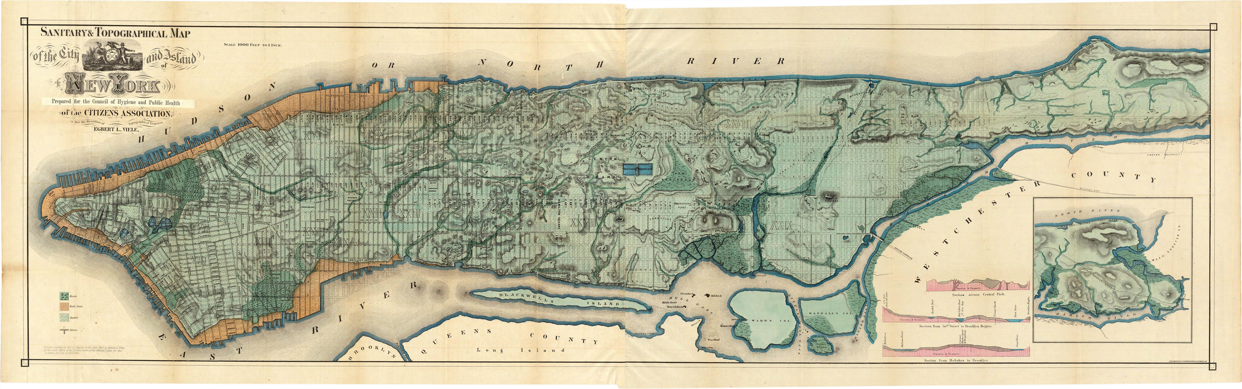
"Sanitary & Topographical Map of the City and Island of New York (1865)", known as the Viele Map
Summary[edit]
| Description |
English: "Sanitary & Topographical Map of the City and Island of New York (1865)", known as the Viele Map. See also Category:Viele map of New York City published in 1874. |
| Date | |
| Source | http://www.codex99.com/cartography/images/nyc/viele_lg.jpg |
| Author | Egbert Viele |
| Other versions |
|
,_1865.jpg)
Licensing[edit]
|
This work is in the public domain in its country of origin and other countries and areas where the copyright term is the author's life plus 70 years or fewer. This work is in the public domain in the United States because it was published (or registered with the U.S. Copyright Office) before January 1, 1929. | |
| This file has been identified as being free of known restrictions under copyright law, including all related and neighboring rights. | |
File history
Click on a date/time to view the file as it appeared at that time.
| Date/Time | Thumbnail | Dimensions | User | Comment | |
|---|---|---|---|---|---|
| current | 06:14, 21 November 2020 | 9,621 × 2,837 (8 MB) | Adamdaley (talk | contribs) | Cropped. | |
| 07:31, 12 December 2013 | 9,859 × 3,115 (8.5 MB) | Thesupermat (talk | contribs) | better | ||
| 15:08, 8 February 2013 | 5,100 × 1,598 (1.64 MB) | Armbrust (talk | contribs) | {{Information |Description ={{en|1="Sanitary & Topographical Map of the City and Island of New York (1865)", known as the Viele Map.}} |Source =http://www.codex99.com/cartography/images/nyc/viele_lg.jpg |Author ={{w|Egbert Viele}} |D... |
You cannot overwrite this file.
File usage on Commons
The following 4 pages use this file:
File usage on other wikis
The following other wikis use this file:
- Usage on azb.wikipedia.org
- Usage on en.wikipedia.org
- Usage on es.wikipedia.org
- Usage on nl.wikipedia.org