File:View of the Delaware Water Gap SE Dunfield.jpg
Jump to navigation
Jump to search
Size of this preview: 800 × 595 pixels. Other resolutions: 320 × 238 pixels | 640 × 476 pixels | 1,024 × 762 pixels | 1,280 × 953 pixels | 2,560 × 1,905 pixels | 4,388 × 3,266 pixels.
Original file (4,388 × 3,266 pixels, file size: 7.14 MB, MIME type: image/jpeg)
Captions
Captions
Add a one-line explanation of what this file represents
Summary[edit]
| Description |
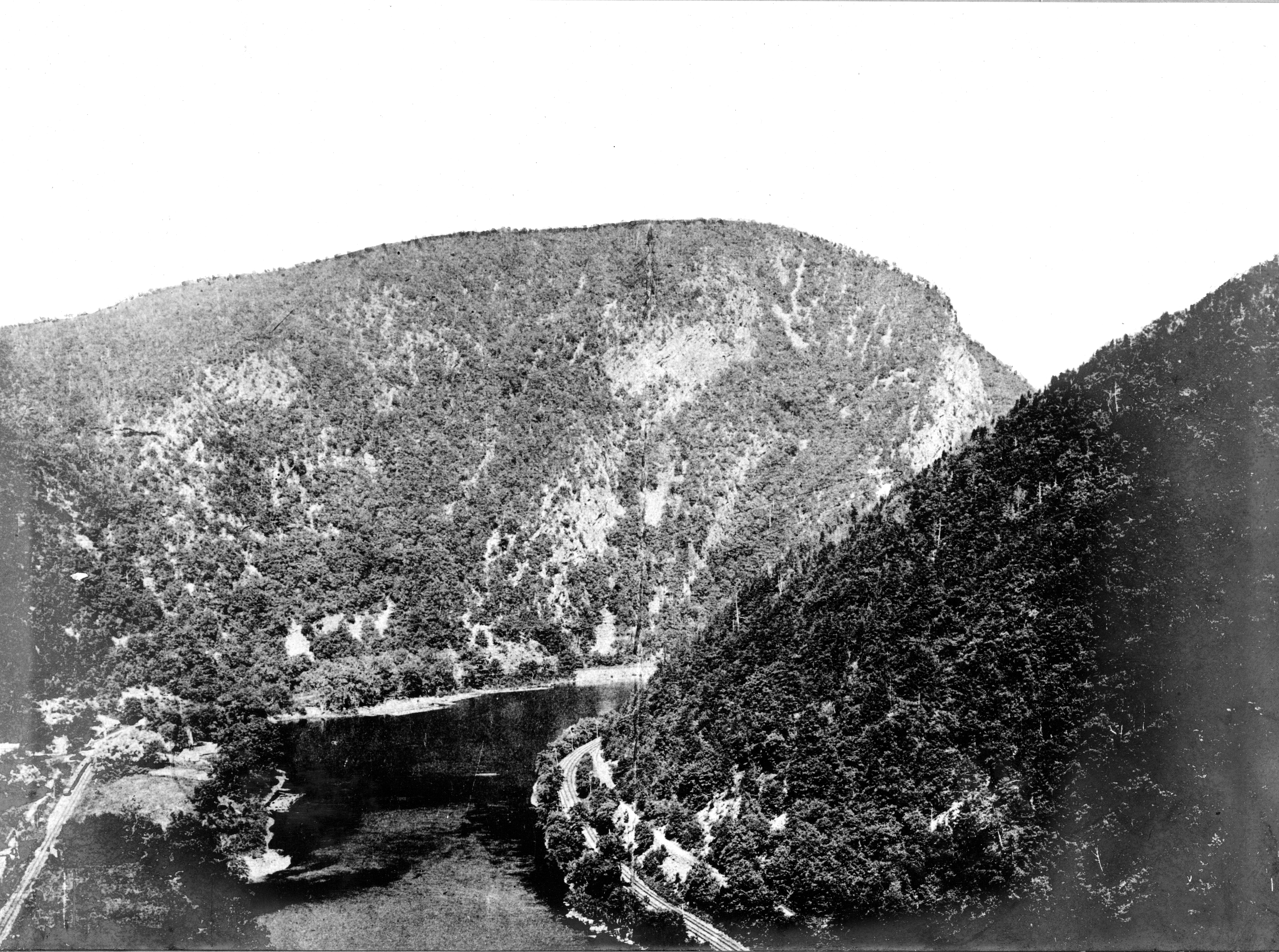
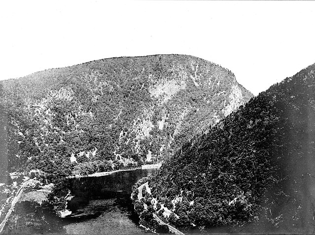
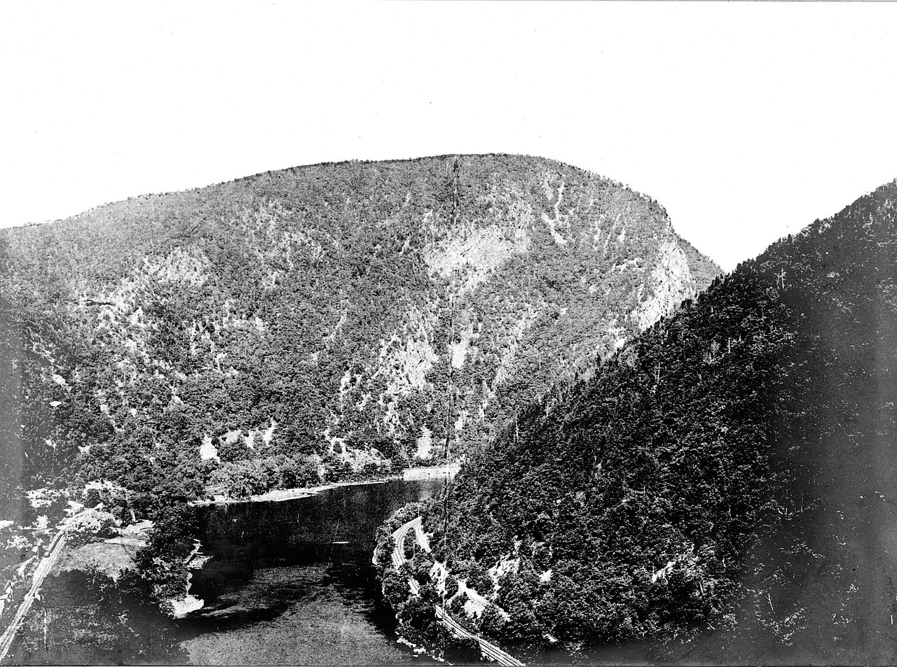
English: View of the Delaware Water Gap from the west |
| Date | Unknown date |
| Source | https://library.usgs.gov/photo/#/item/51ddbcc0e4b0f72b447203f9 Stose, G.W. 810 |
| Author | US Geological Survey (ID. Stose, G.W. 810) |
Licensing[edit]
This image is in the public domain in the United States because it only contains materials that originally came from the United States Geological Survey, an agency of the United States Department of the Interior. For more information, see the official USGS copyright policy.
|
Original upload log[edit]
Transferred from en.wikipedia to Commons using For the Common Good.
The original description page was here. All following user names refer to en.wikipedia.
| Date/Time | Dimensions | User | Comment |
|---|---|---|---|
| 00:17, 17 November 2017 | 4,388 × 3,266 (7,483,316 bytes) | w:en:Jon Kolbert (talk | contribs) | full-res |
| 00:14, 3 January 2013 | 700 × 521 (272,084 bytes) | w:en:ColonelHenry (talk | contribs) | Uploading a public-domain item using [[Wikipedia:File_Upload_Wizard|File Upload Wizard]] |
File history
Click on a date/time to view the file as it appeared at that time.
| Date/Time | Thumbnail | Dimensions | User | Comment | |
|---|---|---|---|---|---|
| current | 00:21, 17 November 2017 | | 4,388 × 3,266 (7.14 MB) | JonKolbert (talk | contribs) | Transferred from en.wikipedia: see original upload log above |
You cannot overwrite this file.
File usage on Commons
There are no pages that use this file.
File usage on other wikis
The following other wikis use this file:
- Usage on en.wikipedia.org
- Delaware Water Gap
- Tocks Island Dam controversy
- Worthington State Forest
- Milford–Montague Toll Bridge
- Dingman's Ferry Bridge
- Dingmans Ferry, Pennsylvania
- Kittatinny Mountain
- Mount Tammany
- Blue Mountain (Pennsylvania)
- Delaware Water Gap National Recreation Area
- Flat Brook
- Old Mine Road
- Delaware Water Gap Toll Bridge
- Brodhead Creek
- Big Bushkill Creek
- George W. Childs Recreation Site
- Silverthread Falls
- Dingmans Falls
- Deer Leap Falls
- Fulmer Falls
- Military Road (New Jersey)
- Geology of New Jersey
- Conashaugh, Pennsylvania
- Eshback, Pennsylvania
- Bushkill, Pennsylvania
- Minisink Archaeological Site
- Mount Minsi
- Sunfish Pond
- Callahan House (Milford, Pennsylvania)
- Zion Lutheran Church (East Stroudsburg, Pennsylvania)
- Dingman's Ferry Dutch Reformed Church
- Pahaquarry Copper Mine
- Delaware Water Gap station (Delaware, Lackawanna and Western Railroad)
- John Michael Farm
- John Turn Farm
- Cold Spring Farm Springhouse
- Schoonover Mountain House
- Capt. Jacob Shoemaker House
- Marie Zimmermann Farm
- Brodhead Farm
- Nyce Farm
- Metz Ice Plant
- Brau Kettle
- Minisink
- Van Campen's Inn
- Template:Delaware Water Gap National Recreation Area
- Wallpack Ridge
- Wallpack Valley
- Wallpack Center, New Jersey
- Flatbrookville, New Jersey
View more global usage of this file.