File:View of the city of Washington in 1792.tif
Original file (9,427 × 6,940 pixels, file size: 187.2 MB, MIME type: image/tiff)
Captions
Captions
Summary[edit]
| Description |
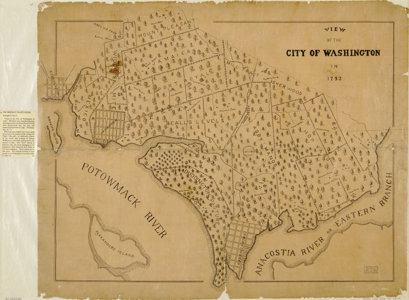
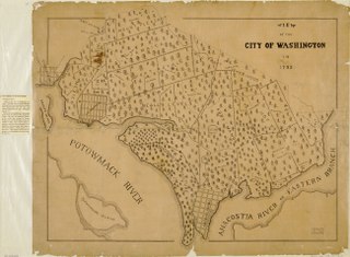
English: - Cadastral map showing named land tracts with owners' names.
- Selected buildings and trees shown pictorially. - Planimetric map--not bird's-eye view. - Also shows townsites of Georgetown, Hamburgh, and Carrollsburg. - Available also through the Library of Congress Web site as a raster image. - LC copy accompanied by D.C. Sesquicentennial exhibition caption, Apr. 1950-Apr. 1951: 9. Pre-District plantations. - LC copy darkened, fold-lined, lacking small sections along edges, and mounted on cloth backing. - Phillips. Washington 1285 - Vault - DCP |
| Date | 18?? |
| Source | Library of Congress Geography and Map Division, Washington, DC: https://www.loc.gov/item/87694269/ |
| Author | Unknown author |

|
This image is available from the United States Library of Congress's Prints and Photographs division
under the digital ID g3851g.ct001791. This tag does not indicate the copyright status of the attached work. A normal copyright tag is still required. See Commons:Licensing.
|
Licensing[edit]
This work is in the public domain in the United States because it is a work prepared by an officer or employee of the United States Government as part of that person’s official duties under the terms of Title 17, Chapter 1, Section 105 of the US Code.
Note: This only applies to original works of the Federal Government and not to the work of any individual U.S. state, territory, commonwealth, county, municipality, or any other subdivision. This template also does not apply to postage stamp designs published by the United States Postal Service since 1978. (See § 313.6(C)(1) of Compendium of U.S. Copyright Office Practices). It also does not apply to certain US coins; see The US Mint Terms of Use.
|
 | |
| This file has been identified as being free of known restrictions under copyright law, including all related and neighboring rights. | ||
File history
Click on a date/time to view the file as it appeared at that time.
| Date/Time | Thumbnail | Dimensions | User | Comment | |
|---|---|---|---|---|---|
| current | 15:17, 4 April 2018 |  | 9,427 × 6,940 (187.2 MB) | Blazingliberty (talk | contribs) | User created page with UploadWizard |
You cannot overwrite this file.
File usage on Commons
There are no pages that use this file.
File usage on other wikis
The following other wikis use this file:
- Usage on en.wikipedia.org
- Usage on hy.wikipedia.org