File:Wadi Halfa Salient-txu-oclc-6949452-nf36-5 crop.jpg
ナビゲーションに移動
検索に移動
このプレビューのサイズ: 566 × 599 ピクセル。 その他の解像度: 227 × 240 ピクセル | 453 × 480 ピクセル | 786 × 832 ピクセル。
元のファイル (786 × 832 ピクセル、ファイルサイズ: 197キロバイト、MIME タイプ: image/jpeg)
キャプション
キャプション
このファイルの内容を1行で記述してください
概要
[編集]
| 解説 |
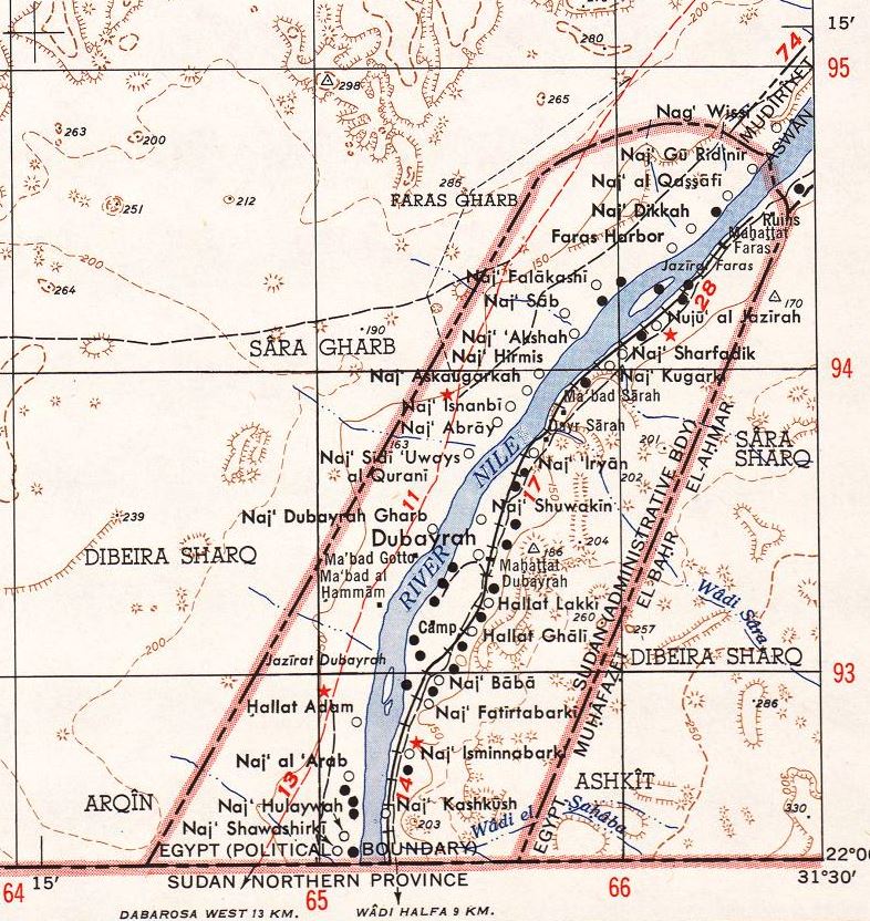
English: North Africa 1:250,000
Sheet NF 36-5 in the southeast is the Wadi Halfa Salient, with the situation before the flooding by the Aswan Dam and Lake Nasser |
| 日付 | |
| 原典 | http://www.lib.utexas.edu/maps/ams/north_africa/txu-oclc-6949452-nf36-5.jpg |
| 作者 | Army Map Service (LD), Corps of Engineers, U.S. Army |
| その他のバージョン |
 |
ライセンス
[編集]
|
|
 |
ファイルの履歴
過去の版のファイルを表示するには、その版の日時をクリックしてください。
| 日付と時刻 | サムネイル | 寸法 | 利用者 | コメント | |
|---|---|---|---|---|---|
| 現在の版 | 2014年7月15日 (火) 03:08 | | 786 × 832 (197キロバイト) | Beyond My Ken (トーク | 投稿記録) | == {{int:filedesc}} == {{Information |Description={{en|1=North Africa 1:250,000 Sheet NF 36-5 in the southeast is the Wadi Halfa Salient, with the situation before the flooding by the Aswan Dam and Lake Nasser }} |Source=http://www.lib.utexas.edu/maps/... |
このファイルは上書きできません。
ファイルの使用状況
以下のページがこのファイルを使用しています:
グローバルなファイル使用状況
以下に挙げる他のウィキがこの画像を使っています:
- ar.wikipedia.org での使用状況
- en.wikipedia.org での使用状況
- ja.wikipedia.org での使用状況