File:Wales Gwynedd locator map.svg
Aller à la navigation
Aller à la recherche

Taille de cet aperçu PNG pour ce fichier SVG : 502 × 600 pixels. Autres résolutions : 201 × 240 pixels | 402 × 480 pixels | 643 × 768 pixels | 857 × 1 024 pixels | 1 714 × 2 048 pixels | 1 047 × 1 251 pixels.
Fichier d’origine (Fichier SVG, nominalement de 1 047 × 1 251 pixels, taille : 151 kio)
Légendes
Légendes
Ajoutez en une ligne la description de ce que représente ce fichier
Description[modifier]
| Description |
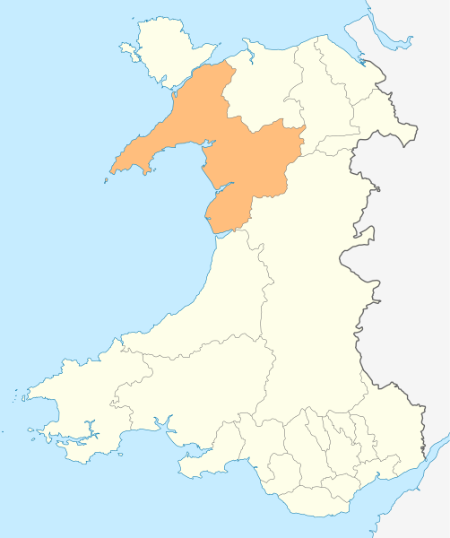
Deutsch: Lagekarte von Gwynedd in Wales
English: Locator map of Gwynedd in Wales |
| Date | |
| Source | Travail personnel, File:Wales location map.svg |
| Auteur | NordNordWest |
| Autorisation (Réutilisation de ce fichier) |
Moi, en tant que détenteur des droits d’auteur sur cette œuvre, je la publie sous la licence suivante : Ce fichier est disponible selon les termes de la licence Creative Commons Attribution – Partage dans les Mêmes Conditions 3.0 (non transposée).
|

|
Cette carte a été créée ou améliorée dans le Kartenwerkstatt (Atelier cartographique allemand). Vous pouvez également y proposer des cartes à améliorer.
|
Historique du fichier
Cliquer sur une date et heure pour voir le fichier tel qu'il était à ce moment-là.
| Date et heure | Vignette | Dimensions | Utilisateur | Commentaire | |
|---|---|---|---|---|---|
| actuel | 4 mai 2010 à 18:52 | | 1 047 × 1 251 (151 kio) | NordNordWest (d | contributions) | {{int:filedesc}} {{Information |Description= {{de|Lagekarte von Gwynedd in Wales}} {{en|Locator map of Gwynedd in Wales}} |Source={{Own}} |Date=2010-05-04 |Author={{U|NordNordWest}} |Permission={{self|cc-by-sa-3.0}} |other_versions= }} {{Kartenwerkstatt} |
Vous ne pouvez pas remplacer ce fichier.
Utilisations locales du fichier
Les 30 pages suivantes utilisent ce fichier :
- Template:Gwynedd year
- Category:1976 in Gwynedd
- Category:1977 in Gwynedd
- Category:1979 in Gwynedd
- Category:1998 in Gwynedd
- Category:2000 in Gwynedd
- Category:2001 in Gwynedd
- Category:2002 in Gwynedd
- Category:2003 in Gwynedd
- Category:2004 in Gwynedd
- Category:2005 in Gwynedd
- Category:2006 in Gwynedd
- Category:2007 in Gwynedd
- Category:2008 in Gwynedd
- Category:2009 in Gwynedd
- Category:2010 in Gwynedd
- Category:2011 in Gwynedd
- Category:2012 in Gwynedd
- Category:2013 in Gwynedd
- Category:2014 in Gwynedd
- Category:2015 in Gwynedd
- Category:2016 in Gwynedd
- Category:2017 in Gwynedd
- Category:2018 in Gwynedd
- Category:2019 in Gwynedd
- Category:2020 in Gwynedd
- Category:2021 in Gwynedd
- Category:2022 in Gwynedd
- Category:2023 in Gwynedd
- Category:2024 in Gwynedd
Utilisations du fichier sur d’autres wikis
Les autres wikis suivants utilisent ce fichier :
- Utilisation sur en.wikipedia.org
- Caernarfon
- Gwynedd
- Portmeirion
- Beddgelert
- Golf Halt railway station
- Harlech Castle
- Criccieth Castle
- Blaenau Ffestiniog
- Aberdaron
- Berwyn range
- Porthmadog
- Bangor, Gwynedd
- Bethesda, Gwynedd
- Ffestiniog
- Llan Ffestiniog
- Harlech
- Criccieth
- Pwllheli
- Bardsey Island
- Llanberis
- Barmouth
- Dolgellau
- Tywyn
- Fairbourne
- Tremadog Bay
- Caernarfon Bay
- Abersoch
- Llanbedr
- Aberdyfi
- Nasareth
- Saint Tudwal's Islands
- Cnicht
- Y Llethr
- Garnedd Ugain
- Yr Aran
- Llyn Llydaw
- Nefyn
- Afon Mawddach
- Trawsfynydd
- Bala, Gwynedd
- Tremadog
- Tanygrisiau
- Llanystumdwy
- Y Rhiw
- Afon Ogwen
- Llanfaglan
- Fort Belan
- List of places in Gwynedd
- Y Felinheli
- River Dwyryd
Voir davantage sur l’utilisation globale de ce fichier.