File:Wales Swansea locator map.svg
ナビゲーションに移動
検索に移動

この SVG ファイルのこの PNG プレビューのサイズ: 502 × 600 ピクセル. その他の解像度: 201 × 240 ピクセル | 402 × 480 ピクセル | 643 × 768 ピクセル | 857 × 1,024 ピクセル | 1,714 × 2,048 ピクセル | 1,047 × 1,251 ピクセル。
元のファイル (SVG ファイル、1,047 × 1,251 ピクセル、ファイルサイズ: 147キロバイト)
キャプション
キャプション
このファイルの内容を1行で記述してください
概要[編集]
| 解説 |
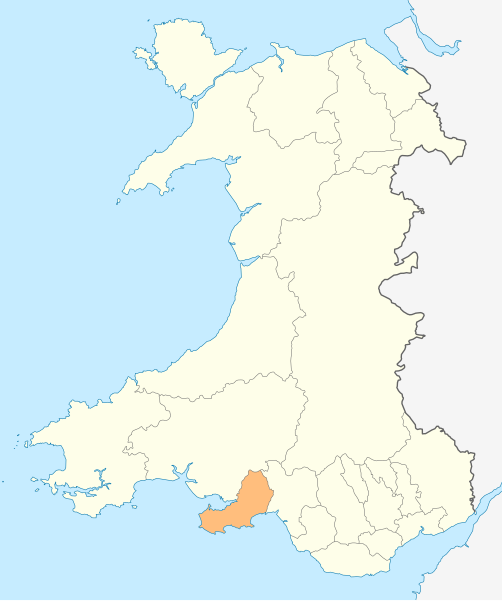
Deutsch: Lagekarte von Swansea in Wales
English: Locator map of Swansea in Wales |
| 日付 | |
| 原典 | 投稿者自身による著作物 |
| 作者 | NordNordWest |
| 許可 (ファイルの再利用) |
この作品の著作権者である私は、この作品を以下のライセンスで提供します。 このファイルはクリエイティブ・コモンズ 表示-継承 3.0 非移植ライセンスのもとに利用を許諾されています。
|

|
この地図は、ドイツ語版の(地図研究室)で制作、もしくは改善されたものです。更なる改善の為、地図を提案することもできます。
|
ファイルの履歴
過去の版のファイルを表示するには、その版の日時をクリックしてください。
| 日付と時刻 | サムネイル | 寸法 | 利用者 | コメント | |
|---|---|---|---|---|---|
| 現在の版 | 2010年5月4日 (火) 18:58 | | 1,047 × 1,251 (147キロバイト) | NordNordWest (トーク | 投稿記録) | {{int:filedesc}} {{Information |Description= {{de|Lagekarte von Swansea in Wales}} {{en|Locator map of Swansea in Wales}} |Source={{Own}} |Date=2010-05-04 |Author={{U|NordNordWest}} |Permission={{self|cc-by-sa-3.0}} |other_versions= }} {{Kartenwerkstatt} |
このファイルは上書きできません。
ファイルの使用状況
以下の 24 ページがこのファイルを使用しています:
- Template:Swanseayear
- Category:1998 in Swansea
- Category:2003 in Swansea
- Category:2004 in Swansea
- Category:2005 in Swansea
- Category:2006 in Swansea
- Category:2007 in Swansea
- Category:2008 in Swansea
- Category:2009 in Swansea
- Category:2010 in Swansea
- Category:2011 in Swansea
- Category:2012 in Swansea
- Category:2013 in Swansea
- Category:2014 in Swansea
- Category:2015 in Swansea
- Category:2016 in Swansea
- Category:2017 in Swansea
- Category:2018 in Swansea
- Category:2019 in Swansea
- Category:2020 in Swansea
- Category:2021 in Swansea
- Category:2022 in Swansea
- Category:2023 in Swansea
- Category:2024 in Swansea
グローバルなファイル使用状況
以下に挙げる他のウィキがこの画像を使っています:
- en.wikipedia.org での使用状況
- Swansea
- Gower (electoral ward)
- M4 motorway
- Mumbles
- A483 road
- A48 road
- Loughor
- Gorseinon
- Oystermouth
- Rhossili
- Heart of Wales line
- Swansea West (UK Parliament constituency)
- Slade Bay
- Gower (UK Parliament constituency)
- Swansea East (UK Parliament constituency)
- River Tawe
- History of Swansea
- Neath and Tennant Canal
- Swansea railway station
- Uplands, Swansea
- Clase
- Birchgrove, Swansea
- Morriston
- Sketty (electoral ward)
- Townhill, Swansea
- Dunvant
- Newton, Swansea
- Llansamlet (electoral ward)
- St Thomas, Swansea
- Cockett
- Landore (electoral ward)
- Port Tennant
- Bon-y-maen
- Waunarlwydd
- Gowerton
- Killay, Swansea
- Penlan
- Penllergaer
- Manselton
- Bishopston, Swansea
- Cwmbwrla
- Mynydd-bach (electoral ward)
- Killay South
- Mawr
- Penderry
- Pennard (electoral ward)
- Clydach, Swansea
- Fairwood, Swansea
- Killay North
- Llangyfelach
このファイルのグローバル使用状況を表示する。