File:Wales location map.svg
跳转到导航
跳转到搜索

此SVG文件的PNG预览的大小:501 × 599像素。 其他分辨率:201 × 240像素 | 401 × 480像素 | 642 × 768像素 | 856 × 1,024像素 | 1,713 × 2,048像素 | 1,047 × 1,252像素。
原始文件 (SVG文件,尺寸为1,047 × 1,252像素,文件大小:237 KB)
说明
说明
添加一行文字以描述该文件所表现的内容
摘要[编辑]
| 描述 |
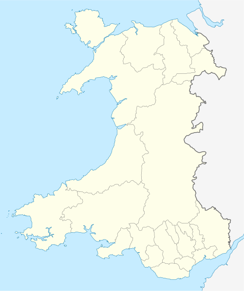
Quadratische Plattkarte, N-S-Streckung 163 %. Geographische Begrenzung der Karte:
Equirectangular projection, N/S stretching 163 %. Geographic limits of the map:
|
| 日期 | |
| 来源 | own work, using United States National Imagery and Mapping Agency data |
| 作者 | NordNordWest |
| 其他版本 |
此文件衍生的作品: |

|
|
许可协议[编辑]
我,本作品著作权人,特此采用以下许可协议发表本作品:
本文件采用知识共享署名-相同方式共享 3.0 未本地化版本许可协议授权。
- 您可以自由地:
- 共享 – 复制、发行并传播本作品
- 修改 – 改编作品
- 惟须遵守下列条件:
- 署名 – 您必须对作品进行署名,提供授权条款的链接,并说明是否对原始内容进行了更改。您可以用任何合理的方式来署名,但不得以任何方式表明许可人认可您或您的使用。
- 相同方式共享 – 如果您再混合、转换或者基于本作品进行创作,您必须以与原先许可协议相同或相兼容的许可协议分发您贡献的作品。
文件历史
点击某个日期/时间查看对应时刻的文件。
| 日期/时间 | 缩略图 | 大小 | 用户 | 备注 | |
|---|---|---|---|---|---|
| 当前 | 2009年6月24日 (三) 13:27 | | 1,047 × 1,252(237 KB) | NordNordWest(留言 | 贡献) | {{Information |Description= {{de|Positionskarte von Wales, Vereinigtes Königreich}} Quadratische Plattkarte, N-S-Streckung 163 %. Geographische Begrenzung der Karte: * N: 53.5° N * S: 51.3° N * W: 5.5° W * |
您不可以覆盖此文件。
文件用途
超过100个页面使用本文件。 下面的列表只显示使用本文件的前100个页面。完整列表可用。
- User:NordNordWest/Gallery/Location maps
- File:2023 North East Wales National Park (Area of Search) draft map.svg
- File:A470-Wales.svg
- File:All-Wales Orange Map.svg
- File:Anglesey in Wales.svg
- File:Blaenau Gwent in Wales.svg
- File:Bridgend in Wales.svg
- File:Caerphilly in Wales.svg
- File:Cardiff in Wales.svg
- File:Carmarthenshire in Wales.svg
- File:Ceredigion in Wales.svg
- File:Clwyd Preserved County in Wales.svg
- File:Clwydian Range and Dee Valley AONB map.svg
- File:Clwydian Range and Dee Valley AONB stages map.svg
- File:Conwy in Wales.svg
- File:Denbighshire in Wales.svg
- File:Dyfed Preserved County in Wales.svg
- File:Flintshire in Wales.svg
- File:Gwent Preserved County in Wales.svg
- File:Gwynedd Preserved County in Wales.svg
- File:Gwynedd in Wales.svg
- File:Map of Owain Glyndŵr's Revolt.svg
- File:Merthyr Tydfil in Wales.svg
- File:Mid Glamorgan Preserved County in Wales.svg
- File:Mid Wales.svg
- File:Mid and South West Wales Map.svg
- File:Mid and West Wales Fire and Rescue Map.svg
- File:Monmouthshire in Wales.svg
- File:NUTS 2 statistical regions of the United Kingdom 2015 map.svg
- File:NUTS 2 statistical regions of the United Kingdom map.svg
- File:NUTS 3 regions of Wales map.svg
- File:Neath Port Talbot in Wales.svg
- File:Newport in Wales.svg
- File:North East Wales Map.svg
- File:North Wales Fire and Rescue Map.svg
- File:North Wales Map.svg
- File:North West Wales.svg
- File:North and Mid Wales map.svg
- File:Pembrokeshire in Wales.svg
- File:Powys Preserved County in Wales.svg
- File:Powys in Wales.svg
- File:Preserved Counties Wales.svg
- File:Rhondda Cynon Taf in Wales.svg
- File:South East Wales.svg
- File:South East and South West Wales map.svg
- File:South Glamorgan Preserved County in Wales.svg
- File:South Wales Fire and Rescue Map.svg
- File:South Wales Map.svg
- File:South West Wales.svg
- File:Swanline Map.png
- File:Swansea District line Map.png
- File:Swansea in Wales.svg
- File:Torfaen in Wales.svg
- File:Vale of Glamorgan in Wales.svg
- File:Wales AONBs map.svg
- File:Wales AONBs map (with local boundaries).svg
- File:Wales Bridgend.svg
- File:Wales Cardiff Capital Region locator map.svg
- File:Wales Carmarthenshire.svg
- File:Wales Ceredigion.svg
- File:Wales City Regions map.svg
- File:Wales Fire and Rescue Services map.svg
- File:Wales Historic Counties map.svg
- File:Wales Historic Counties map Anglesey.svg
- File:Wales Historic Counties map Brecknockshire.svg
- File:Wales Historic Counties map Caernarfonshire.svg
- File:Wales Historic Counties map Cardiganshire.svg
- File:Wales Historic Counties map Carmarthenshire.svg
- File:Wales Historic Counties map Denbighshire.svg
- File:Wales Historic Counties map Flintshire.svg
- File:Wales Historic Counties map Glamorgan.svg
- File:Wales Historic Counties map Merionethshire.svg
- File:Wales Historic Counties map Monmouthshire.svg
- File:Wales Historic Counties map Montgomeryshire.svg
- File:Wales Historic Counties map Pembrokeshire.svg
- File:Wales Historic Counties map Radnorshire.svg
- File:Wales Map 400 x 478.png
- File:Wales Merthyr Tydfil.svg
- File:Wales Mid Wales locator map.svg
- File:Wales National Parks and AONBs map.svg
- File:Wales National Parks and AONBs map (colours).svg
- File:Wales National Parks and AONBs map (colours and labelled).svg
- File:Wales National Parks and AONBs map (labelled).svg
- File:Wales National Parks map.svg
- File:Wales Neath Port Talbot.svg
- File:Wales North Wales locator map.svg
- File:Wales Pembrokeshire.svg
- File:Wales Powys.svg
- File:Wales Principal Areas Density Map.svg
- File:Wales Principal Areas map (in green).svg
- File:Wales Rhondda Cynon Taf.svg
- File:Wales Swansea.svg
- File:Wales Swansea Bay City Region locator map.svg
- File:Wales Trunk Road Agents map.svg
- File:Wales Vale of Glamorgan.svg
- File:Wales location map subdivisions 1996.svg
- File:Welsh weekly newspapers.jpg
- File:West Glamorgan Preserved County in Wales.svg
- File:West Wales lines Map.png
- File:Wild Wales map.svg
_draft_map.svg)
.svg)
.svg)
.svg)
.svg)
.svg)
查看连接到这个文件的更多链接。
全域文件用途
以下其他wiki使用此文件:
- af.wikipedia.org上的用途
- ar.wikipedia.org上的用途
- ast.wikipedia.org上的用途
- az.wikipedia.org上的用途
- ba.wikipedia.org上的用途
- bg.wikipedia.org上的用途
- bh.wikipedia.org上的用途
- bn.wikipedia.org上的用途
- br.wikipedia.org上的用途
- Dolgellau
- Bangor-is-y-coed
- Aberaeron
- Patrom:Infobox UK place
- Rhaeadr Gwy
- Llanfachraeth (Mon)
- Trefor (Mon)
- Caergybi
- Aberporth
- Beulah (Ceredigion)
- Llanfihangel-yn-Nhywyn
- Abermaw
- Llan-faes (Mon)
- Ynyslas
- Clynnog Fawr
- Ffair-rhos
- Patrom:Location map Kembre
- Bont Goch
- Gilfachreda
- Parc-llyn
- Pennant (Ceredigion)
- Brongest
- Bryngwyn (Ceredigion)
- Brynafan
- Brynhoffnant
- Coed-y-bryn
- Cwmsychbant
查看本文件的更多全域用途。