File:Wales location map.svg
跳至導覽
跳至搜尋

此 SVG 檔案的 PNG 預覽的大小:501 × 599 像素。 其他解析度:201 × 240 像素 | 401 × 480 像素 | 642 × 768 像素 | 856 × 1,024 像素 | 1,713 × 2,048 像素 | 1,047 × 1,252 像素。
原始檔案 (SVG 檔案,表面大小:1,047 × 1,252 像素,檔案大小:237 KB)
說明
說明
添加單行說明來描述出檔案所代表的內容
摘要
[編輯]
| 描述 |
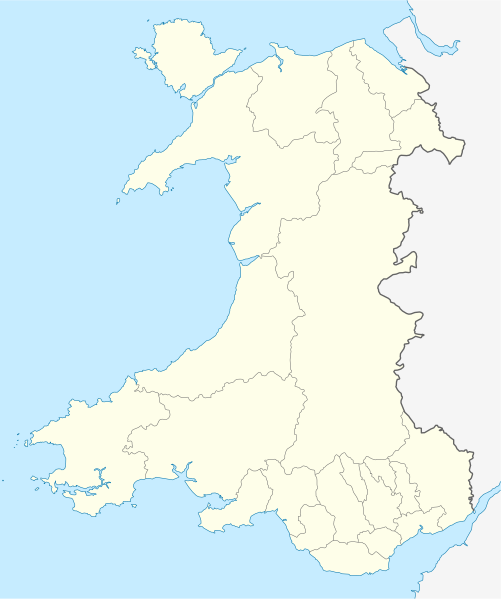
Quadratische Plattkarte, N-S-Streckung 163 %. Geographische Begrenzung der Karte:
Equirectangular projection, N/S stretching 163 %. Geographic limits of the map:
|
| 日期 | |
| 來源 | own work, using United States National Imagery and Mapping Agency data |
| 作者 | NordNordWest |
| 其他版本 |
Derivative works of this file: |

|
|
授權條款
[編輯]
我,本作品的著作權持有者,決定用以下授權條款發佈本作品:
此檔案採用共享創意 姓名標示-相同方式分享 3.0 未在地化版本授權條款。
- 您可以自由:
- 分享 – 複製、發佈和傳播本作品
- 重新修改 – 創作演繹作品
- 惟需遵照下列條件:
- 姓名標示 – 您必須指名出正確的製作者,和提供授權條款的連結,以及表示是否有對內容上做出變更。您可以用任何合理的方式來行動,但不得以任何方式表明授權條款是對您許可或是由您所使用。
- 相同方式分享 – 如果您利用本素材進行再混合、轉換或創作,您必須基於如同原先的相同或兼容的條款,來分布您的貢獻成品。
檔案歷史
點選日期/時間以檢視該時間的檔案版本。
| 日期/時間 | 縮圖 | 尺寸 | 用戶 | 備註 | |
|---|---|---|---|---|---|
| 目前 | 2009年6月24日 (三) 13:27 | | 1,047 × 1,252(237 KB) | NordNordWest(對話 | 貢獻) | {{Information |Description= {{de|Positionskarte von Wales, Vereinigtes Königreich}} Quadratische Plattkarte, N-S-Streckung 163 %. Geographische Begrenzung der Karte: * N: 53.5° N * S: 51.3° N * W: 5.5° W * |
無法覆蓋此檔案。
檔案用途
超過 100 個頁面有用到此檔案。 下列清單只列出前 100 筆有用到此檔案的頁面。 您也可以檢視完整清單。
- User:NordNordWest/Gallery/Location maps
- File:2023 North East Wales National Park (Area of Search) draft map.svg
- File:A470-Wales.svg
- File:All-Wales Orange Map.svg
- File:Anglesey in Wales.svg
- File:Blaenau Gwent in Wales.svg
- File:Bridgend in Wales.svg
- File:Caerphilly in Wales.svg
- File:Cardiff in Wales.svg
- File:Carmarthenshire in Wales.svg
- File:Ceredigion in Wales.svg
- File:Clwyd Preserved County in Wales.svg
- File:Clwydian Range and Dee Valley AONB map.svg
- File:Clwydian Range and Dee Valley AONB stages map.svg
- File:Conwy in Wales.svg
- File:Denbighshire in Wales.svg
- File:Dyfed Preserved County in Wales.svg
- File:Flintshire in Wales.svg
- File:Gwent Preserved County in Wales.svg
- File:Gwynedd Preserved County in Wales.svg
- File:Gwynedd in Wales.svg
- File:Map of Owain Glyndŵr's Revolt.svg
- File:Merthyr Tydfil in Wales.svg
- File:Mid Glamorgan Preserved County in Wales.svg
- File:Mid Wales.svg
- File:Mid and South West Wales Map.svg
- File:Mid and West Wales Fire and Rescue Map.svg
- File:Monmouthshire in Wales.svg
- File:NUTS 2 statistical regions of the United Kingdom 2015 map.svg
- File:NUTS 2 statistical regions of the United Kingdom map.svg
- File:NUTS 3 regions of Wales map.svg
- File:Neath Port Talbot in Wales.svg
- File:Newport in Wales.svg
- File:North East Wales Map.svg
- File:North Wales Fire and Rescue Map.svg
- File:North Wales Map.svg
- File:North West Wales.svg
- File:North and Mid Wales map.svg
- File:Pembrokeshire in Wales.svg
- File:Powys Preserved County in Wales.svg
- File:Powys in Wales.svg
- File:Preserved Counties Wales.svg
- File:Rhondda Cynon Taf in Wales.svg
- File:South East Wales.svg
- File:South East and South West Wales map.svg
- File:South Glamorgan Preserved County in Wales.svg
- File:South Wales Fire and Rescue Map.svg
- File:South Wales Map.svg
- File:South West Wales.svg
- File:Swanline Map.png
- File:Swansea District line Map.png
- File:Swansea in Wales.svg
- File:Torfaen in Wales.svg
- File:Vale of Glamorgan in Wales.svg
- File:Wales AONBs map.svg
- File:Wales AONBs map (with local boundaries).svg
- File:Wales Bridgend.svg
- File:Wales Cardiff Capital Region locator map.svg
- File:Wales Carmarthenshire.svg
- File:Wales Ceredigion.svg
- File:Wales City Regions map.svg
- File:Wales Fire and Rescue Services map.svg
- File:Wales Historic Counties map.svg
- File:Wales Historic Counties map Anglesey.svg
- File:Wales Historic Counties map Brecknockshire.svg
- File:Wales Historic Counties map Caernarfonshire.svg
- File:Wales Historic Counties map Cardiganshire.svg
- File:Wales Historic Counties map Carmarthenshire.svg
- File:Wales Historic Counties map Denbighshire.svg
- File:Wales Historic Counties map Flintshire.svg
- File:Wales Historic Counties map Glamorgan.svg
- File:Wales Historic Counties map Merionethshire.svg
- File:Wales Historic Counties map Monmouthshire.svg
- File:Wales Historic Counties map Montgomeryshire.svg
- File:Wales Historic Counties map Pembrokeshire.svg
- File:Wales Historic Counties map Radnorshire.svg
- File:Wales Map 400 x 478.png
- File:Wales Merthyr Tydfil.svg
- File:Wales Mid Wales locator map.svg
- File:Wales National Parks and AONBs map.svg
- File:Wales National Parks and AONBs map (colours).svg
- File:Wales National Parks and AONBs map (colours and labelled).svg
- File:Wales National Parks and AONBs map (labelled).svg
- File:Wales National Parks map.svg
- File:Wales Neath Port Talbot.svg
- File:Wales North Wales locator map.svg
- File:Wales Pembrokeshire.svg
- File:Wales Powys.svg
- File:Wales Principal Areas Density Map.svg
- File:Wales Principal Areas map (in green).svg
- File:Wales Rhondda Cynon Taf.svg
- File:Wales Swansea.svg
- File:Wales Swansea Bay City Region locator map.svg
- File:Wales Trunk Road Agents map.svg
- File:Wales Vale of Glamorgan.svg
- File:Wales location map subdivisions 1996.svg
- File:Welsh weekly newspapers.jpg
- File:West Glamorgan Preserved County in Wales.svg
- File:West Wales lines Map.png
- File:Wild Wales map.svg
_draft_map.svg)
.svg)
.svg)
.svg)
.svg)
.svg)
檢視連結到這個檔案的更多連結。
全域檔案使用狀況
以下其他 wiki 使用了這個檔案:
- af.wikipedia.org 的使用狀況
- ar.wikipedia.org 的使用狀況
- ast.wikipedia.org 的使用狀況
- az.wikipedia.org 的使用狀況
- ba.wikipedia.org 的使用狀況
- bg.wikipedia.org 的使用狀況
- bh.wikipedia.org 的使用狀況
- bn.wikipedia.org 的使用狀況
- br.wikipedia.org 的使用狀況
- Dolgellau
- Bangor-is-y-coed
- Aberaeron
- Patrom:Infobox UK place
- Rhaeadr Gwy
- Llanfachraeth (Mon)
- Trefor (Mon)
- Caergybi
- Aberporth
- Beulah (Ceredigion)
- Llanfihangel-yn-Nhywyn
- Abermaw
- Llan-faes (Mon)
- Ynyslas
- Clynnog Fawr
- Ffair-rhos
- Patrom:Location map Kembre
- Bont Goch
- Gilfachreda
- Parc-llyn
- Pennant (Ceredigion)
- Brongest
- Bryngwyn (Ceredigion)
- Brynafan
- Brynhoffnant
- Coed-y-bryn
- Cwmsychbant
檢視此檔案的更多全域使用狀況。