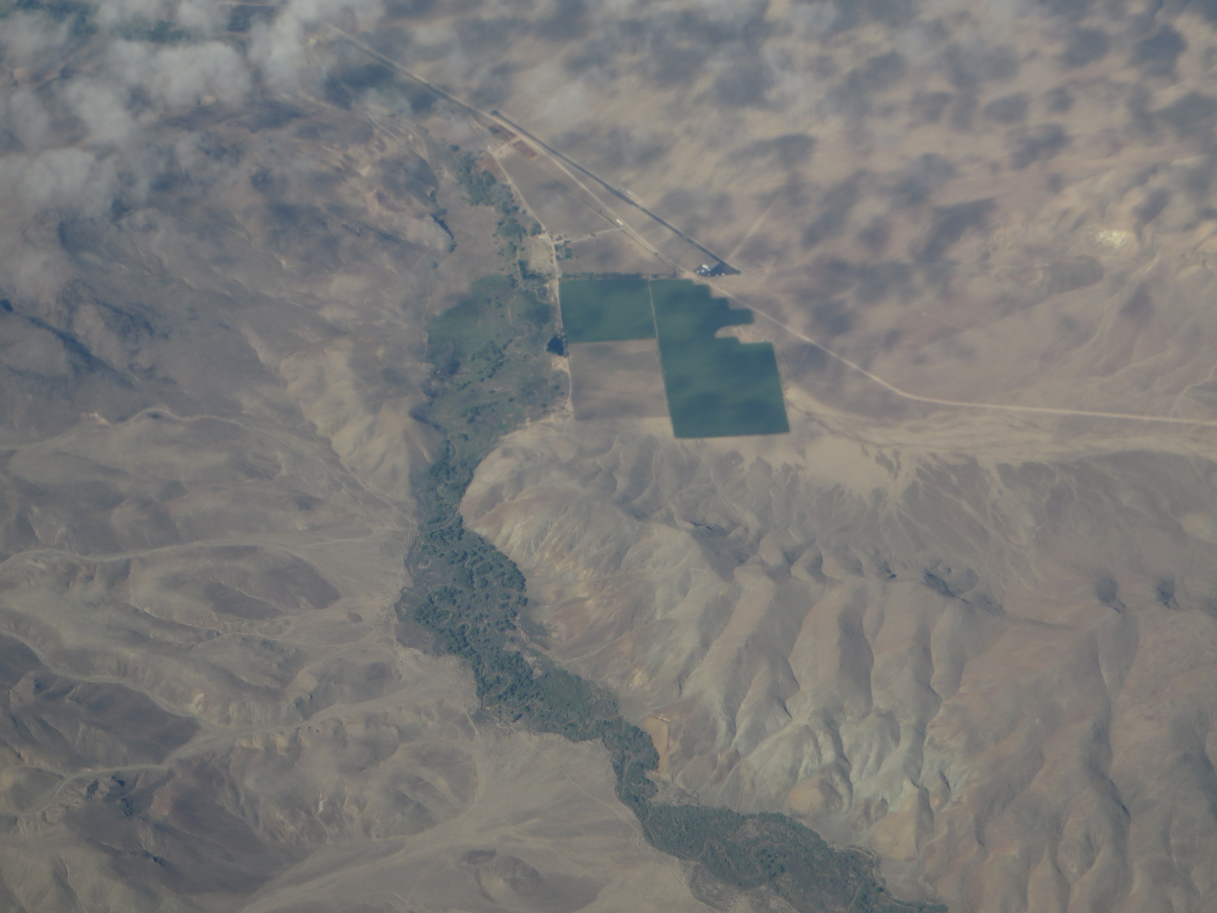
File:Walker River Near Smith Valley, Nevada (18014190299).jpg
Original file (4,000 × 3,000 pixels, file size: 2.39 MB, MIME type: image/jpeg)
Captions
Captions
Summary
[edit].jpg&action=edit§ion=1)
| Description |
The Walker River is a river in west central Nevada in the United States, approximately 62 miles (100 km) long. It drains an arid portion of the Great Basin southeast of Reno, with a watershed that extends into the Sierra Nevada mountains. It flows within an enclosed basin. Due to excessive diversions, it no longer provides the principal inflow of Walker Lake. It does flow through and maintain Topaz Lake (West Fork). The river was named for explorer Joseph Reddeford Walker. Its average discharge is about 360 cubic feet per second (10 m3/s). The river was probably discovered by Hudson's Bay Company fur trapper Peter Skene Ogden, who discovered the Humboldt River in 1828 and returned in 1829 to trap beaver south of the Humboldt Sink, although records are scant. In 1833, Joseph R. Walker led a party sent by Captain Benjamin Bonneville, to find a route from the Great Salt Lake to California via the Humboldt River, the Humboldt Sink, the Carson Sink, and then up into the Sierra Nevada by either the Carson River or the Walker River to near the headwaters of the Merced River and thence down to the San Joaquin River. John Charles Fremont named Walker Lake after the trapper and the United States Geographic Board named the river after Walker in its Fifth Report. The Walker River is formed in southern Lyon County, 9 mi (11 km) south of Yerington, by the confluence of the East Walker and West Walker rivers; the East Walker is regulated by the Bridgeport Reservoir, while the West Walker comes directly from snowmelt. It flows initially north past Yerington into central Lyon County, where it turns sharply to the southeast, flowing through the Walker River Indian Reservation past Schurz. It almost enters the northern end of Walker Lake, along the east side of the Wassuk Range, approximately 20 mi (32 km) NNW of Hawthorne. The Walker River's endorheic drainage basin covers an area of 12,800 sq mi (33,000 km2). Most of the streamflow is consumed by irrigation before reaching Walker Lake. The diversions have caused the level of Walker lake to drop by 140 ft (42 m) between 1882 and 1994. The eastern branch of the river is one of the last natural trout fisheries in California. en.wikipedia.org/wiki/Walker_River en.wikipedia.org/wiki/Wikipedia:Text_of_Creative_Commons_... |
| Date | |
| Source | Walker River Near Smith Valley, Nevada |
| Author | Ken Lund from Reno, Nevada, USA |
| Camera location | | View this and other nearby images on: OpenStreetMap |
|---|
.jpg¶ms=038.736351_N_-119.419174_E_globe:Earth_type:camera_source:Flickr_&language=en)
Licensing
[edit].jpg&action=edit§ion=2)
- You are free:
- to share – to copy, distribute and transmit the work
- to remix – to adapt the work
- Under the following conditions:
- attribution – You must give appropriate credit, provide a link to the license, and indicate if changes were made. You may do so in any reasonable manner, but not in any way that suggests the licensor endorses you or your use.
- share alike – If you remix, transform, or build upon the material, you must distribute your contributions under the same or compatible license as the original.
| This image was originally posted to Flickr by Ken Lund at https://flickr.com/photos/75683070@N00/18014190299. It was reviewed on 4 December 2015 by FlickreviewR and was confirmed to be licensed under the terms of the cc-by-sa-2.0. |
File history
Click on a date/time to view the file as it appeared at that time.
| Date/Time | Thumbnail | Dimensions | User | Comment | |
|---|---|---|---|---|---|
| current | 04:33, 4 December 2015 | | 4,000 × 3,000 (2.39 MB) | INeverCry (talk | contribs) | Transferred from Flickr via Flickr2Commons |
You cannot overwrite this file.
File usage on Commons
There are no pages that use this file.
.jpg&oldid=883633882)