File:West Bank and Gaza Strip location map.svg
Zur Navigation springen
Zur Suche springen

Gröössi vor PNG-Vorschou vor SVG-Datei: 520 × 599 Pixel. Wyteri Ufflösige: 208 × 240 Pixel | 417 × 480 Pixel | 667 × 768 Pixel | 889 × 1.024 Pixel | 1.778 × 2.048 Pixel | 639 × 736 Pixel.
Originaldatei (SVG-Datei, Basisgrößi: 639 × 736 Pixel, Dateigrößi: 98 KB)
Bildtexte
Kurzbeschreibungen
Ergänze eine einzeilige Erklärung, was diese Datei darstellt.

|
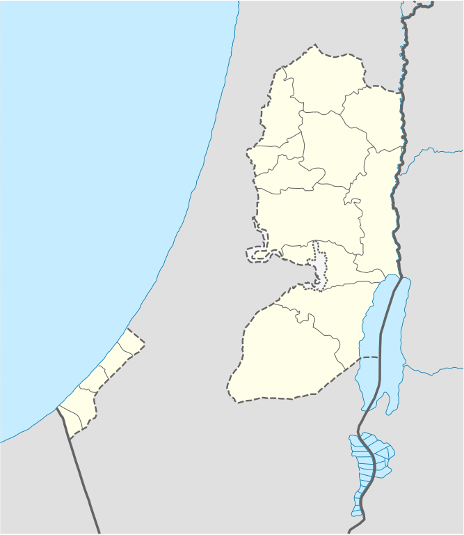
The boundaries on this map show the de facto situation. This is just one of several different views on the subject (see COM:NPOV). |
Bschryybig[ändere]
| Bschryybig |
Deutsch: Positionskarte der Palästinensische Autonomiegebiete bzw. von Westjordanland und Gazastreifen
Quadratische Plattkarte, N-S-Streckung 115 %. Geographische Begrenzung der Karte:
Equirectangular projection, N/S stretching 115%. Geographic limits of the map:
|
||
| Datum | |||
| Quälle |
Eigenes Werk mittels:
|
||
| Urheber | NordNordWest | ||
| Anderi Versione |
Abgleiteti Wärk vo dere Datei: |
||
| SVG‑Erstellung | Diese W3C-invalide Landkarte wurde mit Adobe Illustrator erstellt, und mit Inkscape.
|

Lizänzierig[ändere]
Ich haa s Urheberrächt an däm Wärch un vereffetlig s dodermit unter däne Lizänze:

|
Des Dokumänt derf kopiert, verbreitet un/oder bearbeitet wäre unter dr Bedingige vu dr GNU-Lizänz fir freji Dokumäntation, Version 1.2 oder ere spetere Version, vereffetligt dur Free Software Foundation. S het keini uuveränderlige Abschnitt, kei vordere Umschlagstext un kei hindere Umschlagstext. E Kopii vu dr Lizänz isch verfiegbar im Abschnitt GNU-Lizänz fir freji Dokumäntation. |
Die Datei isch lizänziert unter dr Creative-Commons-Lizenz Namensnännig – Wytergab unter glyche Bedingige 3.0 nit portiert.
- Du derfsch:
- des Wärch an anderi wytergee – des Wärch kopiere, verbreite un ibertrage
- des Wärch verändere – des Wärch aapasse
- Unter däne Bedingige:
- Namenännig – Du muesch aagmässeni Aagabe zum Urheber un dr Rächt mache, e Link zue dr Lizänz zuefiege un aagee, eb Änderige gmacht wore sin. Die Aagabe chenne in ere aagmässene Art gmacht wäre, aber nit eso, ass dr Yydruck entstoht, ass dr Lizänzgeber Dii oder Dyy Gebruch vum Wärch unterstitze un guetheiße.
- Wytergab unter glyche Bedingige – Wänn du des Wärch veränderesch, umwandlesch oder druf ufböusch, no derfsch s Ergebnis nume unter dr glyche oder ere kumpatible Lizänz wie s Orginal vereffetlige.
Du chasch sälber e Lizänz uuswehle.
Dateiversione
Klick uf e Zytpunkt zu aazeige, wie s dert usgsäh het.
| Version vom | Vorschaubild | Mäß | Benutzer | Kommentar | |
|---|---|---|---|---|---|
| aktuell | 11:35, 28. Apr. 2009 | | 639 × 736 (98 KB) | NordNordWest (Diskussion | Byträg) | area of West Bank back to correct position |
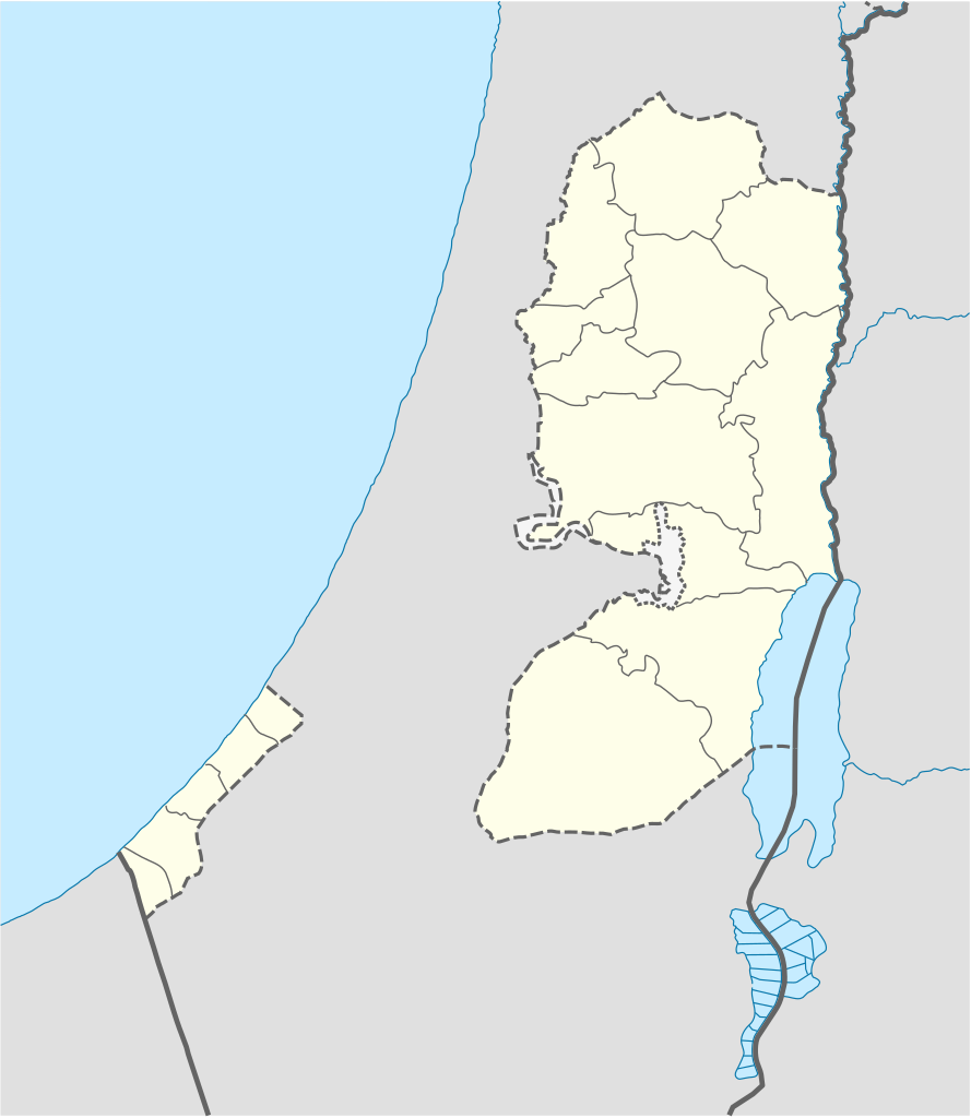
| 02:02, 28. Apr. 2009 |  | 639 × 736 (109 KB) | Fjmustak (Diskussion | Byträg) | 0.85px solid governorate lines (consistent with Israel, Jordan, Lebanon, etc...) | |
| 18:58, 22. Apr. 2009 |  | 639 × 736 (98 KB) | NordNordWest (Diskussion | Byträg) | corr | |
| 02:02, 17. Apr. 2009 |  | 638 × 734 (119 KB) | Fjmustak (Diskussion | Byträg) | Added governorate boundaries | |
| 18:30, 29. Nov. 2008 |  | 638 × 734 (103 KB) | NordNordWest (Diskussion | Byträg) | ||
| 20:05, 19. Nov. 2008 |  | 638 × 734 (118 KB) | NordNordWest (Diskussion | Byträg) | {{Information |Description= {{de|Positionskarte der Palästinensischen Autonomiegebiete bzw. von Westjordanland und Gazastreifen}} Quadratische Plattkarte, N-S-Streckung 115 %. Geographische Begrenzung der Karte: |
Du chasch die Datei nit iberschryybe.
Verwändig vu dr Datei
Die 67 Syte bruuche die Datei:
- User:NordNordWest/Gallery/Location maps
- File:Bethlehem in Palestine.svg
- File:Deir al-Balah in Palestine.svg
- File:Gaza Strip in Palestine.svg
- File:Gaza in Palestine.svg
- File:Hebron in Palestine.svg
- File:Jenin in Palestine.svg
- File:Jericho in Palestine.svg
- File:Jerusalem in Palestine.svg
- File:Jerusalem in Palestine (+claimed).svg
- File:Jerusalem in Palestine (+claimed hatched).svg
- File:Khan Yunis in Palestine.svg
- File:Nablus in Palestine.svg
- File:North Gaza in Palestine.svg
- File:Palestine location map.svg (Dateiwyterleitig)
- User:NordNordWest/Gallery/Location maps
- File:Bethlehem in Palestine.svg
- File:Deir al-Balah in Palestine.svg
- File:Gaza Strip in Palestine.svg
- File:Gaza in Palestine.svg
- File:Hebron in Palestine.svg
- File:Jenin in Palestine.svg
- File:Jericho in Palestine.svg
- File:Jerusalem in Palestine (+claimed hatched).svg
- File:Jerusalem in Palestine (+claimed).svg
- File:Jerusalem in Palestine.svg
- File:Khan Yunis in Palestine.svg
- File:Nablus in Palestine.svg
- File:North Gaza in Palestine.svg
- File:Qalqilya in Palestine.svg
- File:Rafah in Palestine.svg
- File:Ramallah and Al-Bireh in Palestine (+claimed hatched).svg
- File:Ramallah and Al-Bireh in Palestine (+claimed).svg
- File:Ramallah and Al-Bireh in Palestine.svg
- File:Salfit in Palestine.svg
- File:Tubas in Palestine.svg
- File:Tulkarm in Palestine.svg
- File:West Bank in Palestine (+claimed hatched).svg
- File:West Bank in Palestine (+claimed).svg
- File:West Bank in Palestine.svg
- File:Qalqilya in Palestine.svg
- File:Rafah in Palestine.svg
- File:Ramallah and Al-Bireh in Palestine.svg
- File:Ramallah and Al-Bireh in Palestine (+claimed).svg
- File:Ramallah and Al-Bireh in Palestine (+claimed hatched).svg
- File:Salfit in Palestine.svg
- File:Tubas in Palestine.svg
- File:Tulkarm in Palestine.svg
- File:West Bank in Palestine.svg
- File:West Bank in Palestine (+claimed).svg
- File:West Bank in Palestine (+claimed hatched).svg
- Category:1995 in the State of Palestine
- Category:1997 in the State of Palestine
- Category:1998 in the State of Palestine
- Category:Alumni by university or college in the State of Palestine
- Category:Bridges in the State of Palestine
- Category:Caves in the State of Palestine
- Category:Churches in the State of Palestine
- Category:Museums in the State of Palestine
- Category:Nature of the State of Palestine
- Category:Palestine by decade
- Category:Palestine in the 1990s
- Category:Palestine in the 20th century
- Category:Springs of Palestine
- Category:Streets in the State of Palestine
- Category:Tunnels in Palestine
- Category:Water in the State of Palestine
.svg)
.svg)
.svg)
.svg)
.svg)
.svg)
Wältwyti Dateinutzig
Die andere Wikis bruche die Datei:
- Gebruch uf af.wikipedia.org
- Gebruch uf als.wikipedia.org
- Gebruch uf an.wikipedia.org
- Gebruch uf ar.wikipedia.org
- Gebruch uf az.wikipedia.org
- Gebruch uf ba.wikipedia.org
- Gebruch uf be-tarask.wikipedia.org
- Gebruch uf be.wikipedia.org
- Gebruch uf bg.wikipedia.org
- Gebruch uf bn.wikipedia.org
- Gebruch uf ce.wikipedia.org
- Gebruch uf ckb.wikipedia.org
- Gebruch uf cs.wikipedia.org
Wältwyti Verwändig vu däre Datei aaluege.