File:West Sussex UK locator map 2010.svg
跳至導覽
跳至搜尋

此 SVG 檔案的 PNG 預覽的大小:494 × 600 像素。 其他解析度:198 × 240 像素 | 395 × 480 像素 | 633 × 768 像素 | 843 × 1,024 像素 | 1,687 × 2,048 像素 | 1,108 × 1,345 像素。
原始檔案 (SVG 檔案,表面大小:1,108 × 1,345 像素,檔案大小:302 KB)
說明
說明
添加單行說明來描述出檔案所代表的內容
摘要
[編輯]
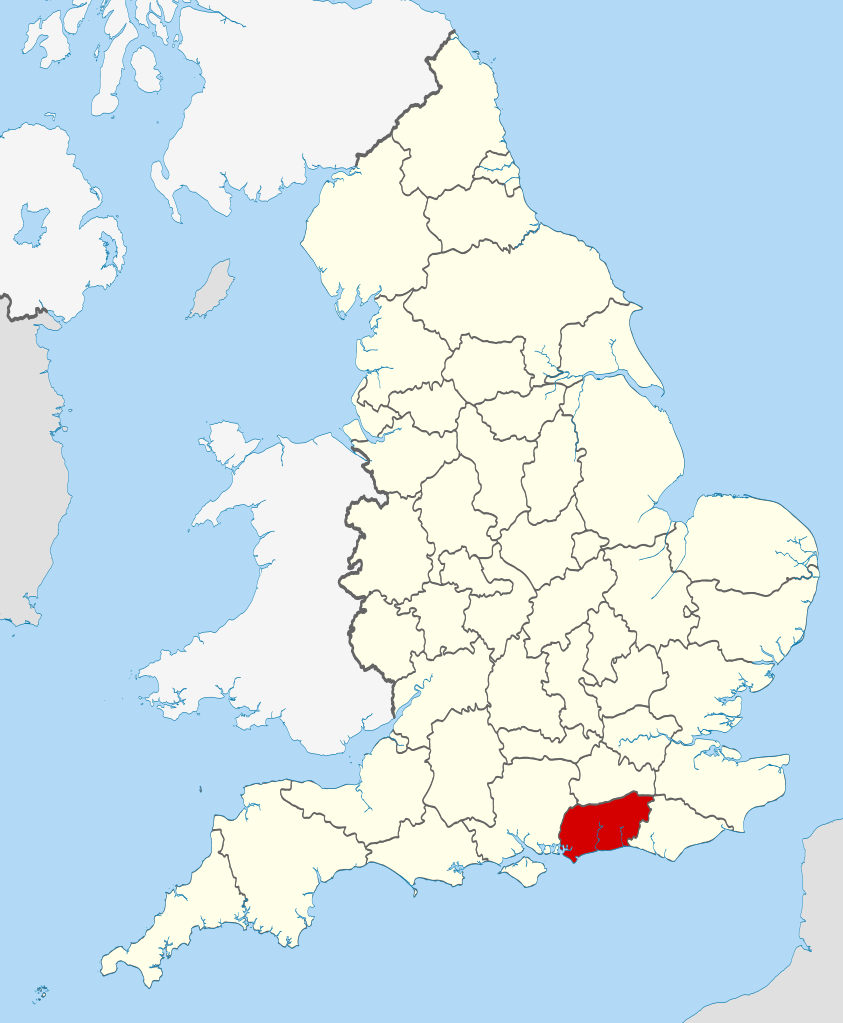
| 描述 | Location of the ceremonial county of West Sussex within England. |
| 日期 | |
| 來源 |
National Geospatial-Intelligence Agency
|
| 作者 | Nilfanion |
授權條款
[編輯]
我,本作品的著作權持有者,決定用以下授權條款發佈本作品:
此檔案採用共享創意 姓名標示-相同方式分享 3.0 未在地化版本授權條款。
- 您可以自由:
- 分享 – 複製、發佈和傳播本作品
- 重新修改 – 創作演繹作品
- 惟需遵照下列條件:
- 姓名標示 – 您必須指名出正確的製作者,和提供授權條款的連結,以及表示是否有對內容上做出變更。您可以用任何合理的方式來行動,但不得以任何方式表明授權條款是對您許可或是由您所使用。
- 相同方式分享 – 如果您利用本素材進行再混合、轉換或創作,您必須基於如同原先的相同或兼容的條款,來分布您的貢獻成品。

|
已授權您依據自由軟體基金會發行的無固定段落、封面文字和封底文字GNU自由文件授權條款1.2版或任意後續版本,對本檔進行複製、傳播和/或修改。該協議的副本列在GNU自由文件授權條款中。 |
您可以選擇您需要的授權條款。

|
This is one of the images forming part of the Valued image set: Locator maps of the Ceremonial counties of England on Wikimedia Commons. The image set has been assessed under the valued image set criteria and is considered the most valued set on Commons within the scope:
Locator maps of the Ceremonial counties of England
You can see its nomination at Commons:Valued image candidates/Locator maps of English ceremonial counties. |
檔案歷史
點選日期/時間以檢視該時間的檔案版本。
| 日期/時間 | 縮圖 | 尺寸 | 用戶 | 備註 | |
|---|---|---|---|---|---|
| 目前 | 2010年11月23日 (二) 22:47 | | 1,108 × 1,345(302 KB) | Nilfanion(對話 | 貢獻) | == Summary == {{Information |Description=Location of the ceremonial county of West Sussex within England. |Source=Ordnance Survey [https://www.ordnancesurvey.co.uk/opendatadownload/products.html OpenData]: *County b |
無法覆蓋此檔案。
檔案用途
下列27個頁面有用到此檔案:
- Valued image set: Locator maps of the Ceremonial counties of England
- Commons:Valued image candidates/Locator maps of English ceremonial counties
- Category:Almshouses in West Sussex
- Category:Alumni by school in West Sussex
- Category:Births in West Sussex
- Category:Bridges in West Sussex
- Category:Canals in West Sussex
- Category:Deaths in West Sussex
- Category:Geography of West Sussex
- Category:Hospitals in West Sussex
- Category:Maps of West Sussex
- Category:Populated places in West Sussex
- Category:Rail transport in West Sussex
- Category:Rivers of West Sussex
- Category:Roads in West Sussex
- Category:Tunnels in West Sussex
- Category:Views of West Sussex
- Category:Villages in West Sussex
- Category:Visitor attractions in West Sussex
- Category:West Sussex
- Category:West Sussex in the 1970s
- Category:West Sussex in the 1980s
- Category:West Sussex in the 1990s
- Category:West Sussex in the 2000s
- Category:West Sussex in the 20th century
- Category:West Sussex in the 21st century
- Category:Windmills in West Sussex
全域檔案使用狀況
以下其他 wiki 使用了這個檔案:
- af.wikipedia.org 的使用狀況
- ast.wikipedia.org 的使用狀況
- be-tarask.wikipedia.org 的使用狀況
- bg.wikipedia.org 的使用狀況
- br.wikipedia.org 的使用狀況
- ca.wikipedia.org 的使用狀況
- ceb.wikipedia.org 的使用狀況
- cs.wikipedia.org 的使用狀況
- dag.wikipedia.org 的使用狀況
- en.wikipedia.org 的使用狀況
- Sussex
- WWT Arundel
- West Sussex
- Furnace Green
- Manor Royal
- Maidenbower
- Elmer, West Sussex
- Wick, West Sussex
- Lyminster
- Mannings Heath
- Highdown Gardens
- Small Dole
- Adversane
- Coolham
- Storrington and Sullington
- Albourne
- North Horsham
- Ashington, West Sussex
- Ashurst, West Sussex
- Barlavington
- Sullington
- Coombes
- Sayers Common
- Ferring
- Madehurst
- Patching
- Lindfield Rural
- Slaugham
- Southwick Hill Tunnel
- Ansty, West Sussex
- Stedham with Iping
- Milland
- Elsted and Treyford
- Elsted
- Ifold
- Wey South Path
- Goodwood Country Park
- Saint Hill Green
- Five Oaks
- Cootham
檢視此檔案的更多全域使用狀況。