File:Westhoek map-fr.svg
跳转到导航
跳转到搜索

此SVG文件的PNG预览的大小:800 × 533像素。 其他分辨率:320 × 213像素 | 640 × 427像素 | 1,024 × 683像素 | 1,280 × 853像素 | 2,560 × 1,707像素 | 1,200 × 800像素。
原始文件 (SVG文件,尺寸为1,200 × 800像素,文件大小:702 KB)
说明
说明
添加一行文字以描述该文件所表现的内容
摘要
[编辑]| 描述 |
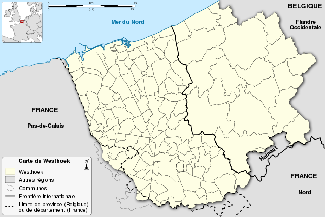
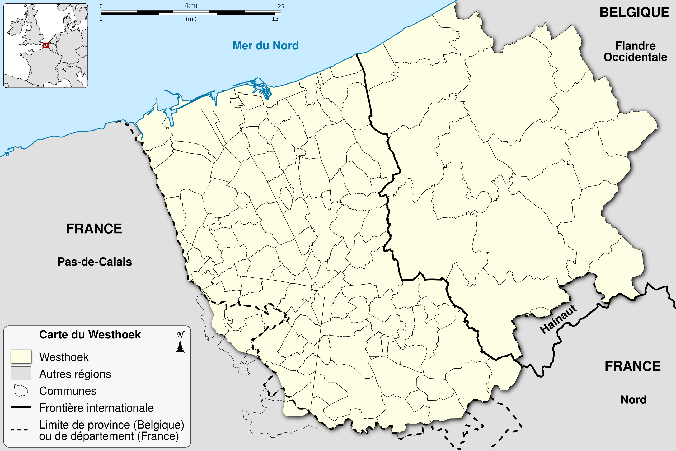
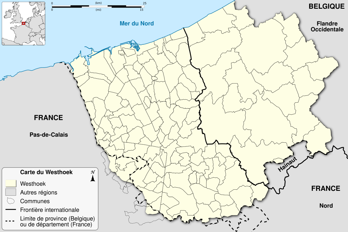
English: Map of Westhoek, a transborder region between Belgium and France. Español: Mapa del Westhoek, una región transfronteriza entre Bélgica y Francia. Français : Carte du Westhoek, une région transfrontalière entre la Belgique et la France. Nederlands: Kaart van Westhoek, een grensoverschrijdende regio tussen België en Frankrijk. |
||
| 日期 | (UTC) | ||
| 来源 |
自己的作品. Source :
|
||
| 作者 | Sémhur (talk) | ||
| 其他版本 |
| ||
| 署名 (由许可协议要求) | © Sémhur / Wikimedia Commons / | ||
| SVG | W3C-validity not checked.
|
||
| Graphic Lab |

| 相机位置 | | 在以下服务上查看本图像和附近其他图像: OpenStreetMap |
|---|
许可协议
[编辑]
我,本作品著作权人,特此采用以下许可协议发表本作品:
| 非营利著作权:本艺术作品是自由的,您可以依据自由艺术作品许可协议的条款传播和/或修改本艺术作品。您可以在Copyleft Attitude网站或其他网站找到该许可协议的样本。 |
This file is licensed under the Creative Commons Attribution-Share Alike Attribution-Share Alike 4.0 International, 3.0 Unported, 2.5 Generic, 2.0 Generic and 1.0 Generic license.
- 您可以自由地:
- 共享 – 复制、发行并传播本作品
- 修改 – 改编作品
- 惟须遵守下列条件:
- 署名 – 您必须对作品进行署名,提供授权条款的链接,并说明是否对原始内容进行了更改。您可以用任何合理的方式来署名,但不得以任何方式表明许可人认可您或您的使用。
- 相同方式共享 – 如果您再混合、转换或者基于本作品进行创作,您必须以与原先许可协议相同或相兼容的许可协议分发您贡献的作品。
您可以选择您需要的许可协议。
文件历史
点击某个日期/时间查看对应时刻的文件。
| 日期/时间 | 缩略图 | 大小 | 用户 | 备注 | |
|---|---|---|---|---|---|
| 当前 | 2011年1月4日 (二) 19:05 | | 1,200 × 800(702 KB) | Sémhur(留言 | 贡献) | == {{int:filedesc}} == {{Information |Description={{Multilingual description |en= Map of Westhoek, a transborder region between Belgium and France. |fr= Carte du Westhoek, une région transfrontalière entre la Belgique e |
您不可以覆盖此文件。
文件用途
没有页面使用本文件。
全域文件用途
以下其他wiki使用此文件:
- fr.wikipedia.org上的用途
- pcd.wikipedia.org上的用途
- zh.wikipedia.org上的用途