File:Westminster Station geograph-4068253-by-Ben-Brooksbank.jpg
跳至導覽
跳至搜尋
預覽大小:800 × 526 像素。 其他解析度:320 × 211 像素 | 640 × 421 像素 | 1,024 × 674 像素 | 1,280 × 842 像素 | 2,359 × 1,552 像素。
原始檔案 (2,359 × 1,552 像素,檔案大小:4.41 MB,MIME 類型:image/jpeg)
說明
說明
添加單行說明來描述出檔案所代表的內容
摘要
[編輯]
| 描述 |
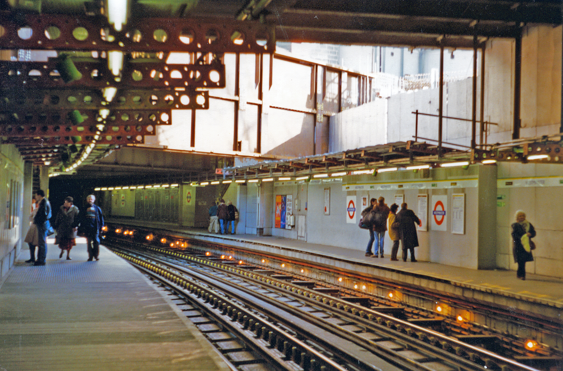
English: Westminster Station, District Line 1996. View NE, towards Embankment, Mansion House and East London: LUL District and Circle Lines. Reconstruction is in progress for connection with the Jubilee Line Extension, which was completed 22/12/99. |
| 日期 | |
| 來源 | From geograph.org.uk |
| 作者 | Ben Brooksbank |
| 授權許可 (重用此檔案) |
Creative Commons Attribution Share-alike license 2.0 |
| 姓名標示 (由许可协议要求) | Ben Brooksbank / Westminster Station, District Line 1996 / |
| 拍攝地點 | | 位於此地的本圖片與其他圖片: OpenStreetMap |
|---|
授權條款
[編輯]

|
此圖像來自Geograph工程圖集。攝影師的聯繫資訊請見Geograph網站上該照片的頁面。此圖像的著作權人為Ben Brooksbank,採用創用CC 署名-相同方式共享 2.0許可協議授權二次使用。
|
此檔案採用共享創意 姓名標示-相同方式分享 2.0 通用版授權條款。
姓名標示: Ben Brooksbank
- 您可以自由:
- 分享 – 複製、發佈和傳播本作品
- 重新修改 – 創作演繹作品
- 惟需遵照下列條件:
- 姓名標示 – 您必須指名出正確的製作者,和提供授權條款的連結,以及表示是否有對內容上做出變更。您可以用任何合理的方式來行動,但不得以任何方式表明授權條款是對您許可或是由您所使用。
- 相同方式分享 – 如果您利用本素材進行再混合、轉換或創作,您必須基於如同原先的相同或兼容的條款,來分布您的貢獻成品。
檔案歷史
點選日期/時間以檢視該時間的檔案版本。
| 日期/時間 | 縮圖 | 尺寸 | 用戶 | 備註 | |
|---|---|---|---|---|---|
| 目前 | 2014年8月2日 (六) 09:54 | | 2,359 × 1,552(4.41 MB) | Chevin(對話 | 貢獻) | == {{int:filedesc}} == {{Information |Description={{en|1='''Westminster Station, District Line 1996.'''<br /> View NE, towards Embankment, Mansion House and East London: LUL District and Circle Lines. Reconstruction is in progress for connection with t... |
無法覆蓋此檔案。
檔案用途
下列頁面有用到此檔案:
全域檔案使用狀況
以下其他 wiki 使用了這個檔案:
- zh.wikipedia.org 的使用狀況