File:Whiteseamap.jpg
跳转到导航
跳转到搜索
本预览的尺寸:699 × 599像素。 其他分辨率:280 × 240像素 | 560 × 480像素 | 896 × 768像素 | 1,195 × 1,024像素 | 1,478 × 1,267像素。
原始文件 (1,478 × 1,267像素,文件大小:370 KB,MIME类型:image/jpeg)
说明
说明
添加一行文字以描述该文件所表现的内容
| 描述 |
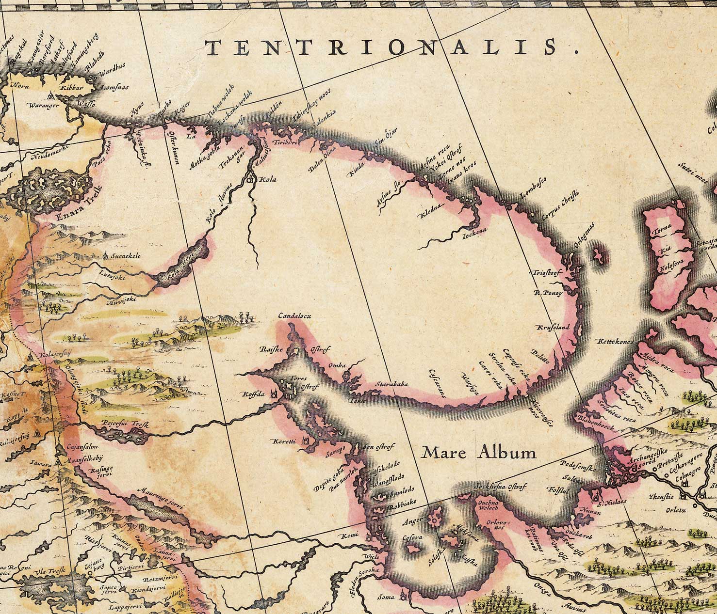
English: Map of the White Sea and adjacent regions. From the Dutch "Novus Atlas" (1635). Cartographer: Willem Janszoon Blaeu. |
|||||||||||
| 来源 | http://biarmia.narod.ru/17.html Transferred from en.wikipedia to Commons by Hardscarf using CommonsHelper. | |||||||||||
| 作者 | ||||||||||||
| 授权 (二次使用本文件) |
|
|||||||||||


原始上传日志[编辑]
The original description page was here. All following user names refer to en.wikipedia.
- 2007-06-19 16:59 Ghirlandajo 1478×1267× (379069 bytes) Map of the [[White Sea]] and adjacent regions. From the Dutch "Novus Atlas" (1635). Cartographer: Willem Janszoon Blaeu. {{PD-art}} Source: http://biarmia.narod.ru/17.html
文件历史
点击某个日期/时间查看对应时刻的文件。
| 日期/时间 | 缩略图 | 大小 | 用户 | 备注 | |
|---|---|---|---|---|---|
| 当前 | 2009年12月2日 (三) 11:00 | | 1,478 × 1,267(370 KB) | File Upload Bot (Magnus Manske)(留言 | 贡献) | {{BotMoveToCommons|en.wikipedia|year={{subst:CURRENTYEAR}}|month={{subst:CURRENTMONTHNAME}}|day={{subst:CURRENTDAY}}}} {{Information |Description={{en|Map of the en:White Sea and adjacent regions. From the Dutch "Novus Atlas" (1635). Cartographer: |
您不可以覆盖此文件。
文件用途
没有页面使用本文件。
全域文件用途
以下其他wiki使用此文件:
- ar.wikipedia.org上的用途
- ca.wikipedia.org上的用途
- cs.wikipedia.org上的用途
- de.wikipedia.org上的用途
- en.wikipedia.org上的用途
- es.wikipedia.org上的用途
- fa.wikipedia.org上的用途
- fi.wikipedia.org上的用途
- frr.wikipedia.org上的用途
- hr.wikipedia.org上的用途
- la.wikipedia.org上的用途
- mt.wikipedia.org上的用途
- nl.wikipedia.org上的用途
- no.wikipedia.org上的用途
- ru.wikipedia.org上的用途
- sr.wikipedia.org上的用途
- ta.wikipedia.org上的用途
- te.wikipedia.org上的用途
- uk.wikipedia.org上的用途
- vi.wikipedia.org上的用途
- zh.wikipedia.org上的用途