File:Wicken Fen NT map.svg

Original file (SVG file, nominally 988 × 1,318 pixels, file size: 1,009 KB)
Captions
Captions
Summary
[edit]| Description |
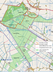
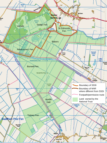
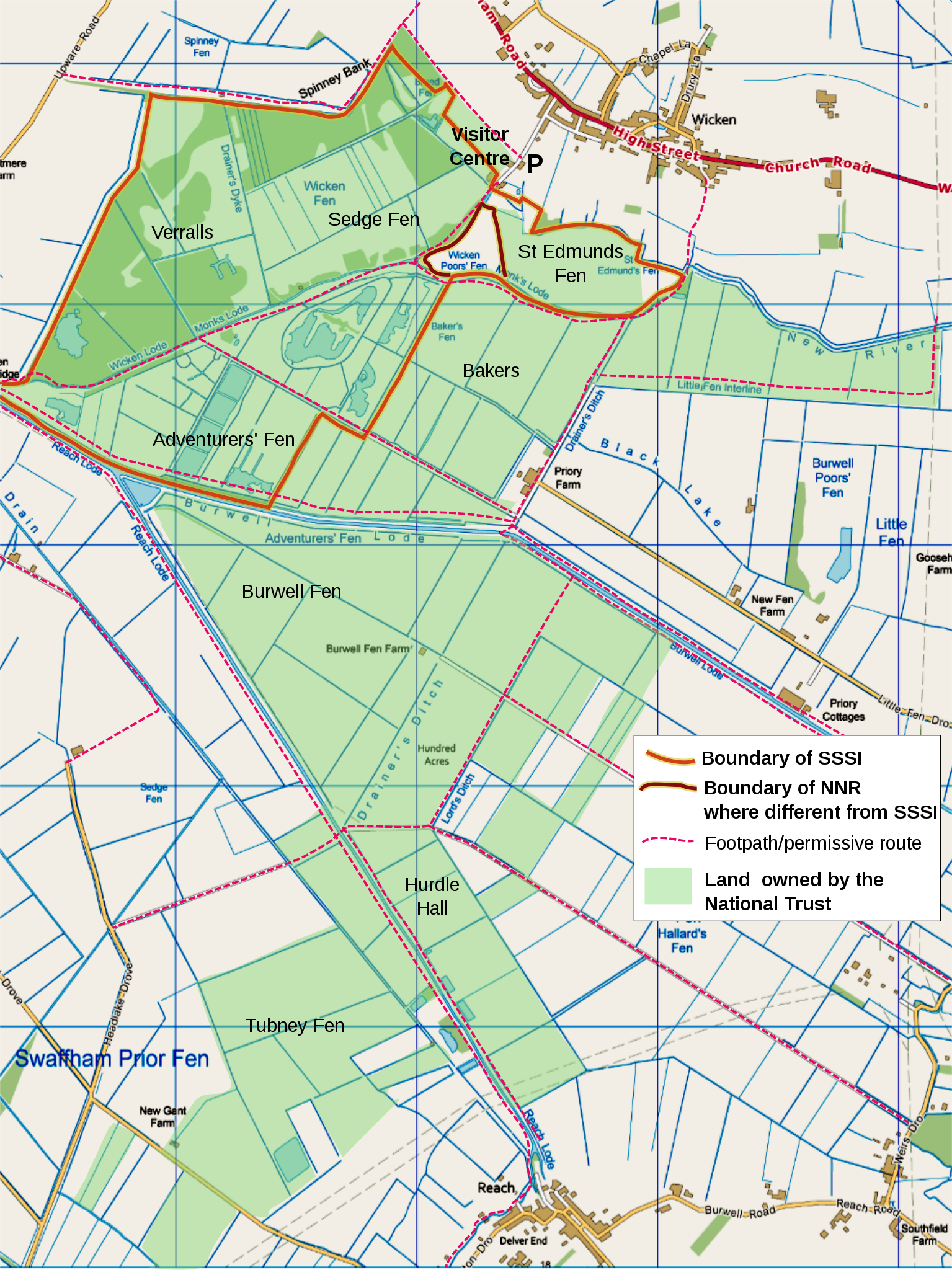
English: map of Wicken Fen National Trust land holdings, Cambridgeshire, UK, using the following for additional information shown:
OS map projection (nb: Not WGS 84 datum) with OS 1km grid squares shown. SW origin is TL543660 Geographic limits:
|
||||||
| Date | |||||||
| Source |
Ordnance Survey OpenData viewer.
|
||||||
| Author | User:RobinLeicester created using Ordnance Survey data | ||||||
| Permission (Reusing this file) |
|
_(St_Edwards_Crown).svg)
Assembled from 1km squares generated by OS OpenData Viewer at scale '4-from-top'. Edited using a combination of Inkscape and Gimp. Colours shifted to get close to Nilfanion's standard (eg Waltham Forest). My Method: Gimp [Color] [Levels...] 'Input Levels' min=195, max=253. The resulting png imported into Inkscape, for additional text, boundary lines, etc.
Geographic limits can be discovered using this locator page
Licensing
[edit]

|
The copyright holder of this file allows anyone to use it for any purpose, provided that the copyright holder is properly attributed. Redistribution, derivative work, commercial use, and all other use is permitted. |
|
|
File history
Click on a date/time to view the file as it appeared at that time.
| Date/Time | Thumbnail | Dimensions | User | Comment | |
|---|---|---|---|---|---|
| current | 00:52, 16 December 2011 | | 988 × 1,318 (1,009 KB) | RobinLeicester (talk | contribs) | {{Information |Description ={{en|1=map of Wicken Fen National Trust land holdings, Cambridgeshire, UK, using the following for additional information shown: *{{legend|#667fff|Motorways}} *{{legend|#4cb336|Primary routes}} *{{legend|#fc744c|Non-primary |
You cannot overwrite this file.
File usage on Commons
There are no pages that use this file.
File usage on other wikis
The following other wikis use this file:
- Usage on de.wikipedia.org
- Usage on en.wikipedia.org
- Usage on fr.wikipedia.org