File:Winter in the Maritimes (MODIS).jpg
Jump to navigation
Jump to search

Size of this preview: 772 × 600 pixels. Other resolutions: 309 × 240 pixels | 618 × 480 pixels | 988 × 768 pixels | 1,280 × 995 pixels | 1,543 × 1,199 pixels.
Original file (1,543 × 1,199 pixels, file size: 402 KB, MIME type: image/jpeg)
Captions
Captions
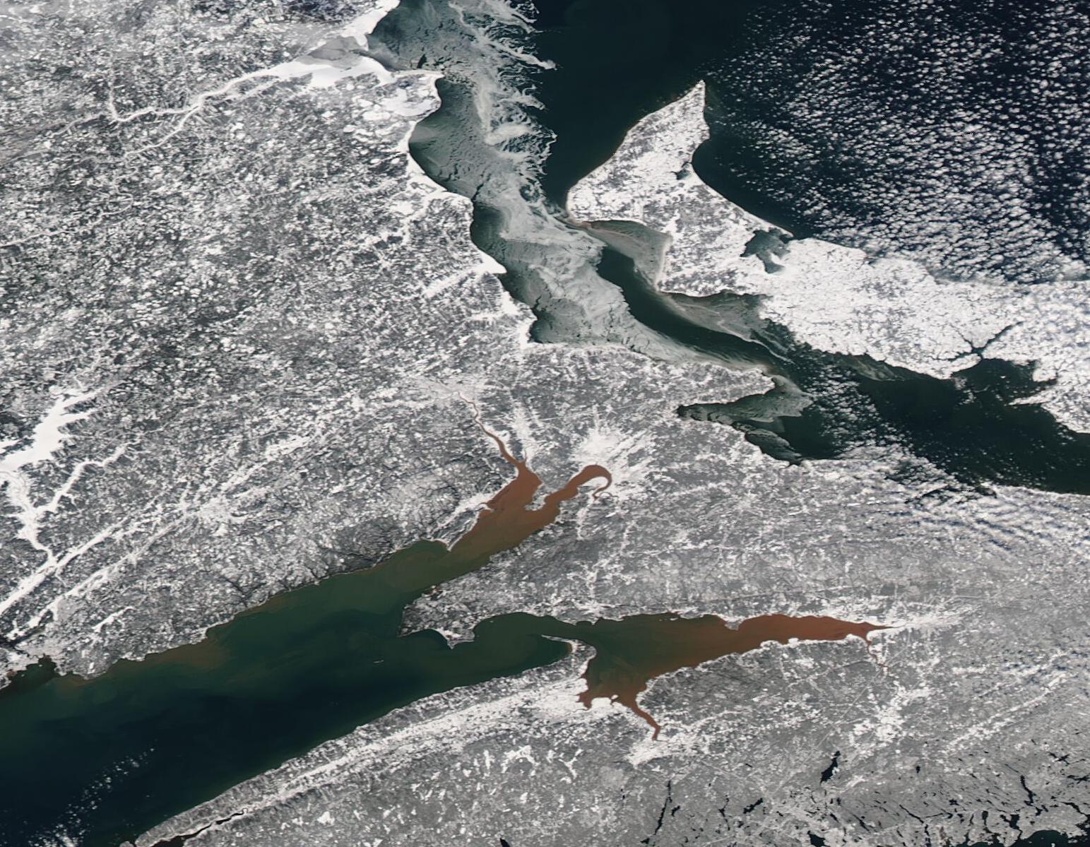
On February 1, 2023, the Moderate Resolution Imaging Spectroradiometer (MODIS) on board NASA’s Aqua satellite captured a true-color image of winter in Canada’s Maritimes.
Summary
[edit].jpg&action=edit§ion=1)
| Description |
English: On February 1, 2023, the Moderate Resolution Imaging Spectroradiometer (MODIS) on board NASA’s Aqua satellite captured a true-color image of winter in Canada’s Maritimes.
The Maritimes are made up of three provinces, Nova Scotia, Prince Edwards Island, and New Brunswick. Each can be seen in this image, with New Brunswick (west) separated from Nova Scotia by the Bay of Fundy. The partially ice-coated Northumberland Strait flows between Prince Edward Island and the other two provinces, while the open waters of the Gulf of Saint Lawrence wash the northern shores of the Island. The wintery scene seems to be painted in monochrome, except for splashes of muddy-toned brick red floating in the northern reaches of the Bay of Fundy. The Bay of Fundy is the scene of the highest tides in the world, which can rise up to 52 feet (16 meters). As the waves crash against the shores and wash against muddy Bay and river bottoms, sediment gets stirred up, creating persistently stained water at these locations. |
||
| Date | Taken on 1 February 2023 | ||
| Source |
Winter in the Maritimes (direct link)
|
||
| Author | MODIS Land Rapid Response Team, NASA GSFC |
| This media is a product of the Aqua mission Credit and attribution belongs to the mission team, if not already specified in the "author" row |
Licensing
[edit].jpg&action=edit§ion=2)
| This file is in the public domain in the United States because it was solely created by NASA. NASA copyright policy states that "NASA material is not protected by copyright unless noted". (See Template:PD-USGov, NASA copyright policy page or JPL Image Use Policy.) | ||
 |
Warnings:
|
File history
Click on a date/time to view the file as it appeared at that time.
| Date/Time | Thumbnail | Dimensions | User | Comment | |
|---|---|---|---|---|---|
| current | 20:05, 31 July 2023 | | 1,543 × 1,199 (402 KB) | OptimusPrimeBot (talk | contribs) | #Spacemedia - Upload of http://modis.gsfc.nasa.gov/gallery/images/image02032023_250m.jpg via Commons:Spacemedia |
You cannot overwrite this file.
File usage on Commons
There are no pages that use this file.
.jpg&oldid=788983332)