File:Woking UK locator map.svg
Pāriet uz navigāciju
Pāriet uz meklēšanu

Size of this PNG preview of this SVG file: 790 × 599 pikseļi. Citi izmēri: 317 × 240 pikseļi | 633 × 480 pikseļi | 1 013 × 768 pikseļi | 1 280 × 971 pikseļi | 2 560 × 1 942 pikseļi | 1 425 × 1 081 pikseļi.
Sākotnējais fails (SVG fails, definētais izmērs 1 425 × 1 081 pikseļi, faila izmērs: 948 KB)
Captions
Captions
Pievieno vienas rindiņas aprakstu, ko šis fails attēlo
Kopsavilkums
[labot šo sadaļu]
| Apraksts |
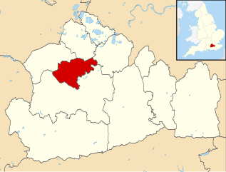
Locator map of the Borough of Woking (red) — in Surrey, England.
|
| Datums | |
| Avots |
|
| Autors | Nilfanion, created using Ordnance Survey data |
| Atļauja: (Šī faila izmantošana citur) |
Šis fails tiek izplatīts saskaņā ar licences Creative Commons Atsauce-Līdzīgi Noteikumi 3.0 Vispārējiem noteikumiem. Atsauce: Contains Ordnance Survey data © Crown copyright and database right
|
Faila hronoloģija
Uzklikšķini uz datums/laiks kolonnā esošās saites, lai apskatītos, kā šis fails izskatījās tad.
| Datums/Laiks | Attēls | Izmēri | Dalībnieks | Komentārs | |
|---|---|---|---|---|---|
| tagadējais | 2011. gada 2. augusts, plkst. 09.32 | | 1 425 × 1 081 (948 KB) | Nilfanion (diskusija | devums) | {{Information |Description=Map of Surrey, UK with Woking highlighted. Equirectangular map projection on WGS 84 datum, with N/S stretched 160% |Source=Ordnance Survey [https://www.ordnancesurvey.co |
Šo failu nevar pārrakstīt.
Faila lietojums
Šo failu izmanto šajās 2 lapās:
Globālais faila lietojums
Šīs Vikipēdijas izmanto šo failu:
- Izmantojums cy.wikipedia.org
- Izmantojums de.wikipedia.org
- Izmantojums en.wikipedia.org
- Brookwood Cemetery
- Woking F.C.
- Church of St Edward the Martyr, Brookwood
- McLaren Technology Centre
- Horsell
- Pyrford
- Victoria Place
- Brookwood, Surrey
- Woking railway station
- West Byfleet railway station
- Byfleet & New Haw railway station
- Brookwood railway station
- Byfleet
- Bishop David Brown School
- Westfield F.C. (Surrey)
- Sheerwater F.C.
- St Andrew's Church, Goldsworth Park
- The Winston Churchill School, Woking
- New Victoria Theatre
- West Byfleet
- Woking Hockey Club
- Woking College
- Knaphill
- Mayford
- Old Woking
- St John the Baptist School, Woking
- Knaphill F.C.
- Brookwood Hospital
- Newark Priory
- Horsell Common
- Sheerwater
- St Peter's Church, Old Woking
- Church of St Mary the Virgin, Horsell
- Hoe Bridge School
- Shah Jahan Mosque, Woking
- Tante Marie
- Woking
- Rhoda McGaw Theatre
- Woking High School
- Woking Crematorium
- Template:Woking
- Export House
- Woking Park
- Westfield, Woking, Surrey
- Westfield Common
- Sutton Green, Surrey
- User:Woking.gov
- Grade II* listed buildings in Woking (district)
Skatīt šī faila pilno globālo izmantojumu.