File:Wrexham UK ward map (blank) 2022.svg
Jump to navigation
Jump to search

Size of this PNG preview of this SVG file: 512 × 362 pixels. Other resolutions: 320 × 226 pixels | 640 × 453 pixels | 1,024 × 724 pixels | 1,280 × 905 pixels | 2,560 × 1,810 pixels.
Original file (SVG file, nominally 512 × 362 pixels, file size: 1.96 MB)
Captions
Captions
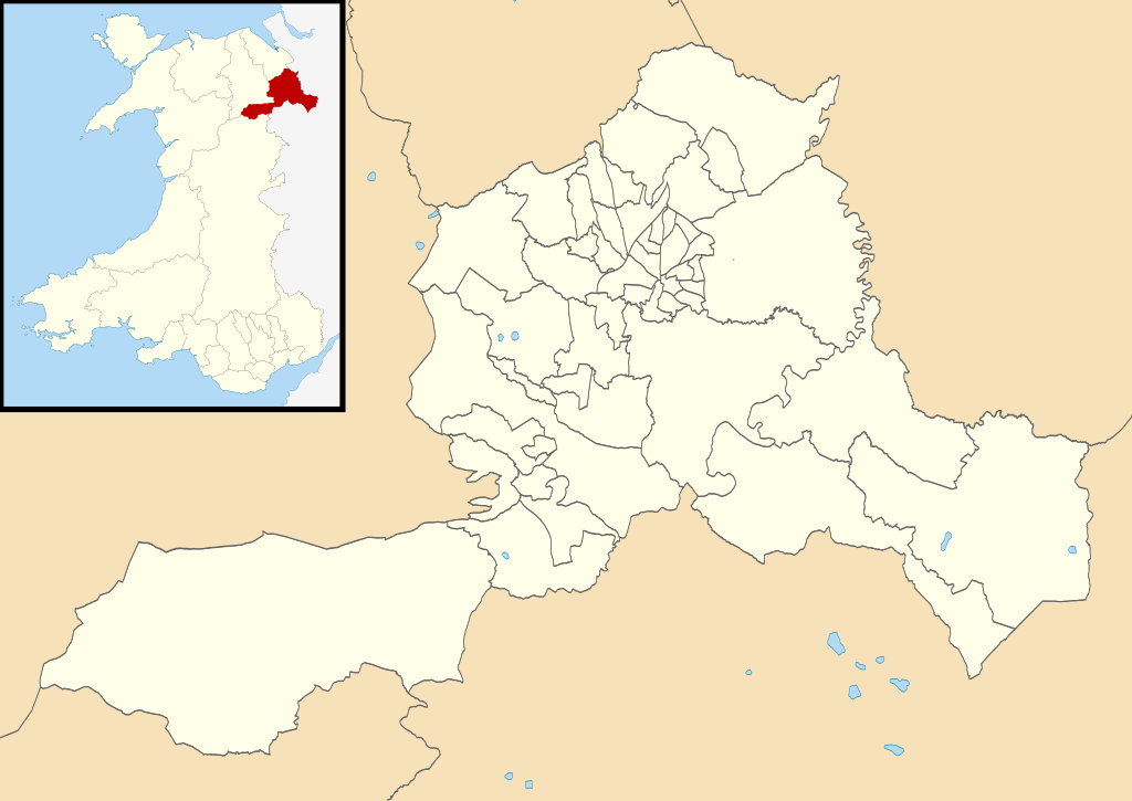
Map of the forty-nine electoral wards of Wrexham County Borough since 2022.
Summary
[edit]_2022.svg&action=edit§ion=1)
| Description |
English: Blank map of the forty-nine electoral wards of Wrexham County Borough, used for Wrexham County Borough elections since 2022.
Other attribution:
Derivative description: Equirectangular map projection on WGS 84 datum, with N/S stretched 165% Geographic limits:
|
| Date | |
| Source |
Ordnance Survey OpenData.
This vector image includes elements that have been taken or adapted from this file: This vector image includes elements that have been taken or adapted from this file: |
| Author | Dank · Jay |
| Permission (Reusing this file) |
This file is licensed under the Creative Commons Attribution-Share Alike 3.0 Unported license. Attribution: Contains Ordnance Survey data © Crown copyright and database right; © Local Democracy and Boundary Commission for Wales, 2020, licensed under the Open Government Licence
|
.svg)
Licensing
[edit]_2022.svg&action=edit§ion=2)
_(St_Edwards_Crown).svg)
|
This file is licensed under the United Kingdom Open Government Licence v3.0. |
See also: Meta for information on usage on Wikimedia wikis.
|
File history
Click on a date/time to view the file as it appeared at that time.
| Date/Time | Thumbnail | Dimensions | User | Comment | |
|---|---|---|---|---|---|
| current | 00:20, 8 May 2022 | | 512 × 362 (1.96 MB) | DankJae (talk | contribs) | Uploaded own work with UploadWizard |
You cannot overwrite this file.
File usage on Commons
The following 50 pages use this file:
- File:2022 Wales Wrexham Ward Acrefair North map.svg
- File:2022 Wales Wrexham Ward Acton and Maesydre map.svg
- File:2022 Wales Wrexham Ward Bangor Is-y-Coed map.svg
- File:2022 Wales Wrexham Ward Borras Park map.svg
- File:2022 Wales Wrexham Ward Bronington and Hanmer map.svg
- File:2022 Wales Wrexham Ward Brymbo map.svg
- File:2022 Wales Wrexham Ward Bryn Cefn map.svg
- File:2022 Wales Wrexham Ward Brynyffynnon map.svg
- File:2022 Wales Wrexham Ward Cartrefle map.svg
- File:2022 Wales Wrexham Ward Cefn East map.svg
- File:2022 Wales Wrexham Ward Cefn West map.svg
- File:2022 Wales Wrexham Ward Chirk North map.svg
- File:2022 Wales Wrexham Ward Chirk South map.svg
- File:2022 Wales Wrexham Ward Coedpoeth map.svg
- File:2022 Wales Wrexham Ward Dyffryn Ceiriog map.svg
- File:2022 Wales Wrexham Ward Erddig map.svg
- File:2022 Wales Wrexham Ward Esclusham map.svg
- File:2022 Wales Wrexham Ward Garden Village map.svg
- File:2022 Wales Wrexham Ward Gresford East and West map.svg
- File:2022 Wales Wrexham Ward Grosvenor map.svg
- File:2022 Wales Wrexham Ward Gwenfro map.svg
- File:2022 Wales Wrexham Ward Gwersyllt East map.svg
- File:2022 Wales Wrexham Ward Gwersyllt North map.svg
- File:2022 Wales Wrexham Ward Gwersyllt South map.svg
- File:2022 Wales Wrexham Ward Gwersyllt West map.svg
- File:2022 Wales Wrexham Ward Hermitage map.svg
- File:2022 Wales Wrexham Ward Holt map.svg
- File:2022 Wales Wrexham Ward Little Acton map.svg
- File:2022 Wales Wrexham Ward Llangollen Rural map.svg
- File:2022 Wales Wrexham Ward Llay map.svg
- File:2022 Wales Wrexham Ward Marchwiel map.svg
- File:2022 Wales Wrexham Ward Marford and Hoseley map.svg
- File:2022 Wales Wrexham Ward Minera map.svg
- File:2022 Wales Wrexham Ward New Broughton map.svg
- File:2022 Wales Wrexham Ward Offa map.svg
- File:2022 Wales Wrexham Ward Overton and Maelor South map.svg
- File:2022 Wales Wrexham Ward Pant and Johnstown map.svg
- File:2022 Wales Wrexham Ward Penycae and Ruabon South map.svg
- File:2022 Wales Wrexham Ward Penycae map.svg
- File:2022 Wales Wrexham Ward Ponciau map.svg
- File:2022 Wales Wrexham Ward Queensway map.svg
- File:2022 Wales Wrexham Ward Rhos map.svg
- File:2022 Wales Wrexham Ward Rhosnesni map.svg
- File:2022 Wales Wrexham Ward Rossett map.svg
- File:2022 Wales Wrexham Ward Ruabon map.svg
- File:2022 Wales Wrexham Ward Smithfield map.svg
- File:2022 Wales Wrexham Ward Stansty map.svg
- File:2022 Wales Wrexham Ward Whitegate map.svg
- File:2022 Wales Wrexham Ward Wynnstay map.svg
- File:2022 Wales Wrexham Ward election results map.svg
File usage on other wikis
The following other wikis use this file:
_2022.svg&oldid=681682260)