File:Wright County Soils Color Coded for Native Vegetation Wiki Version.pdf
Jump to navigation
Jump to search
Size of this JPG preview of this PDF file: 463 × 599 pixels. Other resolutions: 185 × 240 pixels | 371 × 480 pixels | 593 × 768 pixels | 1,275 × 1,650 pixels.
Original file (1,275 × 1,650 pixels, file size: 975 KB, MIME type: application/pdf, 3 pages)
Captions
Captions
Add a one-line explanation of what this file represents
Summary[edit]
| Description |
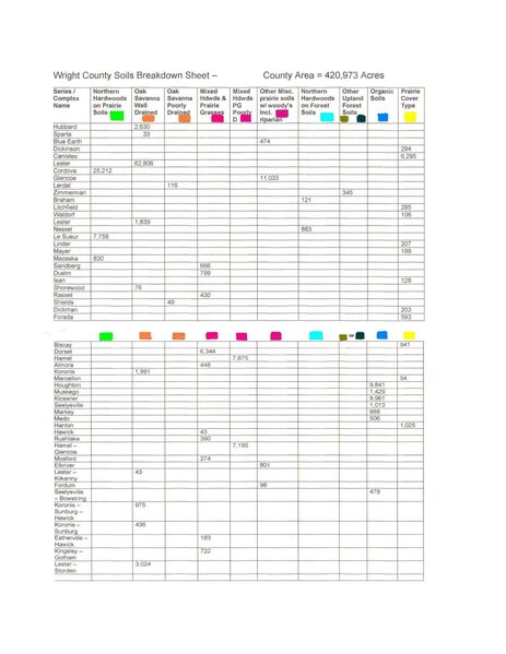
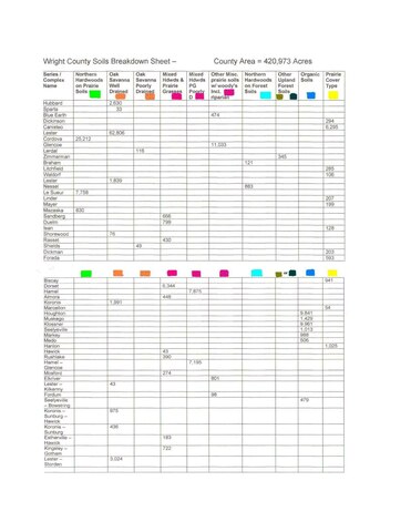
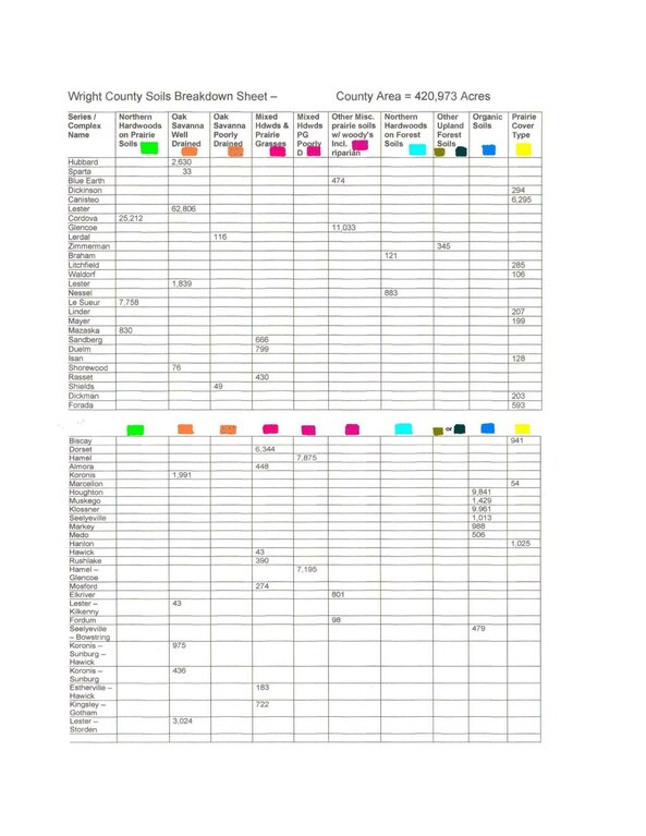
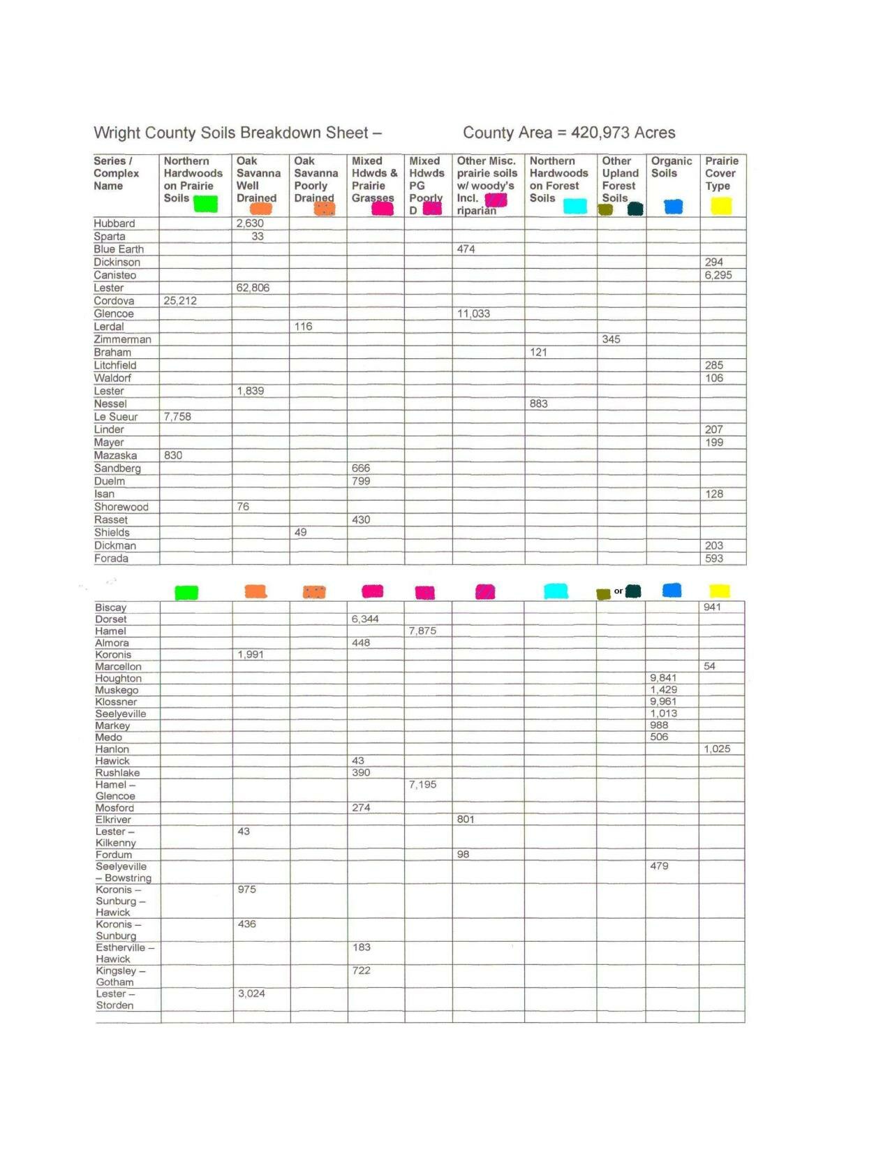
English: Landowners can use a quick guide like this before mapping the native vegetation for their property. Having a list like this, along with a copy of the soil survey for the property, will give landowners "the big picture" in seconds; dominant / extensive soils are identified for their native vegetation. What did grow there and what will still grow there...today.
Here's a Wright County Minnesota example. |
| Date | |
| Source | Own work |
| Author | Firry Floyd |
Licensing[edit]
I, the copyright holder of this work, hereby publish it under the following license:
This file is licensed under the Creative Commons Attribution-Share Alike 3.0 Unported license.
- You are free:
- to share – to copy, distribute and transmit the work
- to remix – to adapt the work
- Under the following conditions:
- attribution – You must give appropriate credit, provide a link to the license, and indicate if changes were made. You may do so in any reasonable manner, but not in any way that suggests the licensor endorses you or your use.
- share alike – If you remix, transform, or build upon the material, you must distribute your contributions under the same or compatible license as the original.
File history
Click on a date/time to view the file as it appeared at that time.
| Date/Time | Thumbnail | Dimensions | User | Comment | |
|---|---|---|---|---|---|
| current | 19:46, 22 February 2013 |  | 1,275 × 1,650, 3 pages (975 KB) | Firry Floyd (talk | contribs) | User created page with UploadWizard |
You cannot overwrite this file.
File usage on Commons
There are no pages that use this file.