File:Yuban Ancient Salt Road in 1970 by CORONA satellite.jpg
Jump to navigation
Jump to search

Size of this preview: 800 × 566 pixels. Other resolutions: 320 × 226 pixels | 640 × 453 pixels | 1,024 × 724 pixels | 1,280 × 905 pixels | 2,560 × 1,810 pixels | 4,961 × 3,508 pixels.
Original file (4,961 × 3,508 pixels, file size: 9.19 MB, MIME type: image/jpeg)
Captions
Captions
Add a one-line explanation of what this file represents
Summary[edit]
| Description |
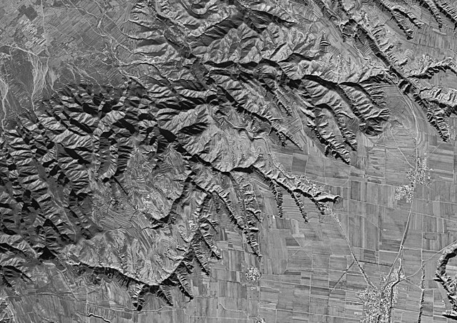
中文:1970年原山西运城与平陆交界处的虞坂古盐道卫星地图。 |
| Date | |
| Source | https://earthexplorer.usgs.gov/metadata/1051/DS1112-2232DA123/ |
| Author | CIA/NRO/USGS |
Licensing[edit]
This image is in the public domain in the United States because it only contains materials that originally came from the United States Geological Survey, an agency of the United States Department of the Interior. For more information, see the official USGS copyright policy.
|
File history
Click on a date/time to view the file as it appeared at that time.
| Date/Time | Thumbnail | Dimensions | User | Comment | |
|---|---|---|---|---|---|
| current | 05:47, 27 February 2019 | | 4,961 × 3,508 (9.19 MB) | 猫猫的日记本 (talk | contribs) | User created page with UploadWizard |
You cannot overwrite this file.
File usage on Commons
There are no pages that use this file.
File usage on other wikis
The following other wikis use this file:
- Usage on zh.wikipedia.org