File:Yugoslavia map norwegian.svg

Alkuperäinen tiedosto (SVG-tiedosto; oletustarkkuus 595 × 431 kuvapistettä; tiedostokoko 315 KiB)
Kuvatekstit
Kuvatekstit
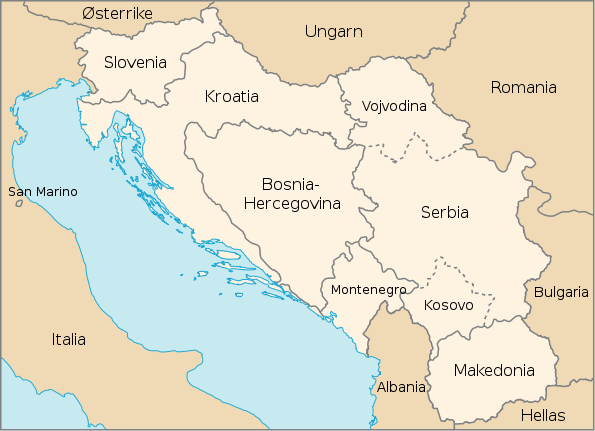
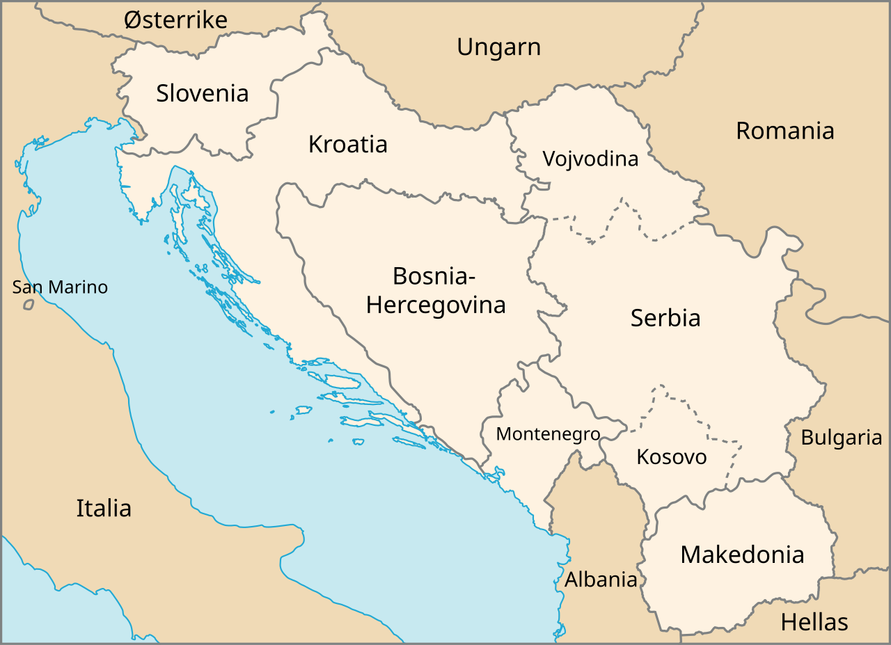
| Kuvaus | Map of The Former Yugoslavia in Norwegian | |||
| Päiväys | February, 2003 (created), February, 2007 (edited) | |||
| Lähde | http://www.un.org/Depts/Cartographic/map/profile/frmryugo.pdf | |||
| Tekijä | Department of Public Information Cartographic Section, edited by Stian H. | |||
| Käyttöoikeus (Tämän tiedoston uudelleenkäyttö) |
|

Tiedoston historia
Päiväystä napsauttamalla näet, millainen tiedosto oli kyseisellä hetkellä.
| Päiväys | Pienoiskuva | Koko | Käyttäjä | Kommentti | |
|---|---|---|---|---|---|
| nykyinen | 19. helmikuuta 2007 kello 17.29 | | 595 × 431 (315 KiB) | Stianbh (keskustelu | muokkaukset) | {{Information| |Description=Map of The Former Yugoslavia in Norwegian |Source=http://www.un.org/Depts/Cartographic/map/profile/frmryugo.pdf |Date=February, 2003 (created), February, 2007 (edited) |Author=Department of Public Information Cartographic Secti |
Et voi tallentaa uutta tiedostoa tämän tilalle.
Tiedoston käyttö
Seuraava sivu käyttää tätä tiedostoa:
Tiedoston järjestelmänlaajuinen käyttö
Seuraavat muut wikit käyttävät tätä tiedostoa:
- Käyttö kohteessa fi.wikipedia.org
- Käyttö kohteessa nn.wikipedia.org
- Käyttö kohteessa no.wikipedia.org