Grand Teton National Park
Jump to navigation
Jump to search
Maps and diagrams[edit]
-
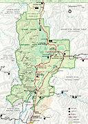 Map of Grand Teton National Park
 -
 Teton fault diagram
 -
 LocMap
 -
 Mount Moran diagram
 -
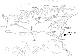 Teton area perspective map
 -
 Teton region in the Lower Cambrian
 -
 Teton region in the Late Cambrian
 -
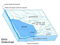 Teton region in the Early Ordovician


Tetons[edit]
-
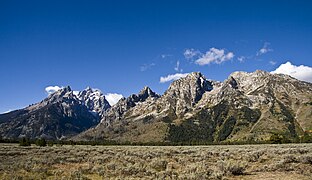
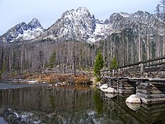
 As seen from signal mountain row
Zoomviewer -
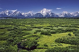
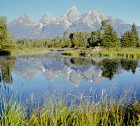
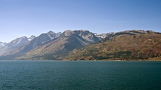
 Jackson Lake and the Teton Range
Zoomviewer -
 From Jackson Lake Lodge
Zoomviewer -
 Cathedral Group panorama from Cathedral Group Scenic Turnout
Zoomviewer -
 Leigh Lake panorama
Zoomviewer -
 Blacktail Butte
Zoomviewer -
 Cathedral Group panorama from the Jackson Lake Lodge outlook
 -
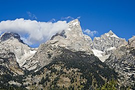
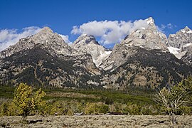
 Cathedral Group
 -
 Cathedral Group
 -
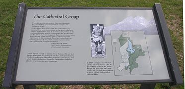 Cathedral Group sign
 -
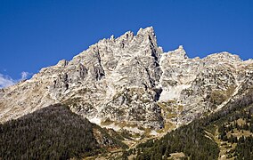
 Closeup of Teton Range
 -
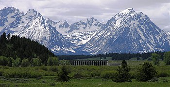
 Mount Moran from Mount Moran Scenic Turnout
 -
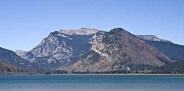
 Teton Range from Glacier View Turnout
 -
 Teton Range from Glacier View Turnout
 -
 Teton Range from west
 -
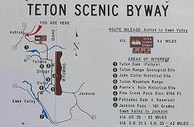 Teton Scenic Byway sign
 -
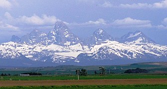 The Three Tetons from the west
 -
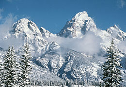 Grand Teton in Winter
 -
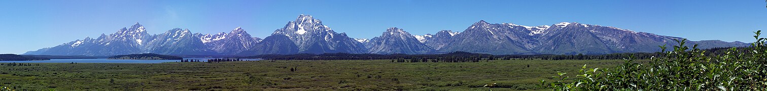
 The Tetons
 -
 Mount Moran
 -
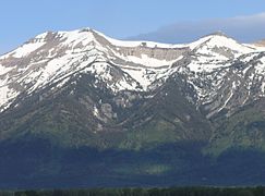
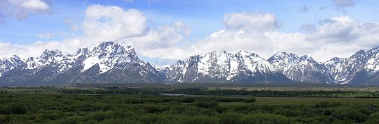
 The Teton Range
 -
 Teewinot Mountain and Mount Owen
 -
 View south from Static Peak Divide
 -
 View north from Static Peak Divide with Alaska basin at left and Grand Teton, upper right
 -
 Trail through Paintbrush Canyon
 -
 Trail through Death Canyon
 -
 Trail through south fork Cascade Canyon
 -
 Leigh Lake and Mount Moran
 -
 Avalanche Canyon
 -
 Buck Mountain
 -
 Buck Mountain
 -
 Disappointment Peak (outcropping to left and below Grand Teton)
 -
 Eagles Rest Peak
 -
 Garnet Canyon with Highlands historic distric
 -
 Grand Teton and Teewinot
 -
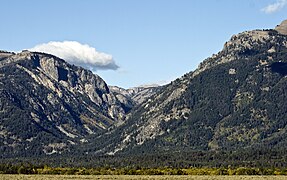
 Death Canyon
 -
 Granite Canyon
 -

-
 Open Canyon
 -
 Middle Teton and the black dike
 -
 Middle Teton
 -
 Traverse and Bivouac peaks
 -
 Mount Wister
 -
 Mount Moran
 -
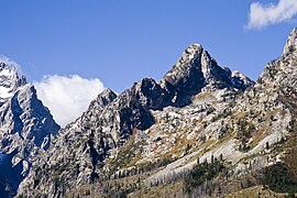
 Mount Owen
 -
 Mount Saint John
 -
 Mount Woodring
 -
 Nez Perce
 -
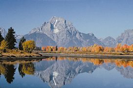
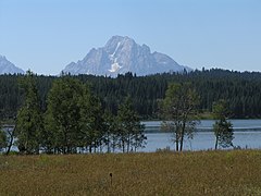
 northern Tetons across Jackson Lake
 -
 northern Tetons across Jackson Lake
 -
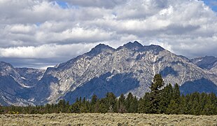
 Rendezvous Mountain
 -
 Rockchuck Peak
 -
 South Teton
 -
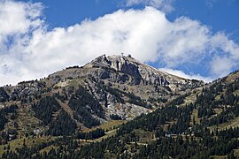
 Static Peak
 -
 Static Peak
 -
 Symmetry Spire
 -
 Symmetry Spire, Mount Saint John, Rockchuck Peak
 -
Teewinot Mountain
-
 Teewinot Mountain
 -
 Thor Peak


Animals[edit]
-
 Bird in the Elk Refuge
 -
 Bird in the Elk Refuge
 -
 Trumpeter Swans
 -
 Sage Grouse
 -
 Birdhouse in Jackson Hole
 -
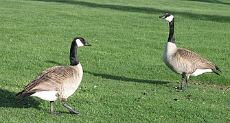 Geese in Elk Refuge overlook area
 -
 Coyote
 -
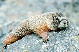 Marmot
 -
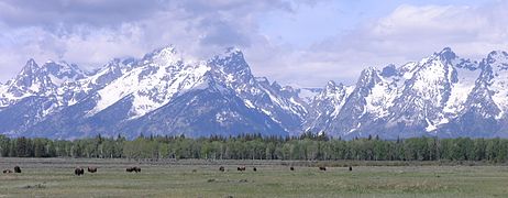
 Bison in Jackson Hole looking east
 -
 Elk Fawn
 -
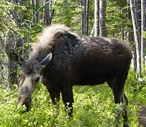
 Moose
Moose -
 Snake River finespotted cutthroat trout
 -
 Female moose
 -
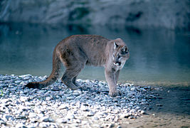 Mountain Lion
 -
 Bison from Elk Ranch Flats Turnout


Plants[edit]
-
 Indian Paintbrush
 -
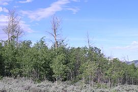 Aspen in Jackson Hole near the Gros Venture River
 -
 Aspen tree in Jackson Hole
 -
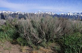 Sagebrush in Jackson Hole
 -
 Stand of trees in pothole in Jackson Hole
 -
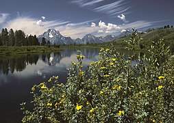
 Yellow flower near Gros Venture Slide
 -
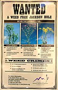 Wanted Weed Free Jackson Hole
 -
 White flower near Gros Venture Slide
 -
 Shooting Stars
 -
 Lupine
 -
 Alpine Forget-Me-Not
 -
 Oxbow Bend
 -
 low Larkspur


Historic[edit]
-
 Grand Teton driftwood by Ansel Adams
 -
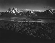 Grand Teton- Mt Moran and Jackson Lake from Signal Hill by Ansel Adams
 -
 The Tetons and the Snake River by Ansel Adams
 -
 Grand Teton by Ansel Adams
 -
 Grand Teton by Ansel Adams
 -
 Bill Menor
 -
 Menor Ferry in 1899
 -
 Menor Ferry in 1924
 -
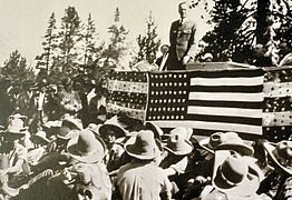 Park Dedication in 1929
 -
 Tetons from the west by William Henry Jackson 1872
 -
 William Henry Jackson 1872
 -
 William Henry Jackson 1872
 -
 William Henry Jackson 1872
 -
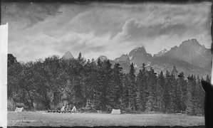 Camp in Jackson Hole William Henry Jackson 1872
 -
 Forest fire near Beaver Creek in 1985
 -
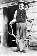
 First ascent, Grand Teton, 1898.


Buildings[edit]
-
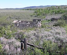 Abandoned homestead near Gros Venture River in Jackson Hole
 -
 Abandoned homestead near Gros Venture River in Jackson Hole
 -
 Chapel of the Sacred Heart
 -
 Old Grand Teton National Park Visitors Center
 -
 Moose visitor center 2010
 -
 Historic structures in Jackson Hole
 -
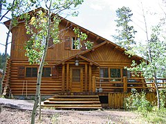
 John Moulton barn
 -
 Jackson Lake Lodge
 -
 Jackson Lake Lodge, Cottages
 -
 Highlands Historic Distric
 -
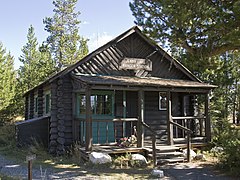
 Jackson Lake Ranger Station
 -
 Jenny Lake Ranger Station
 -
 Leeks Lodge chimney
 -
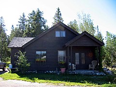
 The Brinkerhoff
 -
 Snake River Land Company Office
 -
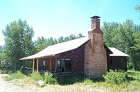
 Cunningham Cabin in Jackson Hole
 -
 Cunningham Cabin in Jackson Hole


Geology and glacier features[edit]
-
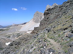
 Cirque in the Tetons
 -
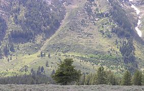 Fault scarp on Teton Range
 -
 Fault scarp sign in GTNP
 -
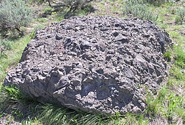 Volcanic breccia in Jackson Hole
 -
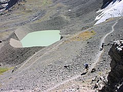 Schoolroom Glacier, terminal moraine and glacial lake
 -
 Middle Teton Glacier


Human impact[edit]
-
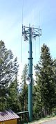 Cell tower, Signal Mountain
 -
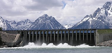 Jackson Lake Dam
 -
 Jackson Lake Dam with Tetons in the backgroud
 -
 Monitoring station in Jackson Hole
 -
 Bear trap


Water and valleys[edit]
-
-
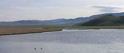
 Tetons from Oxbow Bend overlook
 -
 Oxbow Bend overlook of Snake River
 -
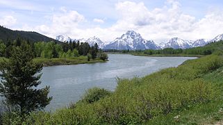
 Snake River with Teton Range in background
 -
 Snake River with Teton Range in background
 -
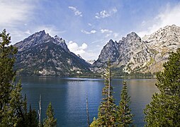 Jenny Lake and Cascade Canyon
 -
 Snake River and Signal Mountain
 -
 String Lake and Mount Moran
 -
 String Lake footbridge
 -
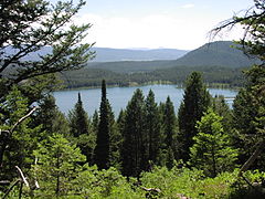
 Trapper Lake
 -
 Bearpaw lake
 -
 Bradley (left) and Taggart lakes
 -
 Two Ocean Lake
 -
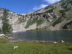
 Surprise Lake
 -
 Holly Lake
 -
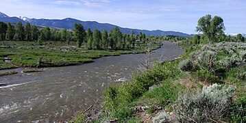 Gros Venture River
 -
 Hidden Falls
 -
 Emma Matilda Lake
 -
 Snake River with Teton Range in background


Activities[edit]
-
 Backpacking
 -
 Photographers at Oxbow Bend
 -
 Wildlife viewing
 -
 Hiker crosses snowfield enroute to Paintbrush Divide


Near to the park[edit]
-
 Grand Teton National Park sign
 -
 National Elk Refuge from overlook
 -
 National Elk Refuge sign
 -
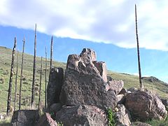
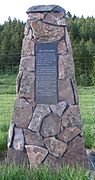 The Astorians plaque
 -
 Gros Ventre Slide
 -
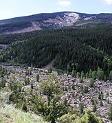 Gros Ventre Slide
 -
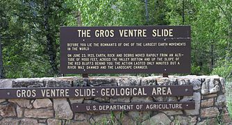 Gros Ventre Slide sign
 -
 Tree destroyed by Gros Ventre Slide
 -
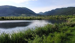
 Lower Slide Lake
 -
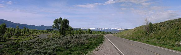
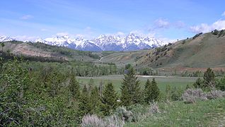 Gros Ventre River valley
 -
 Gros Ventre River with road and terrace
 -
 Terrace along the Gros Ventre River
 -
 Jackson National Fish Hatchery
 -
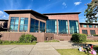
 National Museum of Wildlife Art
 -
 National Museum of Wildlife Art sign
 -
 Flat Creek Valley from National Elk Refuge overlook area
 -
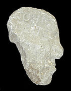 Colter Stone found in 1931 in Tetonia, Idaho
 -
 Alaska Basin


