File:1907 rzeczpospolita yr.jpg
Jump to navigation
Jump to search
Size of this preview: 772 × 599 pixels. Other resolutions: 309 × 240 pixels | 618 × 480 pixels | 989 × 768 pixels | 1,167 × 906 pixels.
Original file (1,167 × 906 pixels, file size: 329 KB, MIME type: image/jpeg)
Captions
Captions
Add a one-line explanation of what this file represents
Summary
[edit]
| Description |
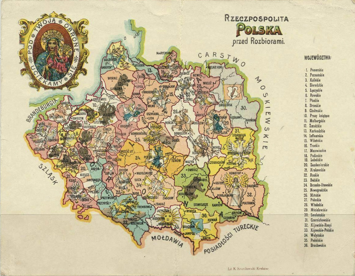
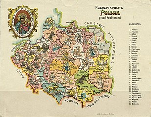
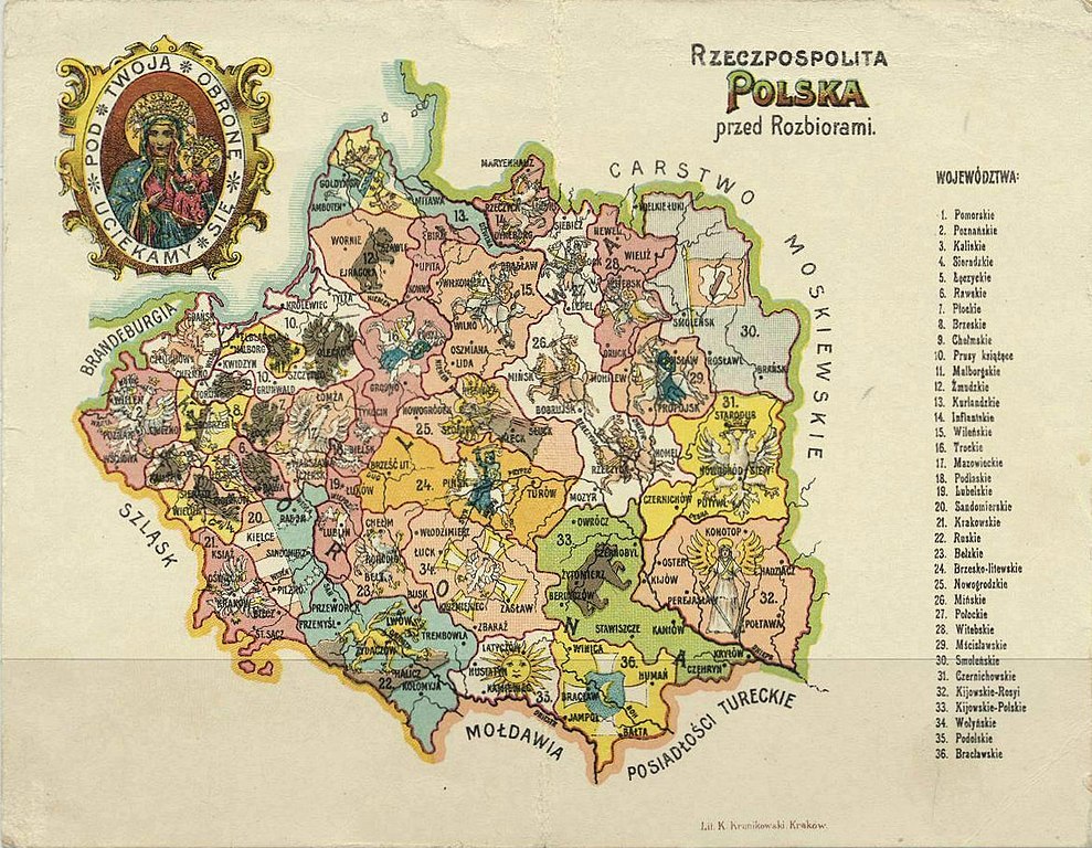
Русский: Карта Речи Посполитой с гербами до её первого раздела. С открытки. Отпечатана в Кракове в 1907 году.
Polski: Pocztówkę "Mapa. Rzeczpospolita Polska przed rozbiorem". Wydaną w Krakowie. 1907 r. English: Map of Poland and/or the Polish-Lithuanian Commonwealth. Supposedly (but no source) drawn in 1907 and showing the situation of the 1770s? |
| Date | |
| Source | http://www.lithuanianmaps.com/images/ |
| Author | Unknown author |
Licensing
[edit]
|
This work is in the public domain in its country of origin and other countries and areas where the copyright term is the author's life plus 70 years or fewer. This work is in the public domain in the United States because it was published (or registered with the U.S. Copyright Office) before January 1, 1929. | |
| This file has been identified as being free of known restrictions under copyright law, including all related and neighboring rights. | |
File history
Click on a date/time to view the file as it appeared at that time.
| Date/Time | Thumbnail | Dimensions | User | Comment | |
|---|---|---|---|---|---|
| current | 11:49, 12 March 2020 | | 1,167 × 906 (329 KB) | Лобачев Владимир (talk | contribs) | Uploaded a work by {{unknown|author}} from http://www.lithuanianmaps.com/images/ with UploadWizard |
You cannot overwrite this file.
File usage on Commons
There are no pages that use this file.
File usage on other wikis
The following other wikis use this file:
- Usage on be.wikipedia.org
- Usage on lt.wikibooks.org
- Usage on ru.wikipedia.org
- Usage on uk.wikipedia.org