File:Annobón Bioko-es.png

Original file (1,895 × 1,098 pixels, file size: 495 KB, MIME type: image/png)
Captions
Captions
Summary[edit]
| Description |
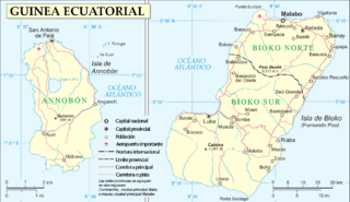
English: Maps of Annobon and Bioko islands, (Equatorial Guinea) in Spanish
Español: Mapa de las islas Bioko y Annobon de Guinea Ecuatorial |
| Date | |
| Source | Own work |
| Author | Basquetteur |
| Other versions |
This file was derived from: |
| This image is a map derived from a United Nations map.
Unless stated otherwise, UN maps are to be considered in the public domain. This applies worldwide. UN maps are, in principle, open source material and you can use them in your work or for making your own map. UN requests however that you delete the UN name, logo and reference number upon any modification to the map. Content of your map will be your responsibility. You can state in your publication, if you wish, something like: based on UN map … (map name, map number, revision number and date). See: Geospatial Information Section. And: Geospatial, location data for a better world. |
 |
Licensing[edit]
- You are free:
- to share – to copy, distribute and transmit the work
- to remix – to adapt the work
- Under the following conditions:
- attribution – You must give appropriate credit, provide a link to the license, and indicate if changes were made. You may do so in any reasonable manner, but not in any way that suggests the licensor endorses you or your use.
- share alike – If you remix, transform, or build upon the material, you must distribute your contributions under the same or compatible license as the original.
File history
Click on a date/time to view the file as it appeared at that time.
| Date/Time | Thumbnail | Dimensions | User | Comment | |
|---|---|---|---|---|---|
| current | 18:58, 15 June 2016 | | 1,895 × 1,098 (495 KB) | W like wiki (talk | contribs) | Even though the source of this file is the UN, the lower latitude coordinates of Annobón (located on the southern hemisphere!) should be 1°27′S instead of 1°23′ !!!! |
| 19:22, 12 September 2014 |  | 1,895 × 1,098 (493 KB) | Basquetteur (talk | contribs) | Fernando Po --> Fernando Poo | |
| 07:25, 7 September 2014 |  | 1,895 × 1,098 (492 KB) | Basquetteur (talk | contribs) | The name isla de Boiko should be isla de Bioko. this has been corrected. The same mistake is also in the original UN map. | |
| 21:03, 5 September 2014 |  | 1,895 × 1,098 (492 KB) | Basquetteur (talk | contribs) | User created page with UploadWizard |
You cannot overwrite this file.
File usage on Commons
The following page uses this file:
File usage on other wikis
The following other wikis use this file:
- Usage on ca.wikipedia.org
- Usage on eo.wikipedia.org
- Usage on es.wikipedia.org
- Usage on fr.wikipedia.org
- Usage on ja.wikipedia.org
- Usage on ka.wikipedia.org
- Usage on tr.wikipedia.org