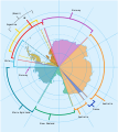
File:Antarctica, territorial claims.svg
From Wikimedia Commons, the free media repository
Jump to navigation
Jump to search

Size of this PNG preview of this SVG file: 600 × 600 pixels. Other resolutions: 240 × 240 pixels | 480 × 480 pixels | 768 × 768 pixels | 1,024 × 1,024 pixels | 2,048 × 2,048 pixels | 820 × 820 pixels.
Original file (SVG file, nominally 820 × 820 pixels, file size: 72 KB)
File information
Structured data
Captions
Captions
Map showing the territorial claims to Antarctica
Прошло
Антарктида
| DescriptionAntarctica, territorial claims.svg |
English: Map showing the territorial claims to Antarctica
|
| Date | |
| Source |
|
| Author | Lokal_Profil |
| Permission (Reusing this file) |
This file is licensed under the Creative Commons Attribution-Share Alike 2.5 Generic license. Attribution: Lokal_Profil
|
| Other versions |
|
File history
Click on a date/time to view the file as it appeared at that time.
| Date/Time | Thumbnail | Dimensions | User | Comment | |
|---|---|---|---|---|---|
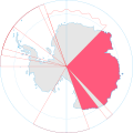
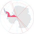
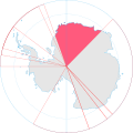
| current | 16:42, 8 May 2020 |  | 820 × 820 (72 KB) | Spesh531 (talk | contribs) | Norway's claim stretches to the South Pole as of June 12 2015 |
| 04:31, 13 October 2009 |  | 820 × 820 (71 KB) | DooFi (talk | contribs) | sauerkraut | |
| 20:08, 30 June 2008 | 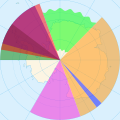 | 806 × 806 (43 KB) | Lokal Profil (talk | contribs) | {{Information |Description={{en|Map showing the territorial claims to Antarctica}} {{legend|#e987eb|New Zealand}} {{legend|#fcc475|Australia}} {{legend|#8282ed|France}} {{legend|#7efa72|Norway}} {{legend|#ec787f|United Kingdom}} {{legend|#6db87f|Chile}} { |
You cannot overwrite this file.
File usage on Commons
The following 10 pages use this file:
- User:4ing/Antarctica/2020-01-06
- User:Jmv/Antarktika für Farbenblinde
- User:Lokal Profil/Gallery/Map
- File:Dufek Coast map.png
- File:Gould Coast map.png
- File:Hillary Coast map.png
- File:Pennell Coast map.png
- File:Scott Coast map.png
- File:Shackleton Coast map.png
- Category:Claimed territories of Antarctica
File usage on other wikis
The following other wikis use this file:
- Usage on af.wikipedia.org
- Usage on ar.wikipedia.org
- Usage on ast.wikipedia.org
- Usage on az.wikipedia.org
- Usage on bar.wikipedia.org
- Usage on bn.wikipedia.org
- Usage on cs.wikipedia.org
- Usage on de.wikipedia.org
- Usage on en.wikipedia.org
- Usage on es.wikipedia.org
- Usage on eu.wikipedia.org
- Usage on fa.wikipedia.org
- Usage on frr.wikipedia.org
- Usage on fy.wikipedia.org
- Usage on gl.wikipedia.org
- Usage on hu.wikipedia.org
- Usage on hy.wikipedia.org
- Usage on id.wikipedia.org
View more global usage of this file.
Metadata
This file contains additional information such as Exif metadata which may have been added by the digital camera, scanner, or software program used to create or digitize it. If the file has been modified from its original state, some details such as the timestamp may not fully reflect those of the original file. The timestamp is only as accurate as the clock in the camera, and it may be completely wrong.
| Width | 820 |
|---|---|
| Height | 820 |

