File:Awagatake (Aerial).jpg
Jump to navigation
Jump to search
Size of this preview: 800 × 450 pixels. Other resolutions: 320 × 180 pixels | 640 × 360 pixels | 1,280 × 720 pixels.
Original file (1,280 × 720 pixels, file size: 220 KB, MIME type: image/jpeg)
Captions
Captions
Add a one-line explanation of what this file represents
| Description |
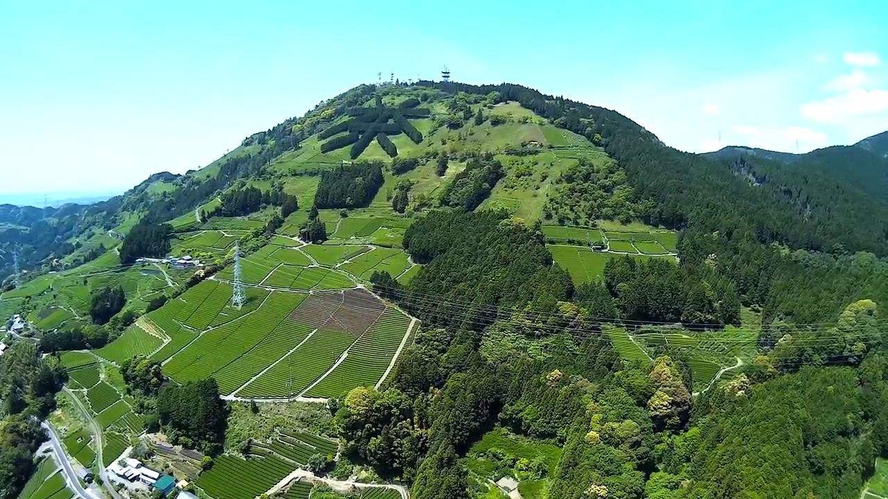
English: Aerial view of the east side of the Mount Awagatake (a.k.a. Mount Awa) in the border Kakegawa & Shimada, Shizuoka Prefecture, Japan.
|
| Date |
Unknown 11 May 2015 (original upload date) |
| Source | https://www.youtube.com/watch?v=zLdikfzdhU4 at 11 second |
| Author | SUGI MAKOTO |
| Permission (Reusing this file) |
This video, screenshot or audio excerpt was originally uploaded on YouTube under a CC license.
Their website states: "YouTube allows users to mark their videos with a Creative Commons CC BY license."
To the uploader: You must provide a link (URL) to the original file and the authorship information if available.
This file is licensed under the Creative Commons Attribution 3.0 Unported license. Attribution: SUGI MAKOTO
|
| Camera location | | View this and other nearby images on: OpenStreetMap |
|---|
.jpg¶ms=034.842222_N_0138.081667_E_globe:Earth_type:camera_region:JP_&language=en)
| Object location | | View this and other nearby images on: OpenStreetMap |
|---|
.jpg¶ms=034.841667_N_0138.067500_E_globe:Earth_class:object_type:object_region:JP_&language=en)
This file, which was originally posted to
https://www.youtube.com/watch?v=zLdikfzdhU4 at 11 second, was reviewed on 24 November 2017 by reviewer Leoboudv, who confirmed that it was available there under the stated license on that date.
|
File history
Click on a date/time to view the file as it appeared at that time.
| Date/Time | Thumbnail | Dimensions | User | Comment | |
|---|---|---|---|---|---|
| current | 07:35, 24 November 2017 | | 1,280 × 720 (220 KB) | Batholith (talk | contribs) | {{Information |Description= {{en|Aerial photographs of the East side of '''Awagatake''' (or Mount Awa) in Kakegawa, Shizuoka & Shimada, Shizuoka, Shizuoka prefecture, Jap... |
You cannot overwrite this file.
File usage on Commons
The following 2 pages use this file:
File usage on other wikis
The following other wikis use this file:
- Usage on ceb.wikipedia.org
- Usage on ja.wikipedia.org
- Usage on lld.wikipedia.org
- Usage on vi.wikipedia.org
- Usage on www.wikidata.org
- Usage on zh-yue.wikipedia.org
- Usage on zh.wikipedia.org
.jpg&oldid=809355495)