File:Camps topographiques de la campagne de MDCCLVII, en Westphalie, Plan No. 29 et No. 55, Holsenstein - detail.jpg
Jump to navigation
Jump to search
Size of this preview: 800 × 522 pixels. Other resolutions: 320 × 209 pixels | 640 × 418 pixels | 1,024 × 668 pixels | 1,280 × 835 pixels | 2,560 × 1,670 pixels | 4,316 × 2,816 pixels.
Original file (4,316 × 2,816 pixels, file size: 15.13 MB, MIME type: image/jpeg)
Captions
Captions
Add a one-line explanation of what this file represents
Summary
[edit]| Description |
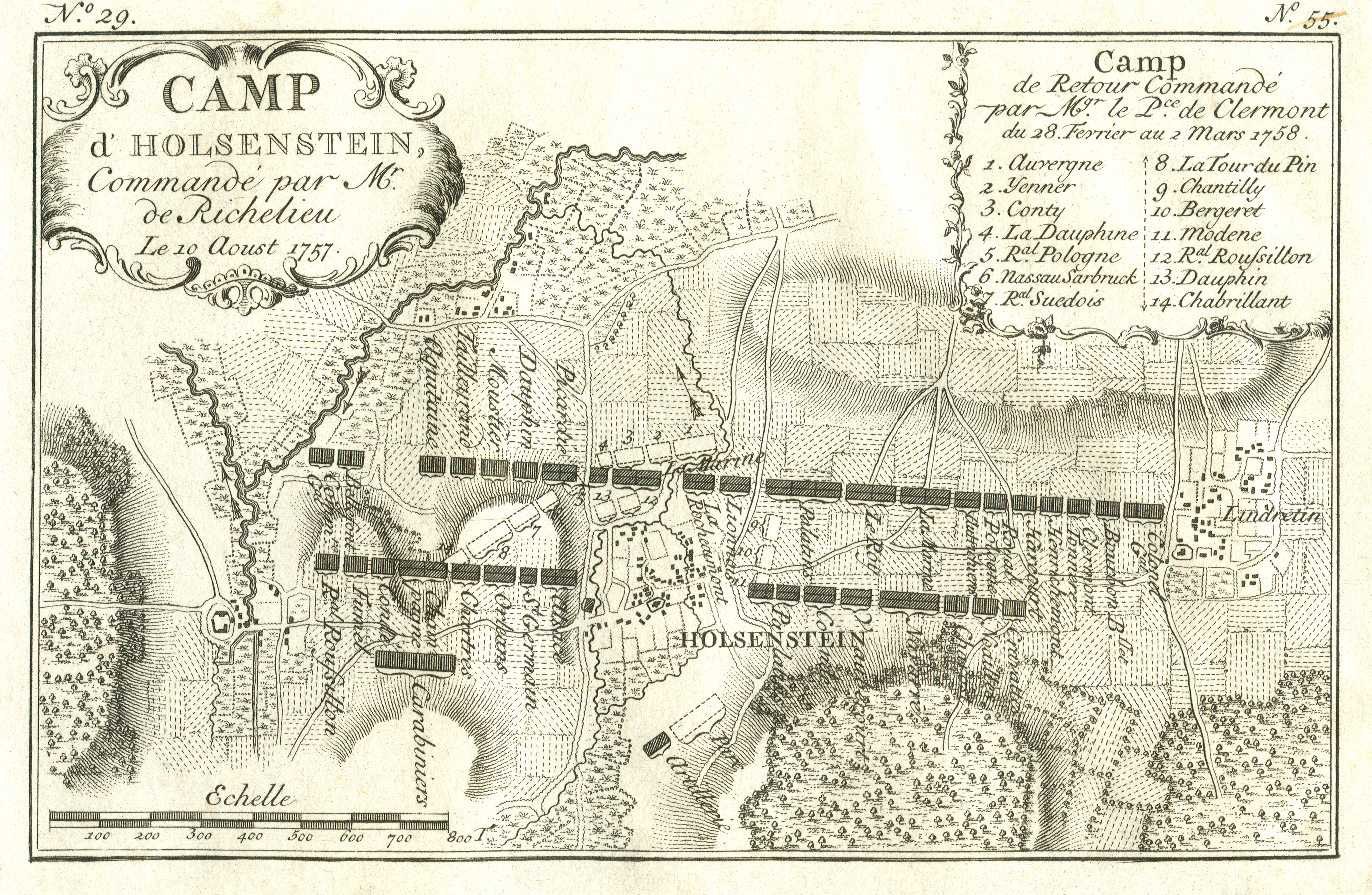
English: Topographic map, No. 29 & 55, of the camps in the Seven Years War with German villages Bredenbeck, Holtensen (Wennigsen) and Linderte in 1757 and 1758
(edited detail-version: color-adjustments by gimp <brightness +32, contrast +24>; cropped and retouched borders; retouching of some spots and scratches in whitespace with nearby content) Deutsch: Topografische Karte No. 29 & 55 der Feldlager bei Bredenbeck am Deister, Holtensen und Linderte im Siebenjährigen Krieg nach der Schlacht bei Hastenbeck, während der Besetzung der französischen Truppen unter dem Kommando von Marschall Herzog von Richelieu (Louis François Armand de Vignerot du Plessis) am 10. August 1757 und auf dem Rückweg unter Clermont am 2. März 1758 |
||||||||||||||||||||||
| Date | |||||||||||||||||||||||
| Source | |||||||||||||||||||||||
| Author |
|
||||||||||||||||||||||
| Other versions |
|
||||||||||||||||||||||

| Object location | | View this and other nearby images on: OpenStreetMap |
|---|
Licensing
[edit]
|
This work is in the public domain in its country of origin and other countries and areas where the copyright term is the author's life plus 100 years or fewer. | |
| This file has been identified as being free of known restrictions under copyright law, including all related and neighboring rights. | |
File history
Click on a date/time to view the file as it appeared at that time.
| Date/Time | Thumbnail | Dimensions | User | Comment | |
|---|---|---|---|---|---|
| current | 15:34, 9 February 2014 | | 4,316 × 2,816 (15.13 MB) | Jaybear (talk | contribs) | {{Information |Description ={{en|1=German villages Bredenbeck, Holtensen (Wennigsen) and Linderte in 1757 and 1758 <br /> (edited version: ...)}} {{de|1=Bredenbeck am Deister, [[:de:Holtensen (Wennigsen)|Holtensen]... |
You cannot overwrite this file.
File usage on Commons
The following page uses this file:
File usage on other wikis
The following other wikis use this file:
- Usage on de.wikipedia.org
- Usage on nds.wikipedia.org