File:Cayman Islands location map.svg
Bước tới điều hướng
Bước tới tìm kiếm

Kích thước bản xem trước PNG này của tập tin SVG: 799×319 điểm ảnh. Độ phân giải khác: 320×128 điểm ảnh | 640×256 điểm ảnh | 1.024×409 điểm ảnh | 1.280×511 điểm ảnh | 2.560×1.022 điểm ảnh | 924×369 điểm ảnh.
Tập tin gốc (tập tin SVG, 924×369 điểm ảnh trên danh nghĩa, kích thước: 33 kB)
Chú thích
Chú thích
Ghi một dòng giải thích những gì có trong tập tin này
| Miêu tả |
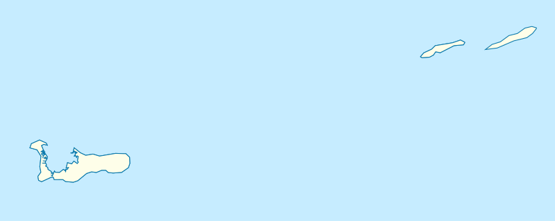
Deutsch: Positionskarte der Kaimaninseln. Geographische Begrenzungen der Karte:
English: Location map of the Cayman Islands. Geographic limits of the map:
|
| Ngày | |
| Nguồn gốc | Tác phẩm được tạo bởi người tải lên, using OpenStreetMap Data for the coastlines |
| Tác giả |
Graphic made by Carport |
Giấy phép
[sửa]
Tập tin này được phát hành theo Giấy phép Creative Commons Ghi công–Chia sẻ tương tự 2.0 Chung
- Bạn được phép:
- chia sẻ – sao chép, phân phối và chuyển giao tác phẩm
- pha trộn – để chuyển thể tác phẩm
- Theo các điều kiện sau:
- ghi công – Bạn phải ghi lại tác giả và nguồn, liên kết đến giấy phép, và các thay đổi đã được thực hiện, nếu có. Bạn có thể làm các điều trên bằng bất kỳ cách hợp lý nào, miễn sao không ám chỉ rằng người cho giấy phép ủng hộ bạn hay việc sử dụng của bạn.
- chia sẻ tương tự – Nếu bạn biến tấu, biến đổi, hoặc làm tác phẩm khác dựa trên tác phẩm này, bạn chỉ được phép phân phối tác phẩm mới theo giấy phép y hệt hoặc tương thích với tác phẩm gốc.
Lịch sử tập tin
Nhấn vào ngày/giờ để xem nội dung tập tin tại thời điểm đó.
| Ngày/Giờ | Hình xem trước | Kích cỡ | Thành viên | Miêu tả | |
|---|---|---|---|---|---|
| hiện tại | 17:07, ngày 23 tháng 11 năm 2009 | 924×369 (33 kB) | Carport (thảo luận | đóng góp) | {{Information |Description={{de|1=Positionskarte der {{w|Kaimaninseln|3=de}}. Geographische Begrenzungen der Karte: * N: 19.84° N * S: 19.14° N * W: 81.52° W * E: 79.66° W}} {{en|1=Location map of the {{w|Cayman Islands}}. Geographic limits of the ma |
Bạn không được phép ghi đè tập tin này.
Trang sử dụng tập tin
12 trang sau sử dụng tập tin này:
- File:United Kingdom (overseas+crown dependencies), administrative divisions - Nmbrs (marker).svg
- File:United Kingdom (overseas+crown dependencies), administrative divisions - Nmbrs (multiple zoom).svg
- File:United Kingdom (overseas+crown dependencies), administrative divisions - Nmbrs (single zoom).svg
- File:United Kingdom (overseas+crown dependencies), administrative divisions - de (marker).svg
- File:United Kingdom (overseas+crown dependencies), administrative divisions - de (multiple zoom).svg
- File:United Kingdom (overseas+crown dependencies), administrative divisions - de (single zoom).svg
- File:United Kingdom (overseas-crown dependencies), administrative divisions - Nmbrs (marker).svg
- File:United Kingdom (overseas-crown dependencies), administrative divisions - Nmbrs (multiple zoom).svg
- File:United Kingdom (overseas-crown dependencies), administrative divisions - Nmbrs (single zoom).svg
- File:United Kingdom (overseas-crown dependencies), administrative divisions - de (marker).svg
- File:United Kingdom (overseas-crown dependencies), administrative divisions - de (multiple zoom).svg
- File:United Kingdom (overseas-crown dependencies), administrative divisions - de (single zoom).svg
,_administrative_divisions_-_Nmbrs_(marker).svg)
,_administrative_divisions_-_Nmbrs_(multiple_zoom).svg)
,_administrative_divisions_-_Nmbrs_(single_zoom).svg)
,_administrative_divisions_-_de_(marker).svg)
,_administrative_divisions_-_de_(multiple_zoom).svg)
,_administrative_divisions_-_de_(single_zoom).svg)
Sử dụng tập tin toàn cục
Những wiki sau đang sử dụng tập tin này:
- Trang sử dụng tại af.wikipedia.org
- Trang sử dụng tại an.wikipedia.org
- Trang sử dụng tại ar.wikipedia.org
- Trang sử dụng tại ast.wikipedia.org
- Trang sử dụng tại ba.wikipedia.org
- Trang sử dụng tại be.wikipedia.org
- Trang sử dụng tại bg.wikipedia.org
- Trang sử dụng tại ceb.wikipedia.org
- Plantilya:Location map United Kingdom Cayman Islands
- Welch Point
- South Channel
- Palmetto Point
- The Narrows
- Crawl Bay
- Sandy Point
- East Point
- West Bay
- Long Point
- Low Point
- South West Point
- George Town
- Charles Bay
- West End Point
- West End
- Water Cay
- Southwest Point
- Gun Bluff
- Cedar Point
- The Bight
- North Side
- East End
- Eden Rocks
- Prospect Point
- Stake Bay
- Little Sound
- Main Channel
- Rum Point
- Sand Cay
- East Channel
- North Reef
- Boatswain Point
- Beach Point
- Owen Island
Xem thêm các trang toàn cục sử dụng tập tin này.