File:Celles Hainaut Belgium Map.png
Jump to navigation
Jump to search
No higher resolution available.
Celles_Hainaut_Belgium_Map.png (355 × 278 pixels, file size: 8 KB, MIME type: image/png)
Captions
Captions
Add a one-line explanation of what this file represents

|
File:Celles Hainaut Belgium Map.svg is a vector version of this file. It should be used in place of this PNG file when not inferior.
File:Celles Hainaut Belgium Map.png → File:Celles Hainaut Belgium Map.svg
For more information, see Help:SVG. |
 |
| Description |
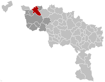
English: Map, municipality belgium Celles
Français : Carte indiquant la localisation de la commune de Celles dans la Province de Hainaut. |
| Source | Own work |
| Author | LennartBolks |
| Permission (Reusing this file) |
PD |
| This work has been released into the public domain by its author, LennartBolks. This applies worldwide. In some countries this may not be legally possible; if so: |
File history
Click on a date/time to view the file as it appeared at that time.
| Date/Time | Thumbnail | Dimensions | User | Comment | |
|---|---|---|---|---|---|
| current | 09:51, 5 March 2007 | | 355 × 278 (8 KB) | Siebrand (talk | contribs) | Updated map by Westermarck |
| 21:34, 28 March 2005 |  | 355 × 278 (6 KB) | Nicnac25~commonswiki (talk | contribs) | Map, municipality belgium Celles {{PD}} FR; Carte indiquant la localisation de la commune de Celles dans la Province de Hainaut. EN; Map from w:nl:Gebruiker:LennartBolks/kaartenhoekje in Public Domain by the Author choice. [[Category:Maps of provinc |
You cannot overwrite this file.
File usage on Commons
There are no pages that use this file.