File:Europe map Napoleon 1811.png
קפיצה לניווט
קפיצה לחיפוש
אין גרסה ברזולוציה גבוהה יותר.
Europe_map_Napoleon_1811.png (415 × 397 פיקסלים, גודל הקובץ: 62 ק"ב, סוג MIME: image/png)
כיתובים
כיתובים
נא להוסיף משפט שמסביר מה הקובץ מייצג


|
קיימת תמונה חדשה תמונה זו בגרסה וקטורית בפורמט "SVG". יש להחליף את התמונה הנוכחית בתמונה החדשה.
File:Europe map Napoleon 1811.png → File:Europe map Napoleon 1811.svg
למידע נוסף אודות גרפיקה וקטורית, אנא קראו אודות המעבר של ויקישיתוף לתמונות בפורמט SVG. ראו גם מידע אודות התמידה של מדיה-ויקי בתמונות בפורמט SVG. |
 |
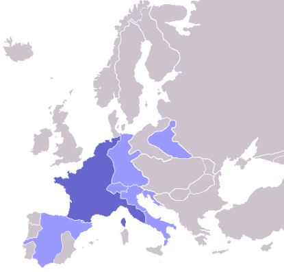
Map of the w:First French Empire and satellite states, with w:1811 borders. Created by User:OwenBlacker from Image:Europe blank map.png, therefore they are the source.
| ברצוני, בעלי זכויות היוצרים על יצירה זו, לשחרר יצירה זו לנחלת הכלל. זה תקף בכל העולם. יש מדינות שבהן הדבר אינו אפשרי על פי חוק, אם כך: אני מעניק לכל אחד את הזכות להשתמש בעבודה זו לכל מטרה שהיא, ללא תנאים כלשהם, אלא אם כן תנאים כאלה נדרשים על פי חוק. |
derivative works
[עריכה]
Derivative works of this file: Europe map Napoleon 1811.svg
היסטוריית הקובץ
ניתן ללחוץ על תאריך/שעה כדי לראות את הקובץ כפי שנראה באותו זמן.
| תאריך/שעה | תמונה ממוזערת | ממדים | משתמש | הערה | |
|---|---|---|---|---|---|
| נוכחית | 08:06, 11 באוקטובר 2022 | | 397 × 415 (62 ק"ב) | Рагин1987 (שיחה | תרומות) | Extended map |
| 13:01, 23 ביולי 2020 |  | 422 × 415 (13 ק"ב) | Leonel Sohns (שיחה | תרומות) | Reverted to version as of 00:53, 16 October 2006 (UTC) | |
| 13:01, 23 ביולי 2020 |  | 422 × 415 (11 ק"ב) | Leonel Sohns (שיחה | תרומות) | Recovered old version from archive.org | |
| 00:53, 16 באוקטובר 2006 |  | 422 × 415 (13 ק"ב) | Deltabeignet (שיחה | תרומות) | Corrected status of Illyrian provinces. | |
| 00:51, 21 באוגוסט 2005 |  | 422 × 415 (11 ק"ב) | OwenBlacker (שיחה | תרומות) | Map of the w:First French Empire and satellite states, with w:1811 borders. Created by User:OwenBlacker from Image:Europe blank map.png {{GFDL}} {{cc-by-sa-2.0-uk}} |
אין באפשרותך לדרוס את הקובץ הזה.
שימוש בקובץ
הדפים הבאים משתמשים בקובץ הזה:
- Atlas of Belgium
- Atlas of European history
- Atlas of France
- Atlas of Galicia
- Atlas of Italy
- Atlas of Luxembourg
- Atlas of Spain
- Atlas of the early modern age
- Napoléon Bonaparte
- User:Magog the Ogre/Maps of conflicts/2020 July
- User:Magog the Ogre/Maps of conflicts/2022 October
- User:Minorax/SVG available/2022 October 7-12
- User:Thegranddesign31415
- File:Apogée Empire Napoleon 1811.jpg
שימוש גלובלי בקובץ
אתרי הוויקי השונים הבאים משתמשים בקובץ זה:
- שימוש באתר arz.wikipedia.org
- שימוש באתר ast.wikipedia.org
- שימוש באתר ba.wikipedia.org
- שימוש באתר be.wikipedia.org
- שימוש באתר bg.wikipedia.org
- שימוש באתר bn.wikibooks.org
- שימוש באתר bs.wikipedia.org
- שימוש באתר ca.wikipedia.org
- שימוש באתר cs.wikipedia.org
- שימוש באתר cv.wikipedia.org
- שימוש באתר de.wikibooks.org
- שימוש באתר en.wikipedia.org
- שימוש באתר en.wikibooks.org
- שימוש באתר eo.wikipedia.org
- שימוש באתר fi.wikipedia.org
- Cisalppinen tasavalta
- Batavian tasavalta
- Hollannin kuningaskunta
- Napolin kuningaskunta
- Helvetian tasavalta
- Ligurian tasavalta
- Varsovan herttuakunta
- Malline:Napoleonin vasallit
- Etrurian kuningaskunta
- Alban tasavalta
- Reinin liitto (1806)
- Italian tasavalta (vasalli)
- Mainzin tasavalta
- Italian kuningaskunta (Napoleon)
- Cispadaaninen tasavalta
- Westfalenin kuningaskunta
- Illyrian provinssit
- Transpadaaninen tasavalta
- שימוש באתר fr.wikipedia.org
- שימוש באתר fy.wikipedia.org
- שימוש באתר gl.wikipedia.org
- שימוש באתר he.wikipedia.org
- שימוש באתר hr.wikipedia.org
- שימוש באתר hu.wikipedia.org
צפייה בשימושים גלובליים נוספים של קובץ זה.