File:Flag map of South Africa.svg
둘러보기로 이동
검색으로 이동

SVG 파일의 PNG 형식의 미리보기 크기: 705 × 600 픽셀. 다른 해상도: 282 × 240 픽셀 | 565 × 480 픽셀 | 903 × 768 픽셀 | 1,204 × 1,024 픽셀 | 2,408 × 2,048 픽셀 | 1,939 × 1,649 픽셀
원본 파일 (SVG 파일, 실제 크기 1,939 × 1,649 픽셀, 파일 크기: 108 KB)
캡션
설명
이 파일이 나타내는 바에 대한 한 줄 설명을 추가합니다
the national fand flag
파일 설명[편집]
| 설명 |
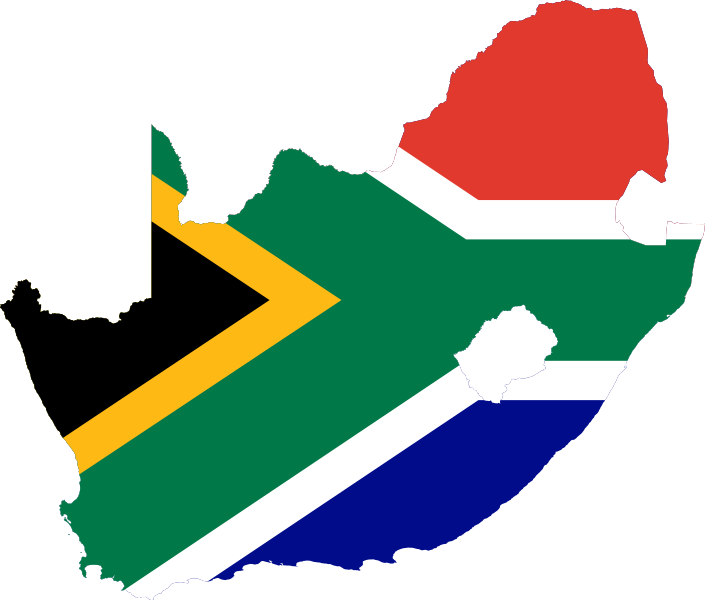
Afrikaans: Vlaggedrappeerde vektorkaart, Suid-Afrika
English: Flag-map of South Africa
Español: Bandera de Sudáfrica inscripta dentro del mapa
Русский: Флаг-карта ЮАР |
| 날짜 | |
| 출처 |
다음을 기초로 한 자작: ✦ Flag of South Africa.svg by South Africa Goverment ✦ South Africa blank map.svg by Mangwanani |
| 저자 |
|
| SVG 발전 |
라이선스[편집]
이 파일은 크리에이티브 커먼즈 저작자표시-동일조건변경허락 3.0 Unported 라이선스로 배포됩니다.
- 이용자는 다음의 권리를 갖습니다:
- 공유 및 이용 – 저작물의 복제, 배포, 전시, 공연 및 공중송신
- 재창작 – 저작물의 개작, 수정, 2차적저작물 창작
- 다음과 같은 조건을 따라야 합니다:
- 저작자표시 – 적절한 저작자 표시를 제공하고, 라이센스에 대한 링크를 제공하고, 변경사항이 있는지를 표시해야 합니다. 당신은 합리적인 방식으로 표시할 수 있지만, 어떤 방식으로든 사용권 허가자가 당신 또는 당신의 사용을 지지하는 방식으로 표시할 수 없습니다.
- 동일조건변경허락 – 만약 당신이 이 저작물을 리믹스 또는 변형하거나 이 저작물을 기반으로 제작하는 경우, 당신은 당신의 기여물을 원저작물과 동일하거나 호환 가능한 라이선스에 따라 배포하여야 합니다.
기존 올리기 기록[편집]
This image is a derivative work of the following images:
- Flag of South Africa.svg licensed with PD-self
- 2008-11-01T12:29:46Z Vzb83 900x600 (1016 Bytes) changed the colours slightly to match http://www.info.gov.za/aboutgovt/symbols/flag.htm
- 2008-10-12T12:33:45Z Poznaniak 900x600 (1016 Bytes) Reverted to version as of 17:34, 31 August 2006
- 2008-10-12T11:49:31Z Mahahahaneapneap 900x600 (829 Bytes) Compressed
- 2006-08-31T17:34:20Z Madden 900x600 (1016 Bytes) exactly constructed after http://www.vexilla-mundi.com/south_africa.htm
- 2006-02-11T22:29:16Z Denelson83 900x600 (2865 Bytes) Enlarge intrinsic size
- 2006-02-05T08:59:40Z Denelson83 450x300 (2832 Bytes) Refactored
- 2006-02-01T00:21:36Z Reisio 450x300 (2001 Bytes) cleanup markup - pd changes
- 2005-09-28T07:32:23Z SKopp 450x300 (3886 Bytes) The flag of South Africa. Source: Drawn by [[User:SKopp]] {{Template:Insignia}} [[Category:Flags of South Africa]]
- South Africa blank map.svg licensed with Cc-by-2.5, Cc-by-sa-2.5,2.0,1.0, Cc-by-sa-3.0-migrated, GFDL
- 2010-01-09T13:52:06Z Clapsus 836x709 (25297 Bytes) {{Information |Description={{en}} Blank Map of South Africa showing provinces. Retouched in order to use it in the geolocation {{fr}} Carte vierge des provinces d'Afrique du Sud .Retouchée pour pouvoir s'en servir dans la g�
Uploaded with derivativeFX
파일 역사
날짜/시간 링크를 클릭하면 해당 시간의 파일을 볼 수 있습니다.
| 날짜/시간 | 섬네일 | 크기 | 사용자 | 설명 | |
|---|---|---|---|---|---|
| 현재 | 2023년 2월 9일 (목) 19:51 | | 1,939 × 1,649 (108 KB) | Leonel Sohns (토론 | 기여) | Reverted to version as of 16:33, 15 August 2022 (UTC) |
| 2023년 1월 30일 (월) 22:54 |  | 707 × 600 (113 KB) | Takiva (토론 | 기여) | Reverted to version as of 04:51, 5 February 2021 (UTC) | |
| 2022년 8월 15일 (월) 16:33 |  | 1,939 × 1,649 (108 KB) | John emil hernandez (토론 | 기여) | remove outline | |
| 2021년 2월 5일 (금) 04:53 |  | 876 × 716 (78 KB) | Fakenoodle (토론 | 기여) | Still laggy | |
| 2021년 2월 5일 (금) 04:51 |  | 707 × 600 (113 KB) | Fakenoodle (토론 | 기여) | Revert because preview is laggy on Google Images | |
| 2020년 12월 19일 (토) 01:48 |  | 876 × 716 (78 KB) | Fakenoodle (토론 | 기여) | Reverted because of the weird green borders | |
| 2016년 5월 9일 (월) 15:07 |  | 707 × 600 (113 KB) | Stasyan117 (토론 | 기여) | corrected | |
| 2016년 1월 15일 (금) 20:18 |  | 876 × 716 (78 KB) | Dim Grits (토론 | 기여) | Reverted to version as of 01:17, 1 February 2011 (UTC) | |
| 2015년 5월 30일 (토) 01:25 |  | 708 × 600 (673 KB) | Stasyan117 (토론 | 기여) | Reduce | |
| 2015년 2월 1일 (일) 01:00 |  | 707 × 601 (201 KB) | Stasyan117 (토론 | 기여) | reduce |
이 파일을 덮어쓸 수 없습니다.
이 파일을 사용하는 문서
100개 이상의 문서가 이 파일을 사용하고 있습니다. 다음 목록은 이 파일을 사용하는 처음 문서 100개만 보여주고 있습니다. 이 파일을 사용하는 모든 문서 목록을 볼 수 있습니다.
- Flag map of the world
- User:Achim55/Sockpuppet investigations/MZ Mbili
- User:Ainsleykg
- User:Alandmanson
- User:Angelz2005
- User:Athistata
- User:Azola Dayile
- User:BurgertB
- User:CJJ2501
- User:Chumwa/OgreBot/Potential transport maps/2016 January 11-20
- User:Cnr.za
- User:Donisc92
- User:EJParsons
- User:Fletch54
- User:Freddie2012a
- User:Gavin.perch
- User:HelenOnline
- User:JMK
- User:Joonji
- User:Leo za1
- User:Liam E. Bekker
- User:Lugerda
- User:M J Hurter
- User:Magemu
- User:NJR ZA
- User:Njabulo19
- User:Node.Ninja
- User:Olga Ernst
- User:Oupoot
- User:PHParsons
- User:Reuben Heydenrych
- User:SAplants
- User:ShadiMon
- User:Takalisa
- User:Thuvack
- User:Waitabout
- User:Xplosivza
- User talk:Takalisa
- Commons:Userboxes/Location/Africa
- Commons:WikiProject Flag-map
- File:Flag-map of South Africa.svg (파일 넘겨주기)
- File:Flag of South Africa.svg
- File:SouthAfricanStub.png
- User:JMK
- User:NJR ZA
- File:South Africa provinces + flag back.png
- User:Thuvack
- Commons:WikiProject Flag-map
- Category:Users in South Africa
- Template:User South Africa
- User:Leo za1
- Template:User South Africa/layout
- Template:User South Africa/en
- Template:User South Africa/bar
- Template:User South Africa/de
- Commons:Userboxes/Location/Africa
- User:Gavin.perch
- Template:User South Africa/fr
- File:Flag map of South Africa (1928–1982).svg
- Template:User South Africa/mk
- Template:User South Africa/pt
- User:BurgertB
- Template:User South Africa/sv
- User:Fletch54
- User:Magemu
- User:HelenOnline
- User:PHParsons
- User:Oupoot
- User:EJParsons
- User:Lugerda
- User:Waitabout
- User:Freddie2012a
- Template:User South Africa/nl
- User:Node.Ninja
- User:Ainsleykg
- User:Donisc92
- User:Angelz2005
- User:Chumwa/OgreBot/Potential transport maps/2016 January 11-20
- User:SAplants
- User:Liam E. Bekker
- Template:User South Africa/uk
- User:Alandmanson
- Flag map of the world
- User:Athistata
- File:Flag map of South Africa (1928–1982).svg
- File:Flag map of South Africa (United Nations).svg
- File:Flag of South Africa.svg
- File:SouthAfricanStub.png
- File:South Africa provinces + flag back.png
- Template:User South Africa
- Template:User South Africa/af
- Template:User South Africa/bar
- Template:User South Africa/de
- Template:User South Africa/en
- Template:User South Africa/fr
- Template:User South Africa/layout
- Template:User South Africa/mk
- Template:User South Africa/nl
- Template:User South Africa/pt
- Template:User South Africa/sv
.svg)
.svg)
이 파일이 쓰이고 있는 문서 목록 더 보기.
이 파일을 사용하고 있는 모든 위키의 문서 목록
다음 위키에서 이 파일을 사용하고 있습니다:
- af.wikipedia.org에서 이 파일을 사용하고 있는 문서 목록
- Gebruiker:Arnobarnard
- Gebruiker:BurgertB
- Gebruiker:BenBezuidenhout
- Gebruiker:Whoosis
- Sjabloon:Gebruiker Voorheen Suid-Afrika
- Sjabloon:Gebruiker Suid-Afrika
- Gebruiker:Wordscape
- Kategorie:Wikipediërs in Suid-Afrika
- Gebruiker:Arnwalt
- Gebruiker:Masrudin
- Gebruiker:Suidpunt
- Gebruiker:Paix1988
- Gebruiker:Setzor
- Gebruiker:Jpm
- Gebruiker:Thermofan
- Gebruiker:Gk sa
- Gebruiker:Stefandprins
- Gebruiker:Aliwal2012
- Gebruiker:Ossewa
- Gebruiker:Jelena.vdw
- Gebruiker:RaniPatel
- Gebruiker:Monica124
- Gebruiker:Naudefj
- Gebruiker:FFouche
- Gebruiker:Shantelvw
- Gebruiker:Renier
- Gebruiker:Ben Bezuidenhout
- Gebruiker:Geebee100
- Gebruiker:Nic Coetzee
- Gebruiker:Kaapwa1
- Gebruiker:Wyatt Tyrone Smith
- Wikipedia:Wikiprojek Suid-Afrika
- Bespreking:David Christiaan de Waal
- Bespreking:William Duncan Baxter
- Bespreking:Glenda Kemp
- Sjabloon:Wikiprojek Suid-Afrika artikel
- Gebruiker:ATravelingWizard
- ar.wikipedia.org에서 이 파일을 사용하고 있는 문서 목록
이 파일의 더 많은 사용 내역을 봅니다.