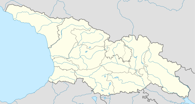
File:Georgia location map.svg

പൂർണ്ണ വലിപ്പം (എസ്.വി.ജി. പ്രമാണം, നാമമാത്രമായ 1,715 × 913 പിക്സലുകൾ, പ്രമാണത്തിന്റെ വലിപ്പം: 141 കെ.ബി.)
തലവാചകം
തലവാചകങ്ങൾ
ചുരുക്കം[തിരുത്തുക]
| വിവരണം |
Deutsch: Positionskarte von Georgien
Quadratische Plattkarte, N-S-Streckung 135 %. Geographische Begrenzung der Karte:
English: Location map of Georgia
Equirectangular projection, N/S stretching 135 %. Geographic limits of the map:
|
| തീയതി | |
| സ്രോതസ്സ് |
സ്വന്തം സൃഷ്ടി, using
|
| സ്രഷ്ടാവ് | NordNordWest |
| അനുമതി (ഈ പ്രമാണത്തിന്റെ പുനരുപയോഗം) |
ഈ സൃഷ്ടിയുടെ പകർപ്പവകാശ ഉടമയായ ഞാൻ, താഴെ പറയുന്ന അനുമതിയിൽ ഈ സൃഷ്ടി ഇതിനാൽ പ്രസിദ്ധീകരിക്കുന്നു: ഈ പ്രമാണത്തിന് അനുമതി നൽകപ്പെട്ടിരിക്കുന്നത് ക്രിയേറ്റീവ് കോമൺസ് ആട്രിബ്യൂഷൻ-ഷെയർ എലൈക് 3.0 അൺപോർട്ടഡ് അനുവാദപത്ര പ്രകാരമാണ്.
|
| മറ്റു പതിപ്പുകൾ |
|


പ്രമാണ നാൾവഴി
ഏതെങ്കിലും തീയതി/സമയ കണ്ണിയിൽ ഞെക്കിയാൽ പ്രസ്തുതസമയത്ത് ഈ പ്രമാണം എങ്ങനെയായിരുന്നു എന്നു കാണാം.
| തീയതി/സമയം | ലഘുചിത്രം | അളവുകൾ | ഉപയോക്താവ് | അഭിപ്രായം | |
|---|---|---|---|---|---|
| നിലവിലുള്ളത് | 10:13, 28 ഒക്ടോബർ 2018 | | 1,715 × 913 (141 കെ.ബി.) | NordNordWest (സംവാദം | സംഭാവനകൾ) | Reverted to version as of 11:58, 25 May 2013 (UTC), COM:OVERWRITE |
| 09:14, 28 ഒക്ടോബർ 2018 |  | 1,715 × 913 (147 കെ.ബി.) | Lamensi (സംവാദം | സംഭാവനകൾ) | De facto independence | |
| 11:58, 25 മേയ് 2013 |  | 1,715 × 913 (141 കെ.ബി.) | NordNordWest (സംവാദം | സംഭാവനകൾ) | Reverted to version as of 16:47, 24 July 2011, COM:OVERWRITE, too important to change without discussion | |
| 11:58, 25 മേയ് 2013 |  | 1,715 × 913 (141 കെ.ബി.) | NordNordWest (സംവാദം | സംഭാവനകൾ) | Reverted to version as of 16:47, 24 July 2011, COM:OVERWRITE, too important to change without discussion | |
| 22:49, 24 മേയ് 2013 |  | 1,715 × 913 (149 കെ.ബി.) | Giorgi Balakhadze (സംവാദം | സംഭാവനകൾ) | South Ossetian Autonomous Region was revoked on December 10, 1990 by the Supreme Soviet of the Georgian SSR. So it's not correct to show it in modern maps. [http://en.wikipedia.org/wiki/South_Ossetian_Autonomous_Oblast] | |
| 16:47, 24 ജൂലൈ 2011 |  | 1,715 × 913 (141 കെ.ബി.) | NordNordWest (സംവാദം | സംഭാവനകൾ) | corr | |
| 08:31, 10 സെപ്റ്റംബർ 2009 |  | 1,716 × 913 (270 കെ.ബി.) | NordNordWest (സംവാദം | സംഭാവനകൾ) | ||
| 20:46, 9 സെപ്റ്റംബർ 2009 |  | 1,716 × 879 (271 കെ.ബി.) | NordNordWest (സംവാദം | സംഭാവനകൾ) | =={{int:filedesc}}== {{Information |Description= {{de|Positionskarte von Georgien}} Quadratische Plattkarte, N-S-Streckung 130 %. Geographische Begrenzung der Karte: * N: 43.7° N * S: 40.9° N * W: 39.8° O * O: 46.9° O {{en|Location ma |
ഈ പ്രമാണത്തിനു മുകളിൽ മറ്റൊരു പ്രമാണം ചേർക്കാൻ താങ്കൾക്ക് കഴിയില്ല.
പ്രമാണത്തിന്റെ ഉപയോഗം
ഈ പ്രമാണത്തിലേയ്ക്ക് 100 താളിലധികം കണ്ണികൾ ഉണ്ട്. താഴെക്കൊടുത്തിരിക്കുന്ന പട്ടിക ഈ പ്രമാണം ഉപയോഗിക്കുന്ന ആദ്യ 100 താളുകൾ മാത്രമാണ് കാട്ടുന്നത്. മുഴുവൻ പട്ടികയും ലഭ്യമാണ്.
- User:NordNordWest/Gallery/Location maps
- File:Abkhazia in Europe (de-facto).svg
- File:Abkhazia in Europe (de-facto) (-rivers -mini map).svg
- File:Akrotiri and Dhekelia in Europe.svg
- File:Akrotiri and Dhekelia in Europe (-rivers -mini map).svg
- File:Aland in Europe.svg
- File:Aland in Europe (-rivers -mini map).svg
- File:Albania in Europe.svg
- File:Albania in Europe (-rivers -mini map).svg
- File:Andorra in Europe.svg
- File:Andorra in Europe (-rivers -mini map).svg
- File:Armenia in Europe.svg
- File:Armenia in Europe (-rivers -mini map).svg
- File:Artsakh in Europe.svg
- File:Austria in Europe.svg
- File:Austria in Europe (-rivers -mini map).svg
- File:Austria in European Union.svg
- File:Azerbaijan in Europe.svg
- File:Azerbaijan in Europe (-rivers -mini map).svg
- File:Belarus in Europe.svg
- File:Belarus in Europe (-rivers -mini map).svg
- File:Belgium in Europe.svg
- File:Belgium in Europe (-rivers -mini map).svg
- File:Bosnia and Herzegovina in Europe.svg
- File:Bosnia and Herzegovina in Europe (-rivers -mini map).svg
- File:Bulgaria in Europe.svg
- File:Bulgaria in Europe (-rivers -mini map).svg
- File:Croatia in Europe.svg
- File:Croatia in Europe (-rivers -mini map).svg
- File:Cyprus in Europe.svg
- File:Cyprus in Europe (-rivers -mini map).svg
- File:Cyprus in Europe (de-facto).svg
- File:Cyprus in Europe (de-facto) (-rivers -mini map).svg
- File:Czech Republic in Europe.svg
- File:Czech Republic in Europe (-rivers -mini map).svg
- File:Denmark in Europe.svg
- File:Denmark in Europe (-rivers -mini map).svg
- File:Estonia in Europe.svg
- File:Estonia in Europe (-rivers -mini map).svg
- File:Faroe Islands in Europe.svg
- File:Faroe Islands in Europe (-rivers -mini map).svg
- File:Finland in Europe.svg
- File:Finland in Europe (-rivers -mini map).svg
- File:France in Europe.svg
- File:France in Europe (-rivers -mini map).svg
- File:France in Europe (relief).svg
- File:Georgia in Europe.svg
- File:Georgia in Europe (-rivers -mini map).svg
- File:Georgia in Europe (de-facto).svg
- File:Georgia in Europe (de-facto) (-rivers -mini map).svg
- File:Germany in Europe.svg
- File:Germany in Europe (-rivers -mini map).svg
- File:Gibraltar in Europe.svg
- File:Gibraltar in Europe (-rivers -mini map).svg
- File:Greece in Europe.svg
- File:Greece in Europe (-rivers -mini map).svg
- File:Guernsey in Europe.svg
- File:Guernsey in Europe (-rivers -mini map).svg
- File:Hungary in Europe.svg
- File:Hungary in Europe (-rivers -mini map).svg
- File:Iceland in Europe.svg
- File:Ireland in Europe.svg
- File:Isle of Man in Europe.svg
- File:Italy in Europe.svg
- File:Jersey in Europe.svg
- File:Kazakhstan in Europe.svg
- File:Kingdom of Denmark in Europe.svg
- File:Kosovo in Europe (de-facto).svg
- File:Latvia in Europe.svg
- File:Liechtenstein in Europe.svg
- File:Lithuania in Europe.svg
- File:Luxembourg in Europe.svg
- File:Luxembourg in Europe (special marker).svg
- File:Macedonia in Europe.svg
- File:Malta in Europe.svg
- File:Moldova in Europe.svg
- File:Monaco in Europe.svg
- File:Montenegro in Europe.svg
- File:Netherlands in Europe.svg
- File:Northern Cyprus in Europe (de-facto).svg
- File:Norway in Europe.svg
- File:Poland in Europe.svg
- File:Portugal in Europe.svg
- File:Romania in Europe.svg
- File:Russia in Europe.svg
- File:San Marino in Europe.svg
- File:Serbia in Europe.svg
- File:Serbia in Europe (de-facto).svg
- File:Slovakia in Europe.svg
- File:Slovenia in Europe.svg
- File:South Ossetia in Europe (de-facto).svg
- File:Spain in Europe.svg
- File:Sweden in Europe.svg
- File:Switzerland in Europe.svg
- File:Transnistria in Europe.svg
- File:Transnistria in Europe (special marker).svg
- File:Turkey in Europe.svg
- File:Ukraine in Europe.svg
- File:United Kingdom in Europe.svg
- File:United Kingdom in Europe (wo crown dependencies).svg
.svg)
_(-rivers_-mini_map).svg)
.svg)
.svg)
.svg)
.svg)
.svg)
.svg)
.svg)
.svg)
.svg)
.svg)
.svg)
.svg)
.svg)
.svg)
_(-rivers_-mini_map).svg)
.svg)
.svg)
.svg)
.svg)
.svg)
.svg)
.svg)
.svg)
.svg)
_(-rivers_-mini_map).svg)
.svg)
.svg)
.svg)
.svg)
.svg)
.svg)
.svg)
.svg)
.svg)
.svg)
.svg)
.svg)
ഈ പ്രമാണത്തിലേയ്ക്കുള്ള കൂടുതൽ കണ്ണികൾ കാണുക.
പ്രമാണത്തിന്റെ ആഗോള ഉപയോഗം
താഴെ കൊടുത്തിരിക്കുന്ന മറ്റ് വിക്കികൾ ഈ പ്രമാണം ഉപയോഗിക്കുന്നു:
- af.wikipedia.org സംരംഭത്തിലെ ഉപയോഗം
- an.wikipedia.org സംരംഭത്തിലെ ഉപയോഗം
- ast.wikipedia.org സംരംഭത്തിലെ ഉപയോഗം
- av.wikipedia.org സംരംഭത്തിലെ ഉപയോഗം
- azb.wikipedia.org സംരംഭത്തിലെ ഉപയോഗം
- az.wikipedia.org സംരംഭത്തിലെ ഉപയോഗം
- Qaqra
- Tbilisi
- Faxralı
- Dmanisi
- Kəpənəkçi (Bolnisi)
- Sadaxlı
- Kəpənəkçi (Sarvan)
- Saraçlı (Borçalı)
- Qızılhacılı (Marneuli)
- İmirhəsən
- Yırğançay
- Qoçulu (Borçalı)
- Aşağı Qarabulaq
- Yuxarı Qarabulaq
- Arıxlı
- Rustavi
- Səfərli (Başkeçid)
- Aşağı Oruzman
- Soğanlıq
- Marabda
- Söyüdlü (Başkeçid)
- Qaracalar (Qarayazı)
- Salamməlik
- Saqareco
- Məmişlər (Başkeçid)
- Tbilisi Azərbaycan Teatrı
- Təkəli (Marneuli)
- Ağaməmmədli (Marneuli)
ഈ പ്രമാണത്തിന്റെ കൂടുതൽ ആഗോള ഉപയോഗം കാണുക.