File:Guinea from Milner's Atlas.jpg
Bước tới điều hướng
Bước tới tìm kiếm

Kích thước hình xem trước: 800×569 điểm ảnh. Độ phân giải khác: 320×228 điểm ảnh | 640×455 điểm ảnh | 1.008×717 điểm ảnh.
Tập tin gốc (1.008×717 điểm ảnh, kích thước tập tin: 1,24 MB, kiểu MIME: image/jpeg)
Chú thích
Chú thích
Ghi một dòng giải thích những gì có trong tập tin này
Miêu tả[sửa]
| Miêu tả |
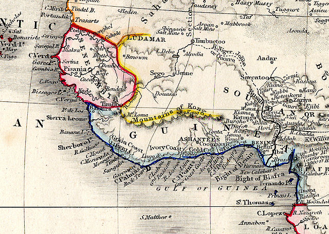
English: Detail showing Guinea and surrounding regions, from "Africa" plate of Milner's Descriptive Atlas |
| Ngày | |
| Nguồn gốc | Tác phẩm được tạo bởi người tải lên |
| Tác giả | Rev. Thomas Milner |
Giấy phép[sửa]
Tôi, người giữ bản quyền tác phẩm này, từ đây phát hành nó theo các giấy phép sau:
Tập tin này được phát hành theo Giấy phép Creative Commons Ghi công - Chia sẻ tương tự 3.0 Chưa chuyển đồi
- Bạn được phép:
- chia sẻ – sao chép, phân phối và chuyển giao tác phẩm
- pha trộn – để chuyển thể tác phẩm
- Theo các điều kiện sau:
- ghi công – Bạn phải ghi lại tác giả và nguồn, liên kết đến giấy phép, và các thay đổi đã được thực hiện, nếu có. Bạn có thể làm các điều trên bằng bất kỳ cách hợp lý nào, miễn sao không ám chỉ rằng người cho giấy phép ủng hộ bạn hay việc sử dụng của bạn.
- chia sẻ tương tự – Nếu bạn biến tấu, biến đổi, hoặc làm tác phẩm khác dựa trên tác phẩm này, bạn chỉ được phép phân phối tác phẩm mới theo giấy phép y hệt hoặc tương thích với tác phẩm gốc.

|
Bạn có quyền sao chép, phân phối và/hoặc sửa đổi tài liệu này theo những điều khoản được quy định trong Giấy phép Tài liệu Tự do GNU, phiên bản 1.2 hoặc các phiên bản mới hơn được Quỹ Phần mềm Tự do; quy định; ngoại trừ những phần không được sửa đổi, bìa trước và bìa sau. Bạn có thể xem giấy phép nói trên ở phần Giấy phép Tài liệu Tự do GNU. |
Bạn có thể chọn giấy phép mà bạn muốn.
Lịch sử tập tin
Nhấn vào ngày/giờ để xem nội dung tập tin tại thời điểm đó.
| Ngày/Giờ | Hình xem trước | Kích cỡ | Thành viên | Miêu tả | |
|---|---|---|---|---|---|
| hiện tại | 18:51, ngày 5 tháng 11 năm 2012 | | 1.008×717 (1,24 MB) | Maproom (thảo luận | đóng góp) | {{Information |Description ={{en|1=Detail showing Guinea and surrounding regions, from "Africa" plate of Milner's Descriptive Atlas}} |Source =Own work |Author =Rev. Thomas Milner |Date =1850 |Permission = |other_versio... |
Bạn không được phép ghi đè tập tin này.
Trang sử dụng tập tin
Không có trang nào sử dụng tập tin này.
Sử dụng tập tin toàn cục
Những wiki sau đang sử dụng tập tin này:
- Trang sử dụng tại ast.wikipedia.org
- Trang sử dụng tại bn.wikipedia.org
- Trang sử dụng tại en.wikipedia.org
- Trang sử dụng tại es.wikipedia.org
- Trang sử dụng tại eu.wikipedia.org
- Trang sử dụng tại ja.wikipedia.org
- Trang sử dụng tại mk.wikipedia.org
- Trang sử dụng tại pt.wikipedia.org
- Trang sử dụng tại si.wikipedia.org
- Trang sử dụng tại te.wikipedia.org
- Trang sử dụng tại tr.wikipedia.org
- Trang sử dụng tại vi.wikipedia.org
- Trang sử dụng tại yo.wikipedia.org
Thể loại:
- 19th-century maps of West Africa
- 1850 maps of Africa
- Mountains of Africa
- English-language maps
- 19th-century maps of Guinea
- 19th-century maps of Senegal
- 19th-century maps of Mauritania
- 19th-century maps of Mali
- 19th-century maps of Liberia
- 19th-century maps of Nigeria
- 19th-century maps of Sierra Leone
- 19th-century maps of Ivory Coast
- 19th-century maps of Ghana
- 19th-century maps of Togo
- Mountains of Kong
- Senegambia region