File:Map of Indiana highlighting Franklin County.svg
Bước tới điều hướng
Bước tới tìm kiếm

Kích thước bản xem trước PNG này của tập tin SVG: 391×599 điểm ảnh. Độ phân giải khác: 156×240 điểm ảnh | 313×480 điểm ảnh | 501×768 điểm ảnh | 668×1.024 điểm ảnh | 1.337×2.048 điểm ảnh | 2.887×4.423 điểm ảnh.
Tập tin gốc (tập tin SVG, 2.887×4.423 điểm ảnh trên danh nghĩa, kích thước: 56 kB)
Chú thích
Chú thích
Ghi một dòng giải thích những gì có trong tập tin này
Miêu tả
[sửa]
| Miêu tả |
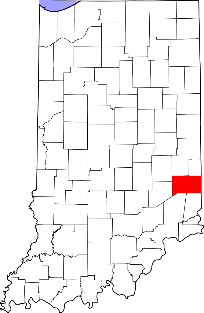
English: This is a locator map showing Franklin County in Indiana. For more information, see Commons:United States county locator maps. |
| Ngày | |
| Nguồn gốc |
Tác phẩm được tạo bởi người tải lên: English: The maps use data from nationalatlas.gov, specifically countyp020.tar.gz on the Raw Data Download page. The maps also use state outline data from statesp020.tar.gz. The Florida maps use hydrogm020.tar.gz to display Lake Okeechobee. |
| Tác giả | David Benbennick |
Giấy phép
[sửa]
| Tôi, người giữ bản quyền của tác phẩm này, chuyển tác phẩm này vào phạm vi công cộng. Điều này có giá trị trên toàn thế giới. Tại một quốc gia mà luật pháp không cho phép điều này, thì: Tôi cho phép tất cả mọi người được quyền sử dụng tác phẩm này với bất cứ mục đích nào, không kèm theo bất kỳ điều kiện nào, trừ phi luật pháp yêu cầu những điều kiện đó. |
Lịch sử tập tin
Nhấn vào ngày/giờ để xem nội dung tập tin tại thời điểm đó.
| Ngày/Giờ | Hình xem trước | Kích cỡ | Thành viên | Miêu tả | |
|---|---|---|---|---|---|
| hiện tại | 12:10, ngày 12 tháng 2 năm 2006 | | 2.887×4.423 (56 kB) | David Benbennick (thảo luận | đóng góp) | {{subst:User:Dbenbenn/clm|county=Franklin County|state=Indiana}} |
Bạn không được phép ghi đè tập tin này.
Trang sử dụng tập tin
13 trang sau sử dụng tập tin này:
- Category:Births in Franklin County, Indiana
- Category:Bodies of water in Franklin County, Indiana
- Category:Bridges in Franklin County, Indiana
- Category:Education in Franklin County, Indiana
- Category:Franklin County, Indiana
- Category:Geography of Franklin County, Indiana
- Category:Landforms of Franklin County, Indiana
- Category:Maps of Franklin County, Indiana
- Category:National Register of Historic Places in Franklin County, Indiana
- Category:People of Franklin County, Indiana
- Category:Populated places in Franklin County, Indiana
- Category:Towns in Franklin County, Indiana
- Category:Visitor attractions in Franklin County, Indiana
Sử dụng tập tin toàn cục
Những wiki sau đang sử dụng tập tin này:
- Trang sử dụng tại ar.wikipedia.org
- Trang sử dụng tại bg.wikipedia.org
- Trang sử dụng tại bpy.wikipedia.org
- Trang sử dụng tại cdo.wikipedia.org
- Trang sử dụng tại ceb.wikipedia.org
- Trang sử dụng tại ce.wikipedia.org
- Trang sử dụng tại cy.wikipedia.org
- Trang sử dụng tại de.wikipedia.org
- Trang sử dụng tại en.wikipedia.org
- List of counties in Indiana
- Franklin County, Indiana
- Batesville, Indiana
- Brookville, Indiana
- Cedar Grove, Indiana
- Laurel, Indiana
- Mount Carmel, Indiana
- Oldenburg, Indiana
- Scipio, Indiana and Ohio
- Metamora, Indiana
- Template:Franklin County, Indiana
- Bath Township, Franklin County, Indiana
- Blooming Grove Township, Franklin County, Indiana
- Brookville Township, Franklin County, Indiana
- Butler Township, Franklin County, Indiana
- Fairfield Township, Franklin County, Indiana
- Highland Township, Franklin County, Indiana
- Laurel Township, Franklin County, Indiana
- Metamora Township, Franklin County, Indiana
- Posey Township, Franklin County, Indiana
- Ray Township, Franklin County, Indiana
- Salt Creek Township, Franklin County, Indiana
- Springfield Township, Franklin County, Indiana
- Whitewater Township, Franklin County, Indiana
- Bath, Indiana
- Buena Vista, Franklin County, Indiana
- Template:FranklinCountyIN-geo-stub
- Drewersburg, Indiana
- Hamburg, Franklin County, Indiana
- Highland Center, Indiana
- Klemmes Corner, Indiana
- Lake View, Indiana
- Midway, Franklin County, Indiana
- Mixersville, Indiana
- Mound Haven, Indiana
Xem thêm các trang toàn cục sử dụng tập tin này.