File:Map of Long Valley Mono area.png
Jump to navigation
Jump to search

Size of this preview: 538 × 599 pixels. Other resolutions: 216 × 240 pixels | 600 × 668 pixels.
Original file (600 × 668 pixels, file size: 178 KB, MIME type: image/png)
Captions
Captions
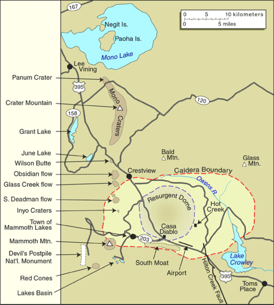
USGS map of the Mono Basin area
| Description | United States Geological Survey map of the Long Valley Caldera and Mono Lake, California | |||
| Date | by 1999 | |||
| Source | Archived source link | |||
| Author | USGS | |||
| Permission (Reusing this file) |
|
|||
| Other versions |

File history
Click on a date/time to view the file as it appeared at that time.
| Date/Time | Thumbnail | Dimensions | User | Comment | |
|---|---|---|---|---|---|
| current | 15:24, 21 June 2005 | | 600 × 668 (178 KB) | Hike395 (talk | contribs) | United States Geological Survey map of the Long Valley Caldera and Mono Lake, California {{PD-USGov-USGS}} Source URL: http://lvo.wr.usgs.gov/gallery/MapGallery.html |
You cannot overwrite this file.
File usage on Commons
The following page uses this file: