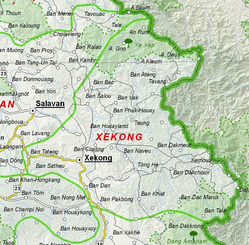
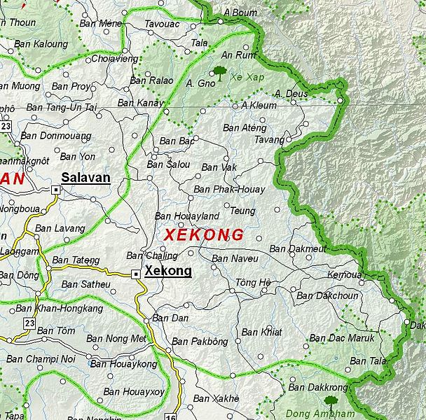
File:Map of Sekong Province, Laos.jpg
Tập tin gốc (873×861 điểm ảnh, kích thước tập tin: 466 kB, kiểu MIME: image/jpeg)
Chú thích
Chú thích
Miêu tả[sửa]
| Miêu tả |
English: Map of Sekong Province, Laos. |
| Ngày | |
| Nguồn gốc | Based on File:UNOSAT Laos Base Map.jpg |
| Tác giả | UNOSAT, United Nations, modified by Dr. Blofeld |
| Giấy phép (Dùng lại tập tin) |
The original file is marked with the UN symbol which means that it is a public domain resource. |
Giấy phép[sửa]
| This image is a map derived from a United Nations map.
Unless stated otherwise, UN maps are to be considered in the public domain. This applies worldwide. UN maps are, in principle, open source material and you can use them in your work or for making your own map. UN requests however that you delete the UN name, logo and reference number upon any modification to the map. Content of your map will be your responsibility. You can state in your publication, if you wish, something like: based on UN map … (map name, map number, revision number and date). See: Geospatial Information Section. And: Geospatial, location data for a better world. |
 |
Lịch sử tập tin
Nhấn vào ngày/giờ để xem nội dung tập tin tại thời điểm đó.
| Ngày/Giờ | Hình xem trước | Kích cỡ | Thành viên | Miêu tả | |
|---|---|---|---|---|---|
| hiện tại | 21:06, ngày 6 tháng 12 năm 2012 | | 873×861 (466 kB) | Blofeld Dr. (thảo luận | đóng góp) | {{Information |Description ={{en|1=d}} |Source =d |Author =d |Date =d |Permission = |other_versions = }} d |
Bạn không được phép ghi đè tập tin này.
Trang sử dụng tập tin
Không có trang nào sử dụng tập tin này.
Sử dụng tập tin toàn cục
Những wiki sau đang sử dụng tập tin này:
- Trang sử dụng tại en.wikipedia.org
- Trang sử dụng tại fa.wikipedia.org
- Trang sử dụng tại fr.wikipedia.org
- Trang sử dụng tại hr.wikipedia.org
- Trang sử dụng tại id.wikipedia.org
- Trang sử dụng tại ru.wikipedia.org
- Trang sử dụng tại th.wikipedia.org
- Trang sử dụng tại ur.wikipedia.org
- Trang sử dụng tại vi.wikipedia.org