File:Map of Virginia highlighting Goochland County.svg
Bước tới điều hướng
Bước tới tìm kiếm

Kích thước bản xem trước PNG này của tập tin SVG: 800×347 điểm ảnh. Độ phân giải khác: 320×139 điểm ảnh | 640×278 điểm ảnh | 1.024×444 điểm ảnh | 1.280×555 điểm ảnh | 2.560×1.110 điểm ảnh | 7.486×3.247 điểm ảnh.
Tập tin gốc (tập tin SVG, 7.486×3.247 điểm ảnh trên danh nghĩa, kích thước: 223 kB)
Chú thích
Chú thích
Ghi một dòng giải thích những gì có trong tập tin này
Miêu tả[sửa]
| Miêu tả |
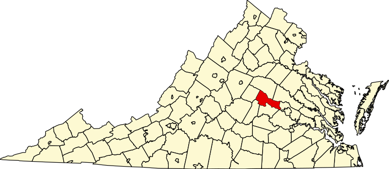
English: This is a locator map showing Goochland County in Virginia. For more information, see Commons:United States county locator maps. |
| Ngày | |
| Nguồn gốc |
Tác phẩm được tạo bởi người tải lên: English: The maps use data from nationalatlas.gov, specifically countyp020.tar.gz on the Raw Data Download page. The maps also use state outline data from statesp020.tar.gz. The Florida maps use hydrogm020.tar.gz to display Lake Okeechobee. |
| Tác giả | David Benbennick |
| SVG genesis | This W3C-invalid map was created with unknown tool. |
Giấy phép[sửa]
| Tôi, người giữ bản quyền của tác phẩm này, chuyển tác phẩm này vào phạm vi công cộng. Điều này có giá trị trên toàn thế giới. Tại một quốc gia mà luật pháp không cho phép điều này, thì: Tôi cho phép tất cả mọi người được quyền sử dụng tác phẩm này với bất cứ mục đích nào, không kèm theo bất kỳ điều kiện nào, trừ phi luật pháp yêu cầu những điều kiện đó. |
Lịch sử tập tin
Nhấn vào ngày/giờ để xem nội dung tập tin tại thời điểm đó.
| Ngày/Giờ | Hình xem trước | Kích cỡ | Thành viên | Miêu tả | |
|---|---|---|---|---|---|
| hiện tại | 17:46, ngày 12 tháng 2 năm 2006 | | 7.486×3.247 (223 kB) | David Benbennick (thảo luận | đóng góp) | {{subst:User:Dbenbenn/clm|county=Goochland County|state=Virginia|type=county}} |
Bạn không được phép ghi đè tập tin này.
Trang sử dụng tập tin
4 trang sau sử dụng tập tin này:
Sử dụng tập tin toàn cục
Những wiki sau đang sử dụng tập tin này:
- Trang sử dụng tại ar.wikipedia.org
- Trang sử dụng tại bg.wikipedia.org
- Trang sử dụng tại bpy.wikipedia.org
- Trang sử dụng tại cdo.wikipedia.org
- Trang sử dụng tại ceb.wikipedia.org
- Trang sử dụng tại ce.wikipedia.org
- Trang sử dụng tại cy.wikipedia.org
- Trang sử dụng tại de.wikipedia.org
- Trang sử dụng tại en.wikipedia.org
- List of cities and counties in Virginia
- Louisa County, Virginia
- Goochland County, Virginia
- Louisa, Virginia
- Mineral, Virginia
- Twin Oaks Community, Virginia
- Goochland, Virginia
- Bumpass, Virginia
- Manakin Sabot, Virginia
- Cuckoo, Virginia
- Zion Crossroads, Virginia
- Template:Goochland County, Virginia
- Template:Louisa County, Virginia
- Oilville, Virginia
- Maidens, Virginia
- National Register of Historic Places listings in Goochland County, Virginia
- National Register of Historic Places listings in Louisa County, Virginia
- Template:GoochlandCountyVA-geo-stub
- User:Nyttend/County templates/VA/1
- User:Nyttend/County templates/VA/2
- Goochland County Public Schools
- User:LBourne/Scratch pad
- Category:Populated places in Louisa County, Virginia
- Category:Populated places in Goochland County, Virginia
- Living Energy Farm
- Dabneys, Virginia
- Blue Ridge Shores, Virginia
- Gum Spring, Virginia
- Sandy Hook, Virginia
- Trevilians, Virginia
- Crozier, Virginia
- Hadensville, Virginia
- Pemberton, Virginia
- Cedar Point, Virginia
- Rock Castle, Virginia
- Childress, Goochland County, Virginia
- User:Nyttend/Virginia NRHP/Goochland
- Fife, Virginia
Xem thêm các trang toàn cục sử dụng tập tin này.