File:Map of Wisconsin highlighting Ozaukee County.svg
Jump to navigation
Jump to search

Size of this PNG preview of this SVG file: 559 × 599 pixels. Other resolutions: 224 × 240 pixels | 448 × 480 pixels | 717 × 768 pixels | 956 × 1,024 pixels | 1,911 × 2,048 pixels | 4,747 × 5,087 pixels.
Original file (SVG file, nominally 4,747 × 5,087 pixels, file size: 103 KB)
Captions
Captions
Add a one-line explanation of what this file represents
Summary[edit]
| Description |
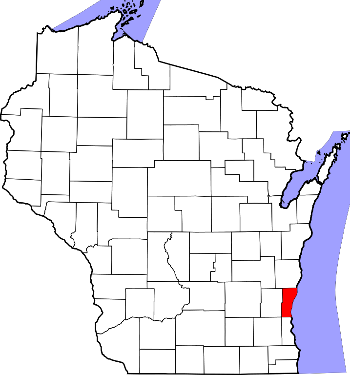
English: This is a locator map showing Ozaukee County in Wisconsin. For more information, see Commons:United States county locator maps. |
| Date | |
| Source |
Own work: English: The maps use data from nationalatlas.gov, specifically countyp020.tar.gz on the Raw Data Download page. The maps also use state outline data from statesp020.tar.gz. The Florida maps use hydrogm020.tar.gz to display Lake Okeechobee. |
| Author | David Benbennick |
Licensing[edit]
| I, the copyright holder of this work, release this work into the public domain. This applies worldwide. In some countries this may not be legally possible; if so: I grant anyone the right to use this work for any purpose, without any conditions, unless such conditions are required by law. |
File history
Click on a date/time to view the file as it appeared at that time.
| Date/Time | Thumbnail | Dimensions | User | Comment | |
|---|---|---|---|---|---|
| current | 00:24, 13 February 2006 | | 4,747 × 5,087 (103 KB) | David Benbennick (talk | contribs) | {{subst:User:Dbenbenn/clm|county=Ozaukee County|state=Wisconsin|type=county}} |
| 18:17, 12 February 2006 |  | 4,747 × 5,087 (103 KB) | David Benbennick (talk | contribs) | {{subst:User:Dbenbenn/clm|county=Ozaukee County|state=Wisconsin|type=county}} |
You cannot overwrite this file.
File usage on Commons
The following 8 pages use this file:
- Category:Births in Ozaukee County, Wisconsin
- Category:Deaths in Ozaukee County, Wisconsin
- Category:Education in Ozaukee County, Wisconsin
- Category:Geography of Ozaukee County, Wisconsin
- Category:Ozaukee County, Wisconsin
- Category:People of Ozaukee County, Wisconsin
- Category:Populated places in Ozaukee County, Wisconsin
- Category:Transport in Ozaukee County, Wisconsin
File usage on other wikis
The following other wikis use this file:
- Usage on ar.wikipedia.org
- بلدة سيداربورغ (ويسكونسن)
- مقاطعة أوزاوكي (ويسكونسن)
- ميكيون
- بورت واشنطن
- سيداربورغ
- بلجيوم (ويسكونسن)
- ساكفيل (ويسكونسن)
- فردونيا (ويسكونسن)
- بايسايد (ويسكونسن)
- ثينسفيل (ويسكونسن)
- نيوبورغ (ويسكونسن)
- غرافتون (ويسكونسن)
- قالب:مقاطعة أوزاوكي (ويسكونسن)
- ديكر كورنر (ويسكونسن)
- ديكر (ويسكونسن)
- داكادا (ويسكونسن)
- هاملتون (مقاطعة أوزاوكي)
- هولي كروس (ويسكونسن)
- هورن كورنرز (ويسكونسن)
- Usage on bg.wikipedia.org
- Usage on bpy.wikipedia.org
- Usage on cdo.wikipedia.org
- Usage on ceb.wikipedia.org
- Usage on ce.wikipedia.org
- Usage on cy.wikipedia.org
- Usage on de.wikipedia.org
- Usage on en.wikipedia.org
- List of counties in Wisconsin
- Ozaukee County, Wisconsin
- Mequon, Wisconsin
- Thiensville, Wisconsin
- Bayside, Wisconsin
- Newburg, Wisconsin
- Belgium (town), Wisconsin
- Belgium, Wisconsin
- Cedarburg (town), Wisconsin
- Cedarburg, Wisconsin
- Fredonia, Wisconsin
- Fredonia (town), Wisconsin
- Grafton (town), Wisconsin
- Grafton, Wisconsin
- Port Washington (town), Wisconsin
- Port Washington, Wisconsin
- Saukville (town), Wisconsin
- Saukville, Wisconsin
- Ulao Creek
- Ulao, Wisconsin
View more global usage of this file.