File:Map of sloboda regiments1764.jpg
Jump to navigation
Jump to search

Size of this preview: 800 × 590 pixels. Other resolutions: 320 × 236 pixels | 640 × 472 pixels | 858 × 633 pixels.
Original file (858 × 633 pixels, file size: 68 KB, MIME type: image/jpeg)
Captions
Captions
Add a one-line explanation of what this file represents
Summary[edit]
| Description |
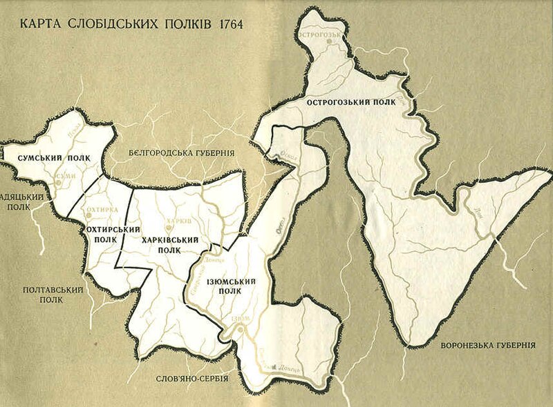
Русский: Карта слободских полков по состоянию на конец 17 века, переведённая в 20 веке на украинский язык.
Українська: Карта слобідських полків |
| Date | |
| Source | http://empiretw.ru/board/lofiversion/index.php?t5616.html |
| Author | Дмитрий Багалей |
Licensing[edit]
|
This work is in the public domain in its country of origin and other countries and areas where the copyright term is the author's life plus 100 years or fewer. | |
| This file has been identified as being free of known restrictions under copyright law, including all related and neighboring rights. | |
Original upload log[edit]
The original description page was here. All following user names refer to uk.wikipedia.
- 2007-05-17 07:34 Kamelot 858×633×8 (69299 bytes)
File history
Click on a date/time to view the file as it appeared at that time.
| Date/Time | Thumbnail | Dimensions | User | Comment | |
|---|---|---|---|---|---|
| current | 20:39, 10 March 2008 | | 858 × 633 (68 KB) | File Upload Bot (Magnus Manske) (talk | contribs) | {{BotMoveToCommons|uk.wikipedia}} {{Information |Description={{uk|== ???????????? ==}} |Source=Transferred from [http://uk.wikipedia.org uk.wikipedia]; Transfer was stated to be made by User:Albedo-ukr. |Date=2007-05-17 (original upload date) |Author |
You cannot overwrite this file.
File usage on Commons
The following 5 pages use this file:
File usage on other wikis
The following other wikis use this file:
- Usage on ru.wikipedia.org
- Usage on uk.wikipedia.org
- Балаклійський полк
- Ізюмський полк
- Острогозький полк
- Охтирський полк
- Сумський полк
- Бахмутський повіт
- Історія Луганської області
- Шаблон:Слобідські козацькі полки
- Слобідські козацькі полки
- Харківський полк
- Чугуївські козаки
- Бригадир Слобідських козацьких полків
- Шидловський Федір Володимирович
- Квітка Іван Григорович
- Зміївський полк
- Слобожанське повстання (1670–1671)
- Usage on www.wikidata.org