File:Map of the Cairo and Helwan tramways.png
Jump to navigation
Jump to search
Size of this preview: 593 × 600 pixels. Other resolutions: 237 × 240 pixels | 475 × 480 pixels | 760 × 768 pixels | 1,013 × 1,024 pixels | 2,026 × 2,048 pixels | 4,245 × 4,292 pixels.
Original file (4,245 × 4,292 pixels, file size: 1.45 MB, MIME type: image/png)
Captions
Captions
Add a one-line explanation of what this file represents
| Description |
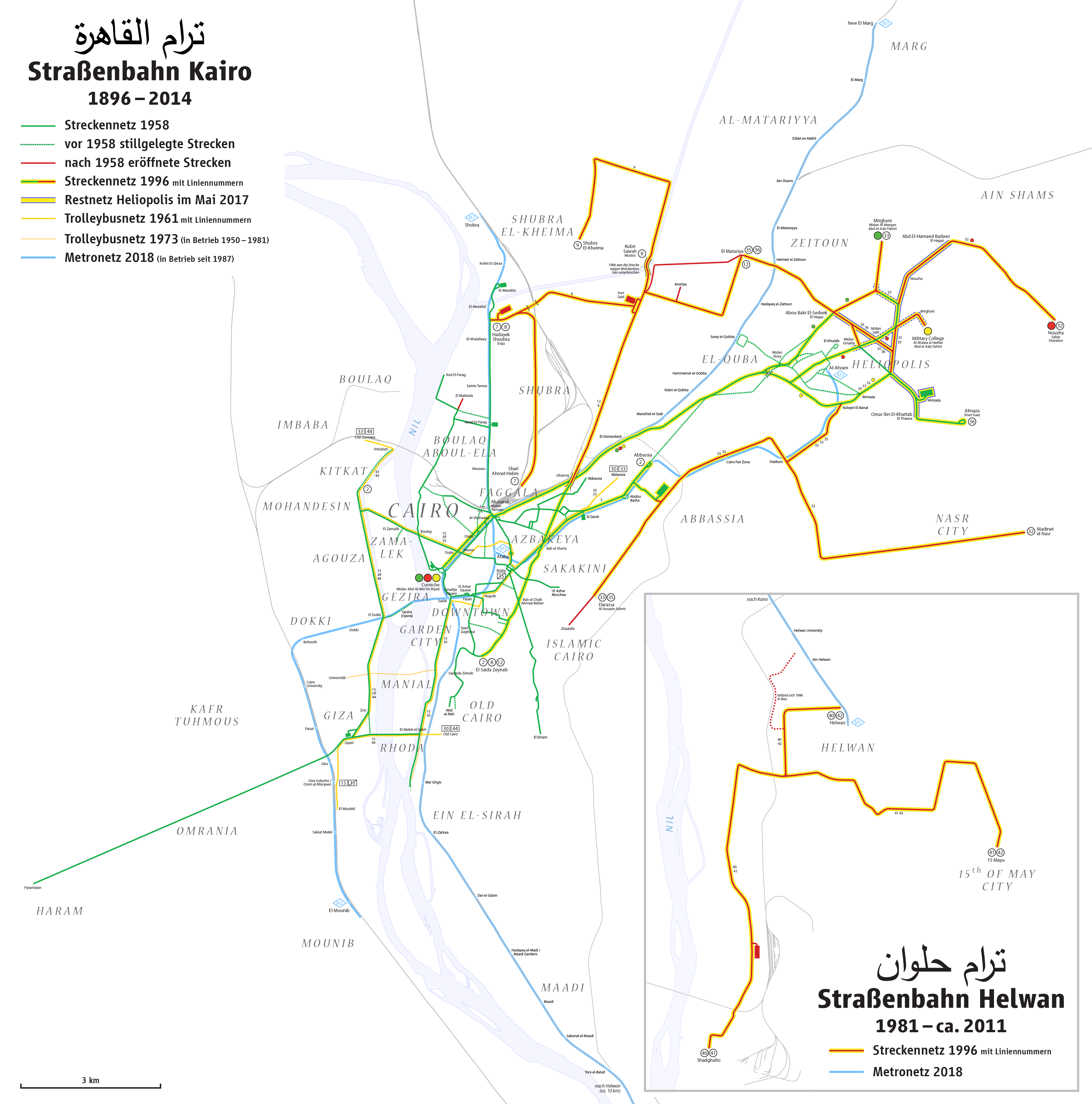
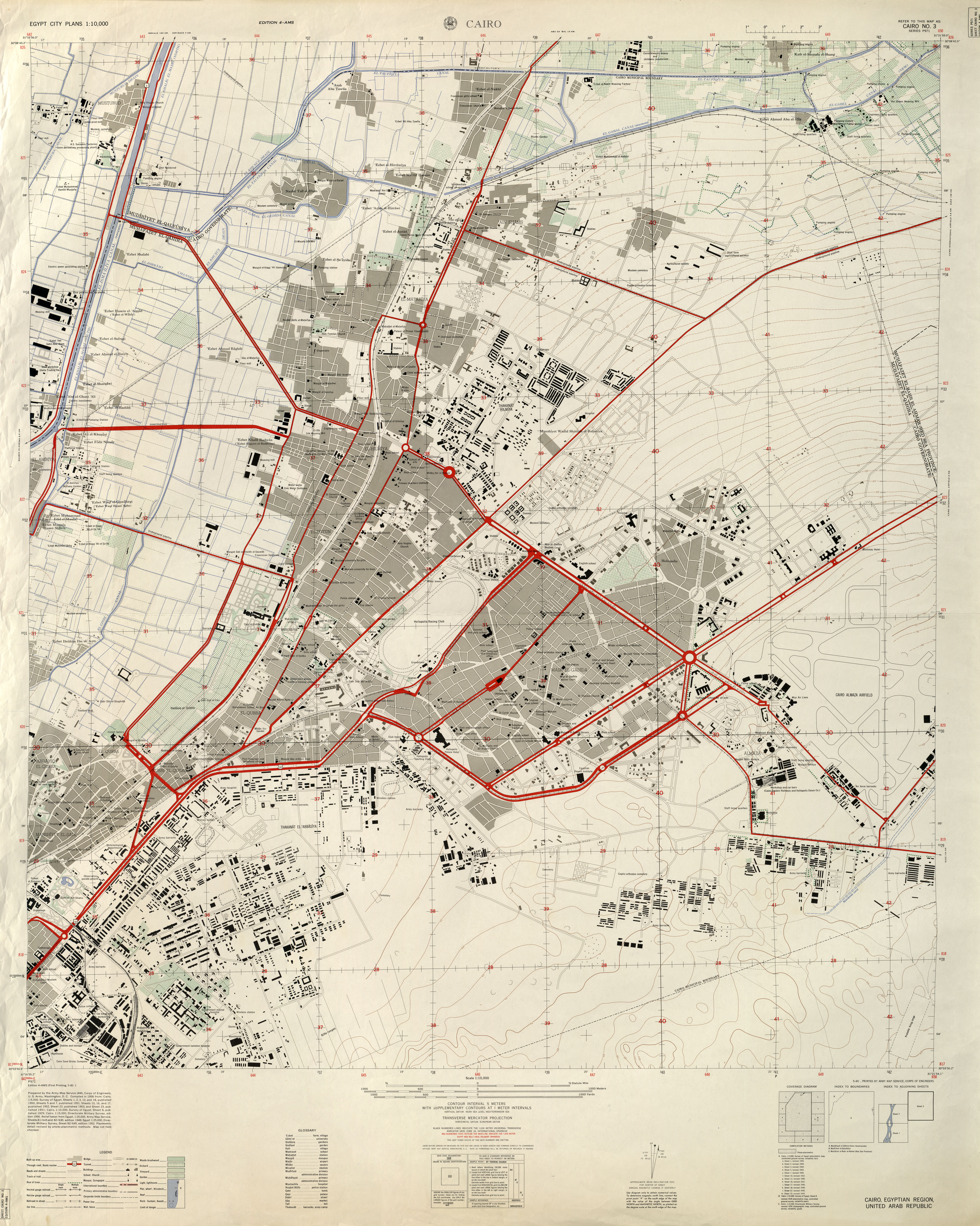
Deutsch: Karte der Straßenbahnen in Kairo und Helwan
English: Map of the Cairo and Helwan tramways
Français : Carte des tramways du Caire et du Helwan |
| Date | see file history |
| Source |
Own work Information is taken from these sources:
|
| Author | Maximilian Dörrbecker (Chumwa) |
| Permission (Reusing this file) |
I, the copyright holder of this work, hereby publish it under the following license: This file is licensed under the Creative Commons Attribution-Share Alike 2.5 Generic license.
Sie dürfen das Bild zu den folgenden Bedingungen nutzen:
|
| Other versions |
|


_(14781591394).jpg)
File history
Click on a date/time to view the file as it appeared at that time.
| Date/Time | Thumbnail | Dimensions | User | Comment | |
|---|---|---|---|---|---|
| current | 20:34, 28 November 2019 | | 4,245 × 4,292 (1.45 MB) | Chumwa (talk | contribs) | Trolleybusnetz 1961 ergänzt |
| 10:05, 27 May 2018 |  | 5,189 × 5,247 (1.79 MB) | Chumwa (talk | contribs) | ||
| 07:00, 3 February 2016 |  | 4,245 × 4,292 (1.23 MB) | Chumwa (talk | contribs) | ||
| 21:18, 2 February 2016 |  | 4,245 × 4,292 (1.23 MB) | Chumwa (talk | contribs) | ||
| 06:56, 26 January 2016 |  | 3,827 × 2,958 (844 KB) | Chumwa (talk | contribs) | ||
| 18:17, 25 January 2016 |  | 3,827 × 2,958 (837 KB) | Chumwa (talk | contribs) | {{Information |Description= *{{de|Karte der Sraßenbahn Kairo }} *{{en|Map of the of Cairo tramways}} *{{fr|Carte des tramways du Caire}} |Source={{Own}} |Date=see file history |Author= Maximilian Dörrbecker ([[:de:User:Chumwa|Chu... |
You cannot overwrite this file.
File usage on Commons
The following 23 pages use this file:
- القاهرة
- User:Chumwa/Gallery
- User:Chumwa/OgreBot/Potential transport maps/2016 February 1-9
- User:Chumwa/OgreBot/Potential transport maps/2016 January 21-31
- User:Chumwa/OgreBot/Potential transport maps/2018 May 21-31
- User:Chumwa/OgreBot/Potential transport maps/2019 November 21-30
- User:Chumwa/OgreBot/Public transport information/2016 February 1-9
- User:Chumwa/OgreBot/Public transport information/2016 January 21-31
- User:Chumwa/OgreBot/Public transport information/2018 May 21-31
- User:Chumwa/OgreBot/Public transport information/2019 November 21-30
- User:Chumwa/OgreBot/Transport Maps/2016 February 1-9
- User:Chumwa/OgreBot/Transport Maps/2016 January 21-31
- User:Chumwa/OgreBot/Transport Maps/2018 May 21-31
- User:Chumwa/OgreBot/Transport Maps/2019 November 21-30
- User:Chumwa/OgreBot/Travel and communication maps/2016 February 1-9
- User:Chumwa/OgreBot/Travel and communication maps/2016 January 21-31
- User:Chumwa/OgreBot/Travel and communication maps/2018 May 21-31
- File:Map of the Cairo and Helwan tramways.png
- File:Map of the Cairo and Helwan tramways with topography.png
- File:Map of the of Cairo tramways.png (file redirect)
- File:StrassenbahnGleisplanKairo1996.png
- File:StrassenbahnNetzplanKairo1996.png
- Category:Trams in Cairo
File usage on other wikis
The following other wikis use this file:
- Usage on ar.wikipedia.org
- Usage on be.wikipedia.org
- Usage on ceb.wikipedia.org
- Usage on de.wikipedia.org
- Usage on en.wikipedia.org
- Usage on eo.wikipedia.org
- Usage on fr.wikipedia.org
- Usage on pl.wikipedia.org
- Usage on ru.wikipedia.org
- Usage on sv.wikipedia.org
- Usage on uk.wikipedia.org
- Usage on www.wikidata.org